With Catherine packed off to school, Kevin decides to try and finish the hike that got interrupted on July 20.
UPDATED Now with more pictures.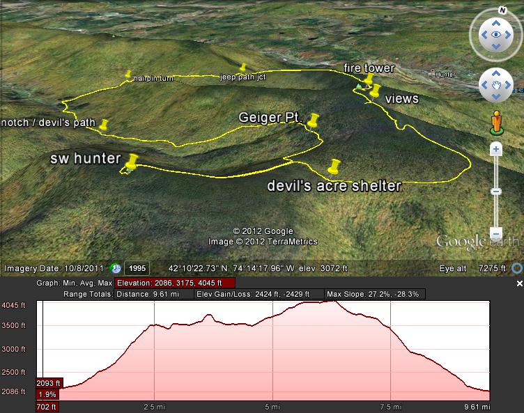
This time, Alberto from work is his hiking partner. They decide to skip Rusk this time, and go counter-clockwise, so as to get Southwest Hunter (Leavitt's Peak), the more difficult of the two peaks, out of the way first.
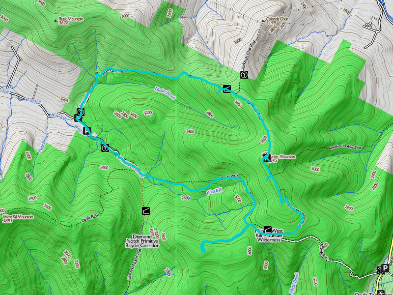
Kevin and Alberto park at the trailhead for the Spruceton Horse Trail and roadwalk over to the Diamond Notch trailhead. The two get on the trail a little before 0900, and make good time up the relatively easy Diamond Notch trail to the lovely little fall that is variously styled Diamond Notch Falls, West Kill Falls, and Buttermilk Falls (the last is puzzling; why do so many different falls in the Catskills bear that name?)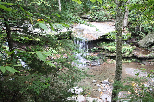
After the briefest pause for photography, the two turn left on the more rugged Devil's Path, and start the long climb up the north wall of the West Kill valley. Kevin is surprised by how gradual the climb turns out to be: there are none of the rock scrambles typical of Catskill trails. This section of the Devil's Path is quite benign, particularly by comparison with what it has further east. Auld Nick must have been sleeping on the job that day. Over the next hour or two, the pair ascend to the 3500 foot level, and arrive at Geiger Point atop the West Kill headwall, with its views of West Kill Mountain and Southwest Hunter.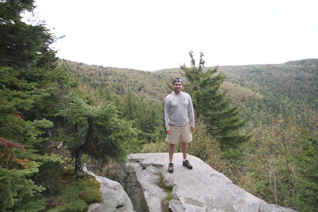
After another pause for compulsive photography, the pair continue up the Devil's Path, 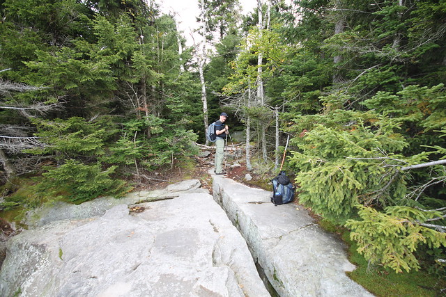
which is now running nearly level along the 3500-foot contour. 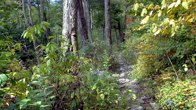
At this elevation, there are still a few late blackberries, and the two enjoy a small snack on them.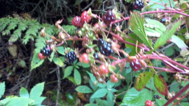
Before long, as the trail veers eastward, a small cairn appears on the right, marking the start of a rail grade over which horse-drawn cars operated for the Fenwick Lumber company. The grade is now abandoned for about a century, but offers level hiking to a point just north of Southwest Hunter Mountain (Leavitt's Peak).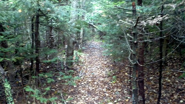
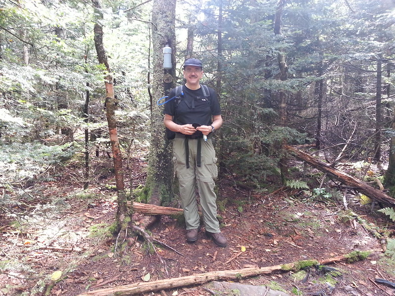
At this point, a pair of cairns mark the turnoff to Southwest. Kevin and Alberto climb the well-defined herd path, which leads into the crown of a fallen tree. Kevin misguesses the direction that the path takes around it (choosing the left side, that offers a line more nearly in the direction of the summit), and sees no sign of the path on the other side. Rather than trying to find it again, he exercises a general rule of mountain navigation: the summit is up., and simply heads upward through the brush. The pair arrive on the flat summit within a few hundred feet of the canister. Now: where the Devil is it?
After about fifteen minutes of fruitlessly casting about, Kevin cheats and turns on the GPS in “orienteering compass” mode. It indicates a line that definitely appears to be gently down hill from where the hikers are standing, but following it a few steps leads to the path and right up to the canister.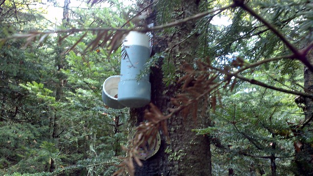
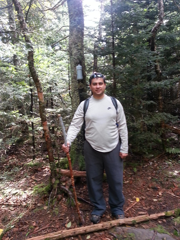
Kevin and Alberto sign in,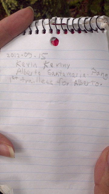 and capture a “we made it” shot (with a cell phone since it's out in Kevin's hand serving as GPS).
After a drink of water and a quick bite, the two follow the herd path (it's obvious from above, including the spot where things went awry) back to the rail grade,
and make tracks back along it - so much on autopilot that they fail to notice the trail junction until the red Devil's Path marker on a tree jolts Kevin. Fortunately, they're headed in the right direction on the Devil's Path, and come a few hundred feet later to the Devil's Acre lean-to.
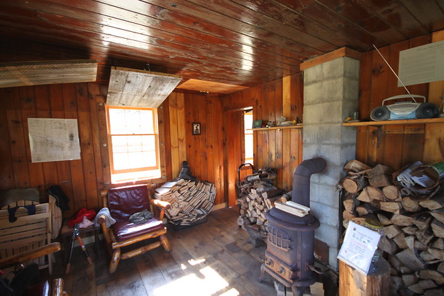
Here the two make an extended stop. Packs off, boots off, cook up a hot lunch (Kevin's mango chicken curry, served over lentils and rice), resupply with water from the nearby spring, and talk to a couple of parties of tourists coming by. One pair of young men has just climbed up from the Devil's Tombstone campground in Stony Clove, just "seeing where the red trail leads" without any destination in mind. Kevin directs the ill-prepared young men up to the fire tower, telling them that the best views are to be had from there.
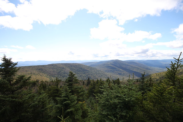
From here on up to the summit of Hunter, there are a lot more people. Hunter Mountain is a popular destination. After meeting the obligatory party of sixteen Koreans, we visit a spectacular overlook west of the Becker Hollow trail junction,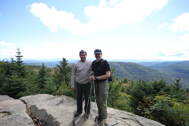
and then make the short walk to the Hunter Mountain fire tower.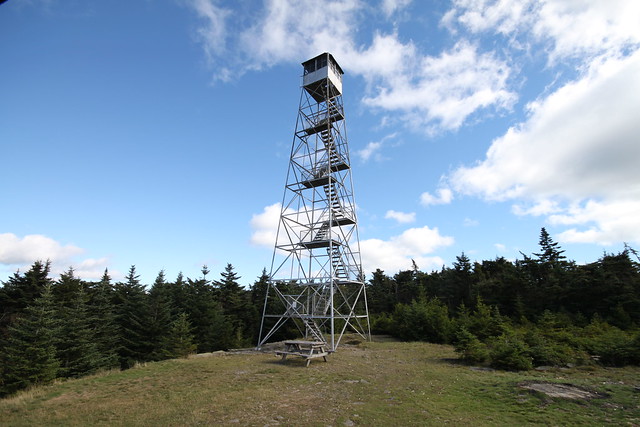
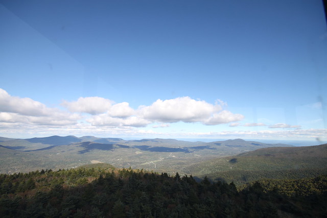
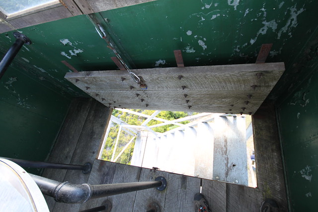
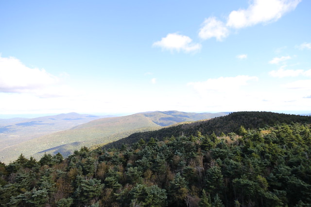
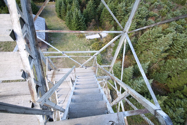
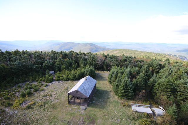
There, we find that a caretaker is there, and we hang out at the summit for a while, talking with the caretaker, the visitors, and the caretaker's two dogs. We climb the tower to get the breathaking 360° views. (Kevin climbs it twice, deciding that going up in a sweaty T-shirt in 50 °F weather and the usual gale blowing across the mountaintop was a trifle chilly, and running back to his pack to fetch a fleece sweater.)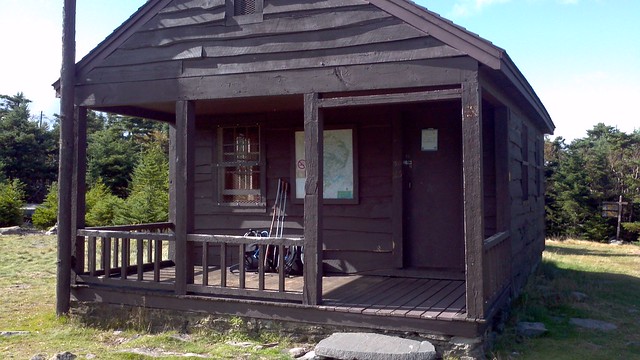
Then it's time to shoulder the packs again and head back down, using the Spruceton bridle path. We plug on downward pretty steadily, deciding to skip the side trip to Colonel's Chair, only take a quick look at the new John Robb lean-to,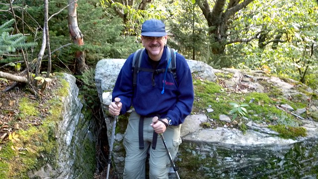
and simply march steadily out to the trailhead and Kevin's car. The low sun angle makes for an interesting lens flare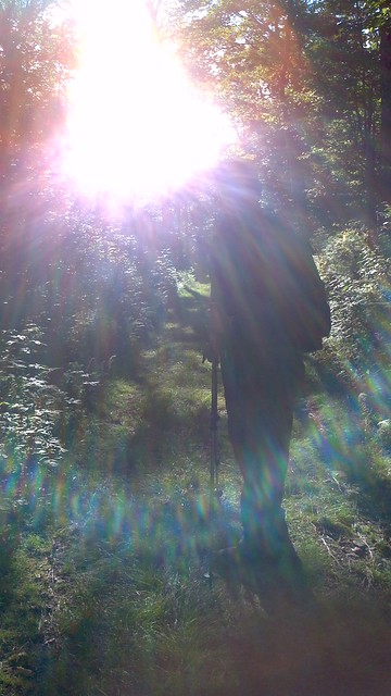
Once there, Kevin mixes up some powdered electrolyte-replacing sport drink at a dilute strength, and hands a litre to Alberto saying, “if you've been sweating the way I have, you need electrolyte replacement. Drink this.” Alberto doesn't argue. Kevin then stops to change to lighter socks and replace boots with sneakers.
While we're doing this, the fire tower caretaker comes off the trail, dogs in tow, sits down, changes from boots to sneakers, gets a two-litre bottle of Powerade out of his car trunk, and chugs about half of it. Great minds think alike. We have another brief conversation, throw the gear in the back of the car, and head for home, having spent about nine hours in the park, and done about ten miles (and with the GPS showing a total of 2600 feet or so of elevation gained and lost).
What went right: Nearly everything. Weather was perfect. Hiking was easier than expected. It took only about 15-20 minutes to find the canister on Leavitt's Peak. Lunch was tasty and filling.
What went wrong: Only a couple of little things. It took 15-20 minutes to find the canister on Leavitt's Peak. Kevin left his camera in the car when starting up the trail (fortunately. Alberto had his DSLR along, and both of us had phone cams.)
Lessons learnt: A trail, even a herd path, seldom peters out abruptly. Had Kevin backtracked after losing the path at the fallen tree, he'd have found it again around the other side of the blowdown and made it to Leavitt without any confusion. But it was fun the way we did it, too.
Read more...