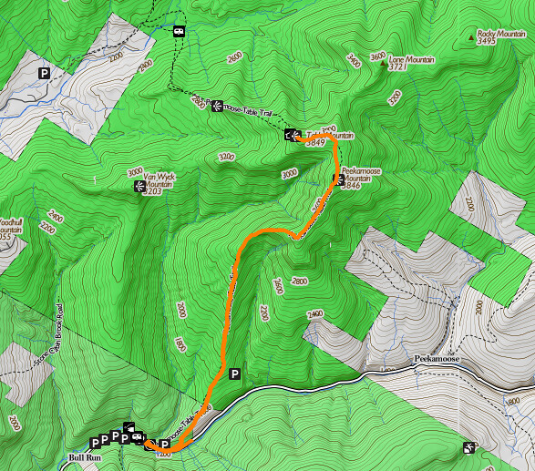
On Sunday, August 17, I was feeling a need to get out and move (I'd committed a few dietary indiscretions at a Polish festival the night before), so I sneaked off to the southern Catskills to climb Peekamoose and Table Mountains, the southernmost of the 3500-footers. Since I was feeling the need of a workout, and since I'd just been at the Denning approach trail last month, I decided to go from the Peekamoose Road trailhead. By the time I reached the trailhead parking lot, it was full to overflowing, with several cars parked across the NO PARKING signs. Instead, I wound up driving another quarter mile (and losing some more elevation) down the road to the Bear Hole parking lot.
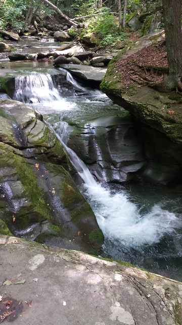
Since Bear Hole is right off the road, I strolled in to have a look.
(I apologize for the image quality on some of these shots. I didn't
have my usual camera with me, so all of these are taken with a cell
phone.) It's a lovely little waterfall, with crystal clear water. I
could see the bottom of the plunge pool as clearly as looking
through window glass. I could also see trout lurking below some of
the rocks and snags above the falls. Fishing was not on the agenda
for the day, though. Getting up to the top of Peekamoose and Table
was going to be time-consuming enough!
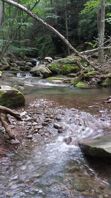
While not particularly technical, Bear Hole to Peekamoose is a
strenuous hike. In a little less than four miles, the trail gains
about 2700 feet of elevation. The first 500 are on a well-graded
woods road, but then there is a fork, and the trail turns right
while the old road heads left. While unblazed, the road looks
hikable, even easy. Maybe one of these months I'll get back in that
hollow and see where it goes.
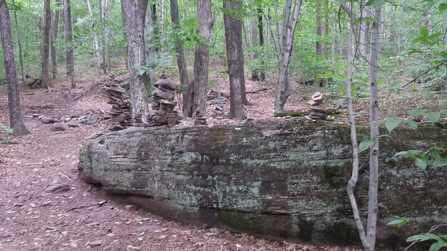
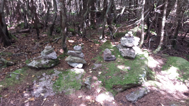
Shortly after the fork, there's a bit of a sculpture garden, where
hikers have built cairns on a slab of conglomerate rock that is
making its eons-long descent down the mountain. I have no idea why
this spot might have been chosen, nor what significance the cairns
might have. So I just paused a moment, added a stone to one of them,
said a prayer for the intentions of whoever built it, and hiked on.
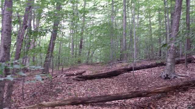
Not far after the little array of sculptures, the trail starts to
show its true character. From here on to the top the hike consists
of walking a couple of hundred yards and scrambling a rock ledge,
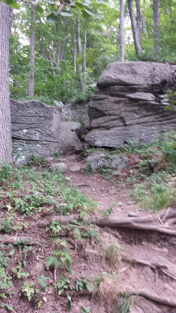
walking another couple of hundred yards and scrambling the next rock
ledge,

and so on, pretty much all the way to the summit.
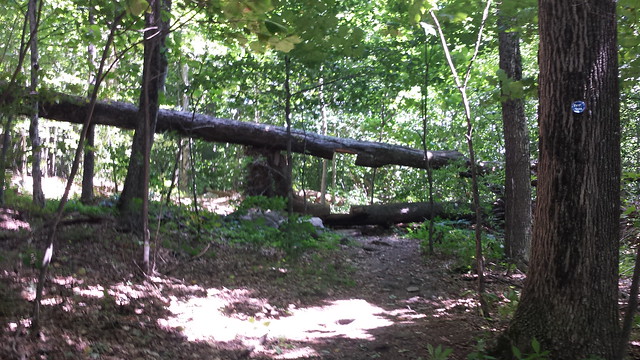
The drudgery is occasionally relieved by a bit of trail maintainer
whimsy, as at this spot where the maintainers, instead of removing a
blowdown, have cut a doorway through it. Theyve even used the
removed billets to build a little stoop!
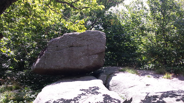
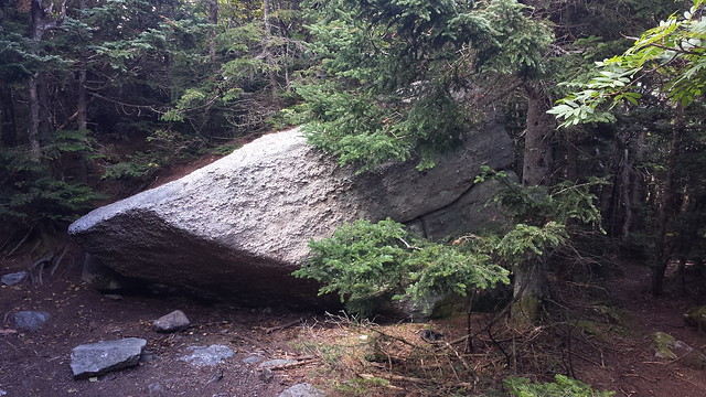
At about 3000 feet elevation, one of the scrambles climbs to
Reconnoiter Rock, a boulder perched precariously on the
edge of a ledge. The guidebooks claim that it boasts a good view,
but at this point, it's all grown in. There may be a limited view in
winter when the leaves are off the trees.
A few steps past the 3500 foot sign, a herd path branches right to a
framed overlook looking west. This herd
path is surprisingly well beaten. I suspect it's because northbound
hikers mistake it for the view in the guidebook, which is only a
little bit farther along. (There are several more rocks atop this
cliff that overlook the same vista, with faint herd paths to
them. Even if it's crowded, you can find a 'room with a view' for
lunch.)
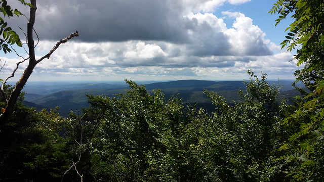
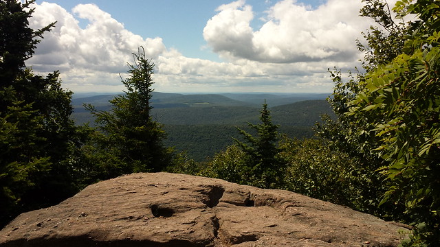
By far the best view in this section is to be had from this boulder,
which is right beside the trail. Stepping out on it reveals a
panorama to the west. The most prominent peaks on the horizon are
Balsam Lake Mountain and Doubletop at right, with Big Indian, Fir,
Eagle, and Haynes partly hidden behind the bushes. In the
foreground, Van Wyck Mountain, Woodhull Mountain, Red Hill, and
Denman Mountain march off to the left toward the Shawangunk Ridge.
(The view is actually wider than this image, but the trees were
swaying so much in the wind that I couldn't capture the wider
panorama.)

Another few hundred feet of climb lead to the summit of
Peekamoose. The actual high point is this boulder in the trail. It
once had a view to the east, but the view has grown in.
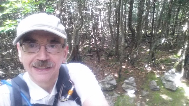
I grabbed the obligatory summit selfie.

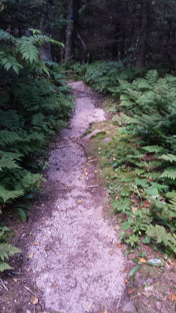
A short, steep descent to the north leads to a pleasant walk through
boreal forest in the col between Peekamoose and Table. The
innumerable footfalls and copious rainfall have worn away the sand
and silt in the conglomerate rock on the trail, leaving only the
white quartz pebbles. Like the Garden Path between Cornell and
Slide Mountains, it looks like an artificial gravel path.
In another half mile or so, the trail ascends steeply once again to
Table Mountain. The summit of Table is, as you might imagine from
the name, flat, and the actual height of land is indeterminate. What
hikers account as the summit is a small clearing at the north end of
the table, marked with several little cairns.
Of course, this sight occasioned another summit selfie.
I'm told that just north of the summit clearing, a herd path branches off to another fine view. I didn't explore this one, for no better reason than the fact that I completely forgot it was there! It's something to do for another trip, I suppose.
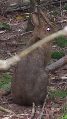
On the return trip through the col, I was surprised by an animal
crashing out of the path into the woods to one side. I thought is
was a fawn at first, but saw that it was a huge snowshoe hare,
nearly the biggest I've seen. With only the cell phone, I was able
to grab only a poor picture.
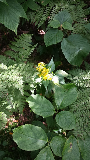
I was also able to mosey a bit more leisurely, knowing that after
the short climb up Peekamoose, the hike would be all downhill. I
noticed that there were yellow and white wildflowers (some sort of
chrysanthemum?) blooming anywhere that a shaft of sunlight managed
to penetrate the canopy.
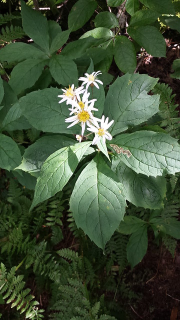
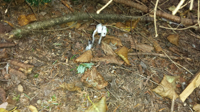
In the shade of the summit rock of Peekamoose, I noticed a few
Indian pipes (Monotropa uniflora) growing. These plants
always fascinate me because of their complex relationship to the
forest. They are flowering plants, not fungi, but they have totally
lost the ability to photosynthesize - they entirely lack a
functioning gene for chlorophyll. Instead, they live, like
mushrooms, off other life forms. Unlike mushrooms, however, they
also cannot break down leaf mould for sustenance, so they can
survive only by parasitizing the mycorrhiza of the Lactarius
mushroom (which itself, in turn, parasitizes tree roots). Because
their ecological niche is so precarious, Indian pipes are
uncommon. I'm always glad to see them.
From here, I put the phone away and motored down the hill back to
the car. I needn't have hurried as much as I did. I got back to Bear
Hole with well over an hour of daylight left.
Read more...