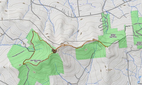
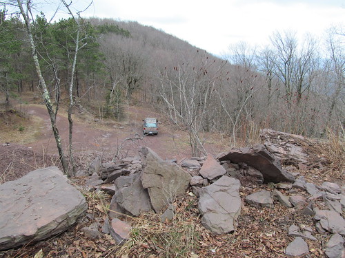
The trailhead is an old gravel pit at the pass where Huntersfield Road turns into Jim Cleveland Road. Note that within the state forest boundary, neither road receives maintenance from the highway department. They are impassable to vehicles in winter, and 4WD is recommended during bad weather at other times of the year. The trail climbs rapidly upward from the right-hand side of the pit. When I was there, I found the place quite a pigsty. Apparently, some irresponsible shooters had been firing at improvised targets. I found spray cans, Chinese food containers, ammunition boxes, beer cans and similar rubbish, all shot up. And I must have picked up two hundred spent 12-gauge shells.
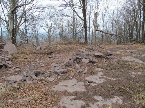
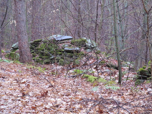
Right above the pit are some old foundations, probably workings for the pit.
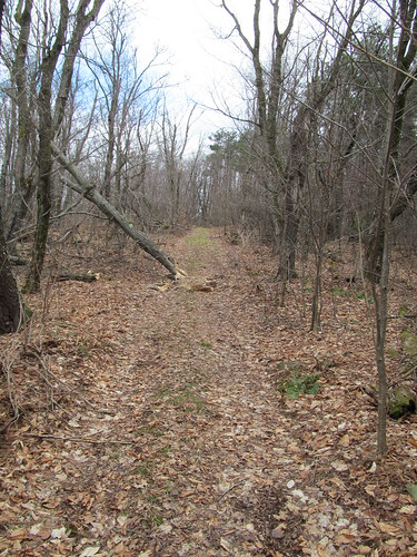
The trail continues up the mountain on a broad woods road. The trees surrounding are in bad shape. Many of them were split and blasted in the hurricanes of the last few years, and there is a lot of standing dead timber and deadfall.
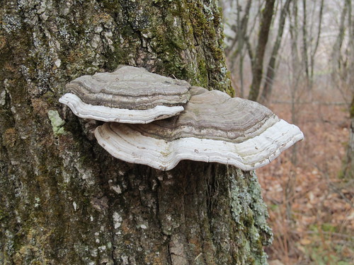
The dead trees are home to many polypore fungi. With the highly inflammable pith of these, and all the dead wood about, I wouldn't want for fuel for a fire if I needed one. Even in a pounding rainstorm, I'd be able to get one going readily.
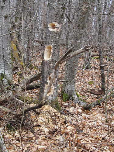
The woods echo with the hammering of pileated woodpeckers. The dead wood makes ideal homes for the birds, and the termites are a major food source for them. Many trees have large excavations and corresponding large piles of sawdust at the base.
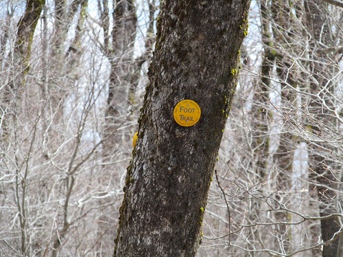
Near the summit, the trail joins with the loop trail serving the Huntersfield lean-to. The yellow markers for the loop appear.
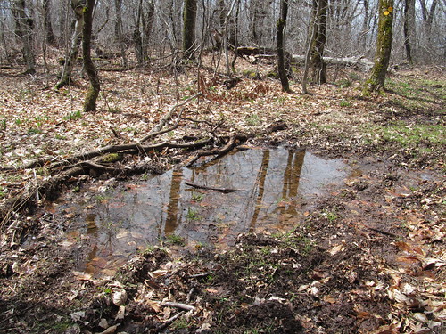
At this elevation, the frost is still in the ground, and the water cannot percolate. The trail surface is punctuated with mudholes. I was glad I wore clunky leather boots and high gaiters!
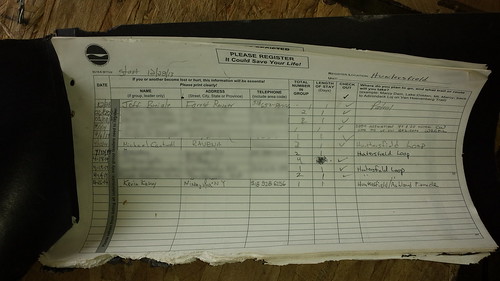
As the trail levels off on the flat summit, the lean-to appears. Uh-oh, it appears that someone's left the register box open.
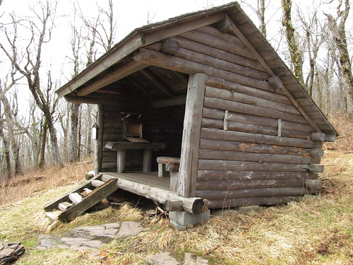
The register has been gnawed a bit by rodents, but it's still legible. I note the name of one of my sometimes hiking partners, who's been up there two weeks earlier. At that point, he was still on snowshoes. It's amazing the difference that two weeks can make. I appear to have the forest to myself on this day of threatening weather. I sign in. Since I'm feeling good, I decide to explore the former route of the New York Long Path over to Ashland Pinnacle, and indicate my intention in the book. The Long Path no longer follows this route, because a disgruntled landowner has canceled a trail easement farther down, and now has several miles of roadwalk just to avoid his parcel. Hikers, please make doubly sure to follow Leave No Trace principles in the places where a trail crosses private land!
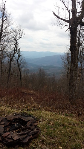
The trees have been cut away from the front of the lean-to, offering a view of the Catskill high peaks. I enjoy this lovely spot while I sit down to eat my lunch.
After lunch, I encounter the trail junction just east of the shelter, and set off on the old Long Path route. The trail is now blazed with red DEC markers as a spur trail, but the aqua blazes of the Long Path are still quite apparent.

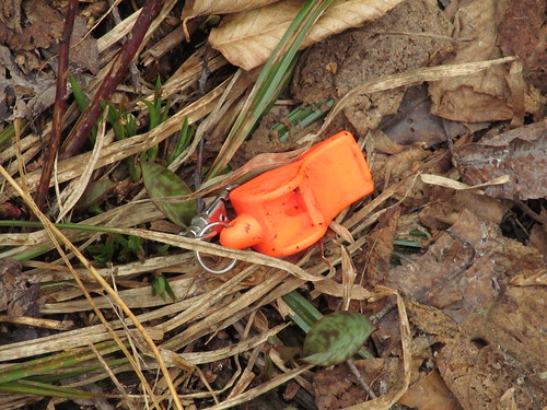
I keep darting my eyes to the ground in hopes of spotting the Mourning Cloak and Grey Comma butterflies, which a friend has reported are already out. Alas, I don't see any butterflies all day. A flash of orange in the treadway turns out to be someone's dropped safety whistle. I pick it up, both in the interest of keeping the place clean and because the whistle, cleaned up, will probably be of use to someone.
This section of trail is well blazed, but is so little traveled that it often feels like a bushwhack, particularly since I'm the only hiker up here. There is a considerable amount of blowdown - I brush out as best I can, but I have to leave a few heavy trees for the maintainers. And there's lots of light growth right in the treadway. In the summer, this section must be a hell of prickers and nettles. It's also quite muddy. In fact, I spot some Viola lanceolata growing right underfoot in the treadway. Since this species is an obligate wetland dweller, this particular spot of trail must be muddy year round! (There's probably a seep or spring just above.)

A mile or so down the trail, I spot a DEC marker disc, hung backward with the print facing the tree, and "VIEW" scratched on its back side. To the side, I spot an abandoned woods road that it seems to be indicating. Despite the fact that the road is all grown to prickers and beech saplings, it's not at all hard for an experienced eye to see the ruts leading off to the south. Never one to pass over a nice view, I head off down the road in search of the promised view. After maybe two hundred yards, I turn around. The road is clearly dropping in elevation into the valley of a creek, and it suddenly occurs to me that I'm straying off a trail easement on private land. Oops. I head back to the trail, having seen no view any better than what the trail offers. (A troll of Google and Bing satellite imagery suggests that there's none to be had.)
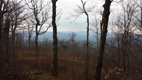
Farther along, there is a nice view, at least this early in the spring when the leaves are still off the trees. Looking out through the trees, I can see the Blackhead range, Ski Windham, and the Devil's Path.
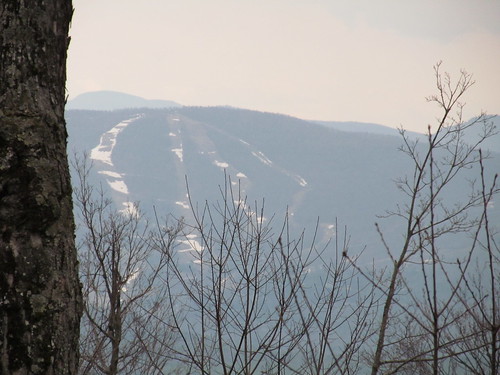
The last vestiges of the snow still cling to the ski runs.
The trail crosses a patchwork of state, private, and New York City watershed land. I'm glad I've brought my New York City watershed access permit.
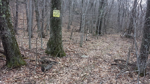
he old Long Path goes just north of the Ashland Pinnacle summit, so I hope for a view from there as well. But the summit itself is on private land. There's a private trail that goes over there, but I respect the posters. The private trail is considerably better maintained than the public one. I suspect the landowner is an ATV rider or snowmobiler.
Just then, a sudden cloudburst makes me adjust clothing. The temperature takes a rapid dip. (The ideal combination for the rest of the hike turns out to be rainsuit and underwear, with no midlayer.) I turn around and head back for Huntersfield, noticing some views of the Schoharie valley to the northwest that I hadn't seen on the trip out, largely because they were behind me. Between the rain and mist, and the trees in the foreground, they're not very photogenic, and I didn't get any usable shots to show you. But I was able to spot the Schoharie Reservoir gleaming in the distance, and the upper pond of the Mine Kill pumped storage facility.
At the top of Huntersfield, I turned right this time, and continued down the former Long Path down a slope of shale and scree, made squishy and slippery by the rain, which by now was starting to turn to sleet. The occasional fallen rock slab or overhanging ledge gave me a reminder that even though I was at the far northern end, this is still a Catskill trail.
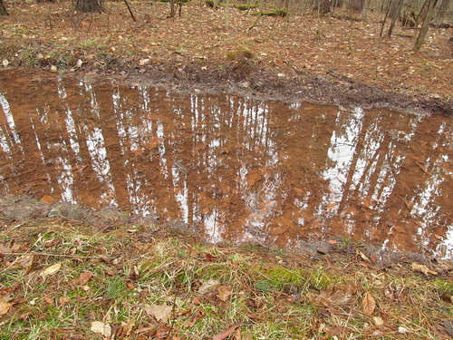
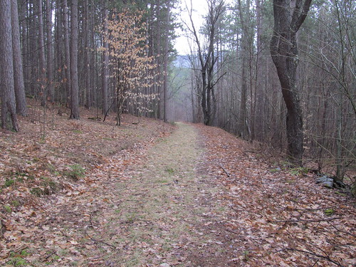
At the bottom, the old Long Path route reaches one of the private land closures, and the trail, now carrying only the red DEC disks, continues its descent until it reaches another broad woods road, this one serving the plantations of the state reforestation area. (The whole mountain, once upon a time, was clearcut.) The road is broad and flat, but often underwater - this is mud season, after all. The rain falling on top, the reflected trees and clouds, and the vegetation and red sandstone make an interesting composition.
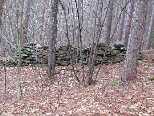
Along the road are many stone walls and foundations, evidence of former habitation.
The plantations that the road traverses have an unnatural (although not entirely unpleasant) feel to them. They consist of stands of trees, all the same species and age, growing in orderly rows. I notice at least pitch pines, white pines, red spruces, and hemlocks. A healthy understory is starting to grow up, and sooner or later Nature will restore some semblance of biodiversity, but recovery will take a very long time. In the defence of the foresters, at the time the trees were planted, the goal was rather to recover the economic value of the land by planting useful timber, and the homogeneous stands would make a subsequent harvest easier - another clearcut, years down the road. It was surely better than the previous generation's practice of merely leaving the land bare, with slash strewn everywhere, which led to horrific wildfires.
The woods road takes me down to the Huntersfield Brook, where I pick up the road I drove in on and walk up it the rest of the way to my car. It's a steep slog, as roadwalks go, about 400 feet of elevation gained over a half mile or so.
Getting back to the car, I grabbed my trash bag and brave the wind and sleet to pick up the trash, because I promised myself I'd leave the trailhead less of a mess than I found it. I called Mary Ann and apologized for the late departure - I'm going to be home about an hour and a half later than expected - and headed off down the hill. By the time I was down into Prattsville, the weather was rain showers and temperatures in the high 40's Fahrenheit - a major change from the mid-30's and sleet up above. Mountains make their own weather.
All in all, not a bad day. About an eight-and-a-half mile hike with 1900 feet of elevation gained and lost (about 1000 feet of elevation change between the summit of Huntersfield and the crossing of Huntersfield Brook). At my usual pace, I'd apply my personal Naismith Rule guidelines of 30 minutes to the mile, 40 minutes per 1000 feet of elevation, and arrive at roughly 4:15 for the distance and 2:40 for the climb and descent, for a total of 6:55. As it was, I did the loop in 6:05 with a twenty-minute break for lunch. I'm a slow hiker, but that's not too bad for having sat on my arse all winter, having shifted a fair amount of fallen brush out of the trail as I went, and getting slowed down a bit on wet shale.
No comments:
Post a Comment