Showing posts with label bushwhack. Show all posts

Monday, November 3, 2014

2014-11-02 North Dome - a pilgrimage, or a bugbear laid to rest.

On November 2, 2014, I climbed North Dome in the Catskills with Jon, an occasional hiking partner of mine, and his friend Chris.

The trip that this report describes is in the nature of a pilgrimage, and the slaying of a personal bugbear. As far as I know, I'm the first in my family to climb North Dome Mountain since the tragic events of 1940.

Note: I expect to be able to include more pictures soon. My partners did most of the photography on this trip.

I'll let the newspapers describe the piece of family history that North Dome represents.


From the Brooklyn Daily Eagle, 29 November 1940, page 7:

Brother Vamps Join Search for L.I. Hunter Missing 3 Days
Special to the Brooklyn Eagle

Inwood, Nov. 29—Twenty-five members of the Inwood Volunteer Fire Department today joined the search for Wesley Meserole, 28, of 143 Lord Ave., here, who disappeared last Tuesday on a hunting trip in the mountainous countryside near Spruceton. Meserole is a member of long standing of the local fire company.

Headed by Nassau County Police Sgt. Robert O. Kirk of the Woodmere Precinct, brother-in-law of young Meserole, the firemen left here in five automobiles. The missing man's wife is on the verge of collapse at his home, where she and their two children are anxiously awaiting news.

Police Continue Search

Spruceton, N. Y., Nov. 29 (UP)—State police, CCC workers and volunteers continued to search the woods near here today for Wesley Meserole, 28, who disappeared on a hunting trip Tuesday. Meserole, father of two children, left his Inwood, L. I. home Monday. Hunters at a Catskill mountain camp said he had ascended nearby North Dome Mountain. State police were notified when he failed to return that night and a search has been in progress since.


From the Catskill, N.Y. Examiner-Recorder,, January 9, 1941, page 5:

Shells Identified As Fired By Meserole

Shotgun shells found in Mink Hollow, town of Lexington, were positively identified by experts as shells fired by Wesley Meserole, Inwood, L.I. hunter who has been missing since November 26 when he left a Spruceton farmhouse to go hunting.

The search for the hunter is expected to continue whenever weather permits and many county residents, CCC boys and friends from Inwood have participated in the search.


From the Catskill, N.Y. Examiner-Recorder,, April 24, 1941, page 1:

TO SEARCH FOR MISSING HUNTER AGAIN SUNDAY

Volunteers are again requested to join in a search of the Mink Hollow and Broad Street Hollow sections near Westkill in a final effort to locate some clue to the mysterious disappearance of Wesley Meserole, Inwood, L.I. hunter who vanished during a hunting trip on November 26.

The search, to be held Sunday, May 4, is sponsored by the Inwood Volunteer Firemen. Cooperation will be offered by county volunteer firemen and others from several sections of the state. State Troopers, game wardens, fire wardens, local police, and residents will also join the hunt. It is hoped that sufficient manpower will be present to comb every inch of the territory in which Meserole had been hunting.

Searchers are requested to report at Westkill Community Hall at 8 a.m., Sunday. Sandwiches and coffee will be served throughout the day.

Since Meserole's disappearance, several attempts have been made to locate the missing man, his gun, or some definite clue which might help in solving the mystery of his disappearance. After January 12, the search was discontinued due to the snow on the mountains.

The only clues found so far have been discharged shotgun shells identified as the same type used by Meserole.


From the Catskill, N.Y. Examiner-Recorder,, May 15, 1941, page 1:

EXPECT 500 MEN TO JOIN SEARCH FOR MESEROLE

The search for Wesley Meserole, missing Inwood, L.I. volunteer fireman, who disappeared while on a hunting trip near Westkill, town of Lexington, on November 26, will be organized this Sunday, The search, a final attempt to solve the mysterious disappearance of the hunter, was originally scheduled for May 4, but was cancelled when the state closed the woods to the public due to the danger of fire.

More than 500 searchers, consisting of volunteer firemen and co-operating residents from Inwood, Meserole's home town, and communities throughout Greene and adjacent counties are expected to join the searching parties.

Charles Stewart, president of the Green County Firemen's Association, is in charge of the arrangements. All searchers will leave the Westkill Community Hall at 8 a.m.


From the Catskill, N.Y. Examiner-Recorder,, May 22, 1941, page 1:

SEARCHERS FAIL TO FIND ANY TRACE OF LOST HUNTER

Although upwards of 400 men gathered at Westkill on Sunday for a final search through the Broad Street Hollow, North Dome, and adjacent areas, no trace of Wesley Meserole, 29, was found.

Meserole, a volunteer fireman from Inwood, L.I., has been missing since he started on a hunting trip last November.

Participating in the search Sunday were volunteer firemen from nearly every company in Greene ounty, as well as representatives from Columbia and Schoharie counties, Inwood, and residents from the nearby communities, headed by men from the Conservation Department, the sheriff's office, State Police, Charles Stewart, president of the Greene County Firemen's Association, and Frank D. Meserole, the missing man's father.

Any number of miscellaneous objects, left by countless hunters in the area, were found, but nothing could be located to indicate the whereabouts of Meserole.

Many persons apparently are convinced that Meserole was accidentally shot and killed by another hunter, and that the body and all equipment which he carried, have been hidden in the rocks or buried. The mystery may remain unsolved forever. Providing Meserole was killed by another hunter, hope has been expressed that a guilty conscience may cause the killer to reveal the whereabouts of the body in due time, either by personal confession or by an unsigned message to the authorities.


From the Catskill, N.Y. Examiner-Recorder,, May 29, 1941, page 1:

$1,000 REWARD OFFERED FOR BODY OF W. MESEROLE

Determined to solve the mysterious disappearance of his son, Wesley Meserole, Frank Meserole now offers $1,000 reward to any person or persons locating the missing Inwood, L.I. hunter, dead or alive.

Meserole disappeared on November 26, 1940, while hunting rabbits in the town of Lexington, south of the Westkill and Spruceton road, presumably in the Broad Street Hollow area.

Thousands of searchers have combed the mountainous area of North Dome where the hunter was last seen. The hunt continued for some time after Meserole disappeared, although the men were handicapped by snow, the first of which fell the night Meserole was reported missing.

A final search was organized on May 18 when a large group of men, composed of volunteer firemen, civilians, friends from Inwood, state police, game protectors, and men from the sheriff's office combed a large area, but failed to find a single clue to indicate the whereabouts of Meserole.

The theory that Meserole had died in the woods as the result of an accident, or from wounds inflicted by himself, is now discounted, since it is believed that his body would have been found on May 18 had the remains been exposed since his disappearance.


A couple of side notes: I'd describe Wesley Meserole as having gone hiking. A strict Methodist, he was never one to "eat the bread of idleness," but carrying a gun would give his expeditions purpose, however unsuccessful they might be—and they most often were. In his time, there was little in the popular conception to distinguish recreational hiking from vagrancy.

The $1,000 that the elder Meserole offered as a reward was quite a substantial sum, more than half a year's wage for a journeyman carpenter in those days. Nobody ever stepped forward to claim it.

Wesley Meserole was the father of Roy Meserole, who eventually became my mother's long-time companion. (I often refer to him as my stepfather, although they never contracted a formal marriage, owing in part to the fact that doing so would jeopardize the assets of both should either ever suffer a severe medical problem.) Among my family, North Dome was a mountain whose name was uttered in hushed tones. When I took up mountaineering in the Catskills, my brother strongly reminded me of the tragic events that befell the Meserole family, and told me in no uncertain terms that I must not leave my wife a widow! With that background, North Dome was the one of the Catskill 3500's in particular that filled me with profound unease, if not indeed dread.

It was against this background that Jon called me on November 1 (rather at the last minute), inviting me to hike North Dome and Mount Sherrill on the following day. I accepted, warning him that I would be a bit of a nervous Nellie on the trip, and telling him some of the family history that made that so. We agreed to meet at the Shaft Road trailhead to shuttle cars.

We got started from the Mink Hollow trailhead in Spruceton (do you recognize names from the newspapers?) in reasonably good order, if at quite some delay, owing to the fact that I got delayed a little bit north of Schoharie village for some sort of police roadblock. I never found out what was going on. They were talking with a good many drivers, but when I finally got to the head of the line, they waved me through.

We walked in on the Devil's Path to roughly the first place where it's possible to turn up North Dome without trespassing. We rock-hopped the Mink Hollow brook, and started up the steep ascent to North Dome.
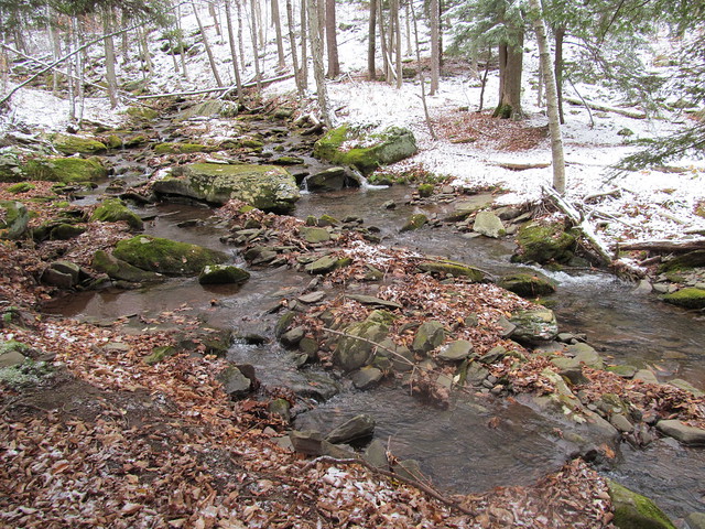
Mink Hollow Brook

About a quarter of the way up, Jon had to sit down, and started looking quite ill, and talking about aborting the hike. Chris and I of course stayed with him, and offered considerable reassurances that we'd not be at all annoyed at an abort, Objective Number One is to come home safe! But it turned out that he'd skipped breakfast, and had had nothing to eat that day but a couple of cups of coffee, and a Slim Jim munched in the car washed down with a can of Red Bull. He got out some of the food he brought, and had a sandwich. We made sure to get extra water into him, since he'd had nothing earlier in the day but salt and caffeine! He came around nicely, and said, "Let's try just moving slowly, and do just North Dome," insisting over our objections that he was well enough to travel.

In the event, it turned out that he was right. He continued to improve and was soon hiking strongly. Nevertheless, I'm a slow hiker, and the various delays made it obvious that we didn't have enough time to do Sherrill and descend to the west.

There had been a dusting of snow at the trailhead, and it gradually got deeper until it was boot-deep at the summit. The snow atop slippery fallen leaves made the ledges quite challenging. It was difficult finding safe footing for scrambling. Still, nobody had a bad fall or got hurt.

We eventually made it onto the north spur of the mountain, making the ledges slightly less high. They were still just as precipitous, and as frequent. They were just somewhat less tall. They continued up into the balsam forest.

Conditions on the ascent

Finally, we emerged onto an open path that led for about half a mile across the flat summit, depositing us directly at the canister.

Crossing the summit plateau

At last, I'd reached the spot that my family's lore had me believe was cursed.
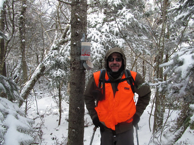
Kevin at the summit

I wrote a lengthy inscription in the log book:

Memorial inscription
IN MEMORIAM
F. WESLEY MESEROLE
BORN 1911
LAST SEEN ON THIS MOUNTAIN
NOV. 26, 1940
LEAVING BEHIND
HIS WIFE GEORGINA
AND TWO YOUNG CHILDREN
ROY AND ETTA

THIS NOTE LEFT
NOV. 2, 2014
ALL SOULS DAY
BY HIS STEP-GRANDSON
KEVIN KENNY 

I hope that for me, at least, that particular ghost will now be laid to rest.

We then started back down the mountain. Jon was quite enjoying his descent, glissading wherever possible. I was going at it considerably more gingerly, glissading only when necessary, mostly when the arses of the two hikers ahead of me had compacted the snow into a slippery mass that would not give me stable footing. A few of my glissades were of the "inadvertent seated glissade" variety. There wasn't really enough snow for a good slide, and I suspect that the rocks may have done some damage to the seat of my pants.

On the way down, I happened to notice a row of trees where the snow had made near-perfect AT blazes - nowhere near the Appalachian Trail. This potential confusion is one reason that I find the AT is interesting to navigate in the winter.

Not AT Blazes

Without much further ado, but on an approach trail that seemed much longer in the afternoon than it had in the morning, we made our way back to my car, shuttled back to grab Jon's car, and got on the road.

After getting into dry clothing, we adjourned to the Sportsman's Alamo Cantina in Phoenicia for a post-hike celebratory meal. The verdict: a successful day.

Map of our tracks:
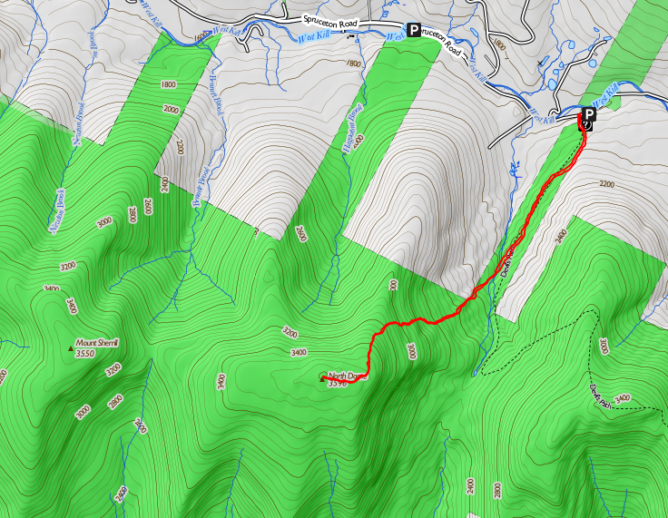
Map of the hike

Read more...

Saturday, July 28, 2012

Trip report - Rusk Mountain, 2012-07-20

In which your protagonists bag a trail-less Catskill high peak without a guide, overcome a number of difficulties, and decide once again to abort a longer hike.

ruskmtn

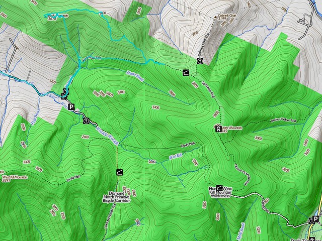
The original plan was to make a large circuit up the east side of Hunter Mountain (visiting Rusk and perhaps the Colonel's Chair on the way), and back down on the southwest side (visiting Southwest Hunter/Leavitt Peak on the way), bagging three Catskill high peaks, two of them trail-less. Had the entire hike been on trail, this would have been quite easy; two nights at lean-to's would allow ample time for the whole plan. But, the best laid plans of mice and men gang aft agley!

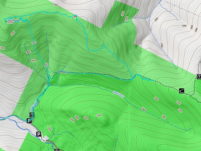
We got off to rather a late start, because of Catherine's having to work the night before. We arrived at the Spruceton Road trailhead after noon, hiked the short trip up to the hairpin turn on the Spruceton Road trail, and left the trail at the hairpin turn just after the bridge over Hunter Brook, at almost exactly 13:00. Just then, it started to rain. We continued, and soon climbed above the rain into the clouds - where a soaking mist continued all day.

We crossed Ox Hollow Brook, and started up the ridge between it and the unnamed tributary to the west. Catherine was given the job of holding us to the compass bearing, since she needed orienteering practice.

The trip up was fairly routine, except for the fact that red spruce, blackberry and stinging nettle were growing tall - tall enough in some spots to seriously compromise visibility. But we held to the line pretty well up to the ledge at 3420 feet or so.

ruskmtn2

Catherine was able to scramble right up the ledge - she's younger and more agile than Kevin. Kevin had to circle around to the east to find a more easily climbed rock slide, and carefully waypointed it on GPS against a return trip. (He had to call on Catherine to hold his baseball cap - which eventually just got stuffed in his pack - because the bill of the cap was dripping on the touch screen of the smartphone and the water drops were being interpreted as screen taps, with various unamusing results.)

Once up on the flat ridge, we made our first real mistake with route-finding. We turned immediately west toward the Rusk Mountain summit. The next quarter-mile was utter hell, pushing through a mix of blackberry, nettle, and balsam fir growing above our heads in many spots, while simply trying to hold a line westward. All the while, a few hundred feet to the north, the ridge broke out into open forest with a somewhat indistinct but hikable herd path on the ferny floor! It must have taken two hours to get us through that quarter mile, but we eventually caught sight of the canister at the summit. By now it was about 16:30 and we were thoroughly scratched up and nettle-stung.

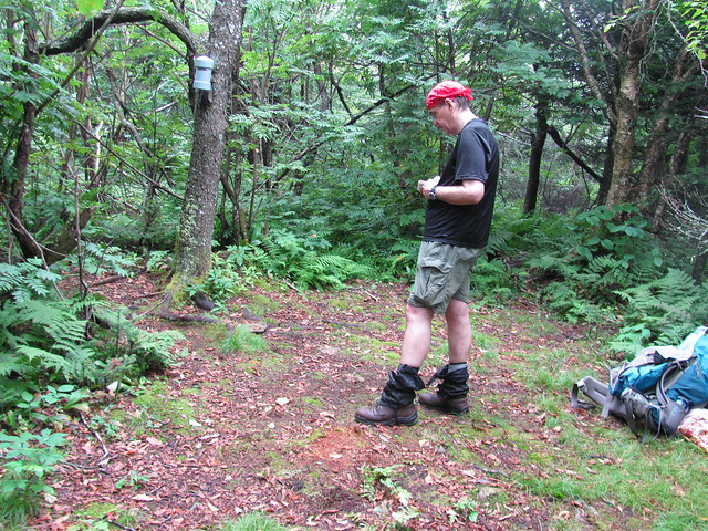
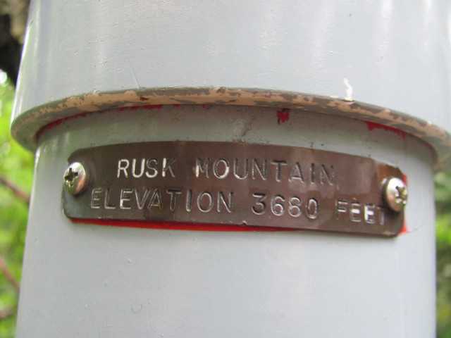
Kevin undid his gaiters to extract the various bits of vegetation that had worked their way inside, and signed in, double-checking the name on the canister to make sure we'd not got so lost as to have climbed the wrong mountain. Catherine went back up the trail with the camera to duplicate her first sight of a Catskill summit canister.

IMG_2492
IMG_2490
IMG_2493

Kevin handed the notebook and pencil over to Catherine to let her make her own mark in the summit register.

IMG_2495

We spread our fine tablecloth, unpacked our delicacies, and reverently consumed a celebratory meal. (Translation: We put a tarp on the ground so that we wouldn't get our arses muddy, and gobbled the deli sandwiches and pretzels that we had in our packs.) We shouldered our packs again, and started off on the herd path on the ridgetop, which had us moving at a brisk clip. No more than 20 minutes later, we were on - or at least near, it's pretty flat and unmarked - the summit of East Rusk.

At this point, we made another bad navigational decision - or rather a sequence of them. We allowed ourselves to fall off the ridge to the south - the trail, and Hunter Brook (our next reliable water source) were both in that direction, after all. But the talus slope to the source is a horribly steep and confused pile of broken conglomerate stone, covered with pricker bushes and red spruce (which picks up as soon as you're below the elevation for balsams). Progress became agonizingly slow again; worse, it seemed as if every rock that sprang up in the way forced us to detour even lower on the slope.

Before we'd gone very far at all, it was obvious that we would run out of daylight before reaching the trail. Kevin judged the talus to be unsafe to hike by headlamp; he'd already done one spectacular faceplant in daylight! (Catherine complimented him on falling technique, observing that he'd tucked, rolled, and taken the impact on shoulder and backpack, ready to dig in poles in need be.) We stopped on the biggest flattish patch that we'd seen in about half an hour.

Said patch was not notably big - it would hold our crash pads but would not allow our tent vestibules to be pulled out all the way. Nor was it more than flattish. Although digging out one head-sized half-buried rock and rolling it aside helped a bit, our heads were still higher than our feet. And the encroaching brush made Kevin decide not to pitch the tent proper, lest the bug netting be reduced to confetti. Rather, we made do with rainfly and footprint. Nevertheless, we managed to make ourselves a tiny warm, dry, islet in the midst of the dripping woods. Catherine hung the bearbag - she's a mean shot with a bearbag line! - and Kevin finished setting up.

There's nothing like a good night's sleep, and we had exactly that - it was nothing like a good night's sleep! Catherine grew apprehensive listening to the howls of a distant pack of coyotes, and then a screech owl right overhead started in with an unholy racket! Catherine spent the night having nightmares of Kevin falling off cliffs, and Kevin spent the night trying to sleep through Catherine's stirrings and the screech owl's cries.

To top it all off, Kevin woke up in the morning to find that the underwear that he'd hung out under the beak of the rainfly to (he hoped) drip off a little was no longer there - or anywhere else at the site as we were packing up. He suspects that a porcupine made off with it - they'll brave even hiker funk to get salt, and the skivvies were pretty sweaty! So he headed off in the morning “going commando.”

Finishing the trip off the mountain in the morning went a good bit easier. Somehow, more of the rocks led upward, and we were able to get back up on the ridge and find slopes that were hikeable without hands virtually the whole way. A little way short of the bottom, we intentionally “aimed off” a bit south to be sure of not having to search for the trail. We then set off to continue our hike, at least to the John Robb lean-to and its springs.

About halfway up the trail to the lean-to came the final straw. The waist belt buckle on Kevin's backpack started obstinately refusing to stay fastened. At that point, Kevin said to Catherine, “We're both filthy. We've both been scratched to ribbons by the prickers. We've had a poor night's sleep - you even worse than me. Everything we're wearing is still soaking wet. My you-know-what is getting chafed thanks to the missing skivvies, and my shoulders are killing me with all the pack weight on them. Hunter and Southwest Hunter are supposed to be easy - let's do them another time when it'll be fun. How about we hike back to the car?” Catherine agreed with some relief, and we turned around and started heading downhill.

A short way later, we ran into two other parties: a pair of middle-aged ladies, and a couple of younger men who were overtaking them. The ladies were making a day trip to Hunter, and one of the men greeted us with, "You must be the Kennys!"

"Uhm, yeah, how'd you know?"

The man turned to his companion and punched him playfully. "Told you so! We saw your names ahead of ours in the summit register on Rusk, and I figured that nobody would get as beat-up as you two just hiking on the trail down here!">

Catherine, meanwhile, is talking to the two ladies: "Rusk Mountain: that's a bushwhack, isn't it?

"Well, yes, it is."

"Whoa, that's way too much for us!"

A half-hour later, after tanking up our water near the bridge, we were in the parking lot, stowing our packs and explaining to a family from New York City that if they were looking for Diamond Notch Falls, they were at the wrong trailhead. One of them, to make conversation, asked where we were coming out from, and we explained that we had been bushwhacking a trail-less peak.

"Good heavens! Is that even legal?"

Catherine rose to the occasion. "Perfectly legal, but if you don't know what you're doing, it's horribly stupid. You'll get in trouble with Mother Nature, rather than the law."

This hike probably deserves a longer postmortem than most, since it went so far away from plan.

What went right: We bagged the difficult peak (even though we missed the two easier ones) and came home safely. And we did the orienteering for it without a guide. And we successfully dealt with being caught out by darkness on a rugged slope.

What went wrong: We got started late, although Catherine's schedule didn't leave us too much choice. I can live with that, but next time I might want to pick a hike with an easier way to cut the day short if we get a late start.

A couple of minor navigational errors cost a lot of time. Even in retrospect, though, I don't think they were avoidable without having someone else along who already knew the way. Knowing what we know now about the lay of the land, I think we could repeat Rusk Mountain in a third the time. So I'd say that the route-finding challenges were just part of bushwhack hiking. Perhaps more worrisome is that we displayed a certain level of "get-there-ism" in not turning back sooner at the top, to make it down before dark. There, too, though, we went into things with our eyes open. We were equipped to spend the night on the mountain if necessary, and so weren't trying to make hell-and-high-water sure that it wouldn't be necessary. Again, I'd probably make the same decision even now.

Catherine wants a PLB next time. My feelings about this are ... complicated. I think that should be the subject of another essay entirely. But Mary Ann comes down squarely in Catherine's camp, so domestic tranquility may demand that I carry one, at least off-trail.

Bailing out over the minor problem of the broken buckle felt like wimping out, but it was really the last straw. We'd accumulated too large a stock of minor annoyances, and the rest of the trip simply wasn't going to be much fun at that point. If we'd had to keep going (say, if it was going to be a day or two hike to our pickup point), I daresay we could have salvaged our spirits, but we just didn't want to make the effort.

Lessons learnt: Catherine and Kevin can spend a night in a problematic situation and come out of it unbowed. Catherine has learnt a lot about orienteering and about managing a bivouac. Kevin has got one more lesson in never lose elevation unnecessarily. That one is the lesson of a lifetime, though; particularly in situations when it's a judgment call between “go down now” and “go down later.”

It's hard to hold to a ridge when coming down it. Up is a lot easier. (But we knew that!)

I'd have liked to have come away with a lesson in how to have avoided the uncomfortable night. But in retrospect, it was a sequence of tiny factors running against us: we'd had a late start; the mist was heavy; the brush was a lot thicker than expected (because we didn't know how much it thinned out a short distance away); and in a few places we turned downhill when we ought to have tried to hold onto our elevation. I guess the big lesson is: when bushwhacking, be prepared to bivouac. (But we knew that!)

Ask us again in a few weeks. This trip has the feeling, to me, of “fun only in retrospect, but fun nonetheless!”

Postscript: Kevin was talking on Catskill Mountaineer with the guy whose name was in the summit register ahead of ours. On learning how our trip went, the gentleman replied with,

That must have been really crappy to crash on [E]ast [R]usk. That place was so wet, my stuff is still not dry even after hanging all my clothes and having a fire. How did you find anywhere that wasn't just thick prickers? The summit was completely destroyed by [I]rene too.


Read more...