Tuesday, August 28, 2012

Trip report - Harriman Park, 2012-08-24

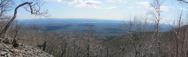
Kevin, Mary Ann and Catherine planned a very full few days, going to the Renaissance Faire in Sterling Forest, NY and then to Catherine's orientation at Molloy College. On the way down, Kevin and Catherine decided to take a few hours' break and do a nice moderate hike in Harriman Park.

We meet nice people even before starting out: a young couple bringing "trail magic" (a cooler of soda for thru-hikers) to the Elk Pen. They are planning nearly the same loop we're making, but we don't see them again. (We're slowpokes, so it's not surprising.)

Ourhike's first 2.5 miles takes us over the first stretch of the Appalachian Trail that Kevin had ever hiked, way back as a pre-teen. (It's also very nearly the first stretch that was blazed: the A-T has gone through the Lemon Squeezer for its entire history.) He is quite pleased to note that the bit that seemed so tough to an 11-year-old flatlander is actually a piece of cake!

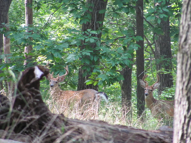
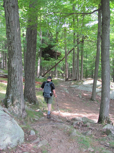
The trail ascends gradually through open woodland (what a relief after a few hikes through Catskill brush!) On the way, we see a group of three bucks, still in velvet in late summer, placidly staring back at us.
IMG_2501
IMG_2519
And of course, we kill a good half-hour trying to get better pictures. (Compulsive photography is one of the reasons that our hiking speed varies between 'snail' and 'tortoise'.)

Continuing on over the summit of Island Pond Mountain (a small hill, really!),
IMG_2521
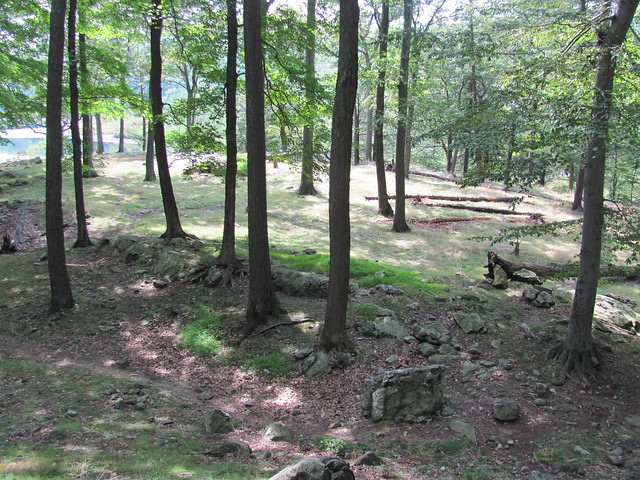
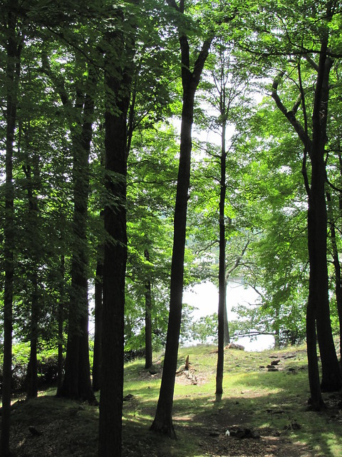
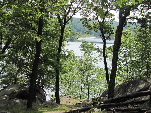
we quickly make our way down to the Island Pond Road and the knoll where Edward Harriman's hunting cabin once stood. The knoll affords some lovely glimpses of the pond through the trees, and the stone foundation of the cabin offers us a place to sit and eat lunch. While there, we are greeted by three southbound A-T thru-hikers.
IMG_2522
IMG_2526

Less than a mile farther onward over an easy trail
IMG_2529
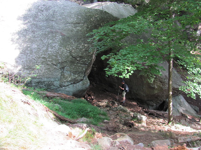
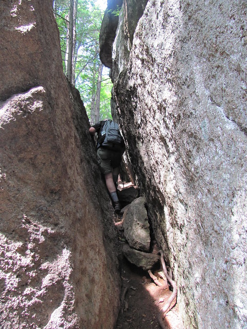
lies the Harriman Lemon Squeezer, a defile in the rock through which the Appalachian Trail passes. The Squeezer begins with a big triangular gateway through the boulders,
IMG_2541
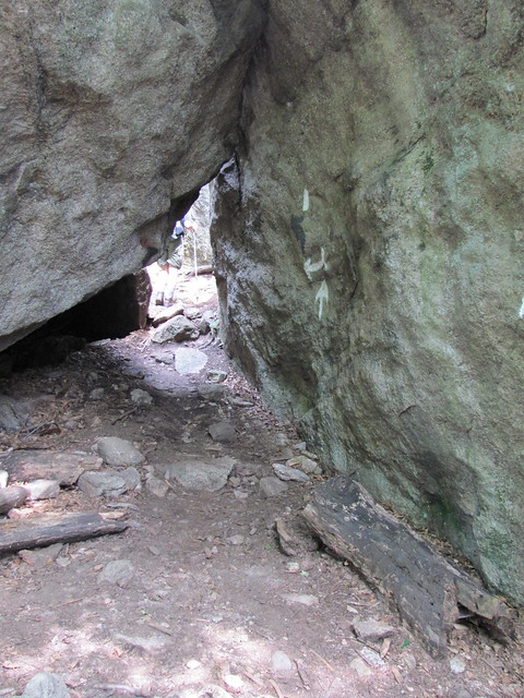
which soon narrows down to a passage through which hikers must stoop or even crawl on hands and knees.
IMG_2542

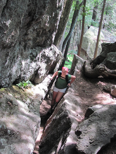
Following that little manoeuvre, the trail scrambles up a narrow and tilted crevice, to the sounds of scraping gear and muttered profanity.
IMG_2547
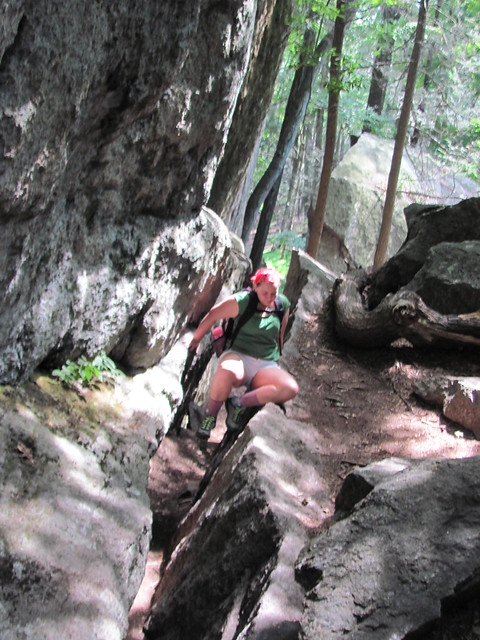
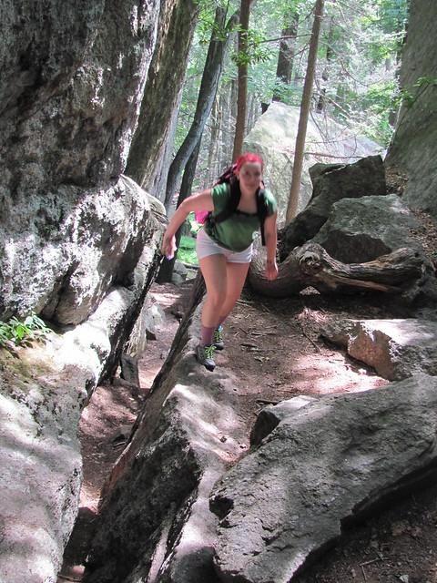
Eventually, the hiker must hoist out of it before it narrows too far to be walkable. Catherine shows how it's done.
IMG_2549IMG_2550IMG_2551

The final bit of the Lemon Squeezer is a rock scramble where we put away the camera. (A blazed alternative offers an "Easy Way", which we didn't explore.) The scramble can surely be done by brute strength, but a few moments' study actually offers a way that's no harder than a stepladder. Since the camera was put away, I offer a picture courtesy of Linda Frank of NJ Hiking:

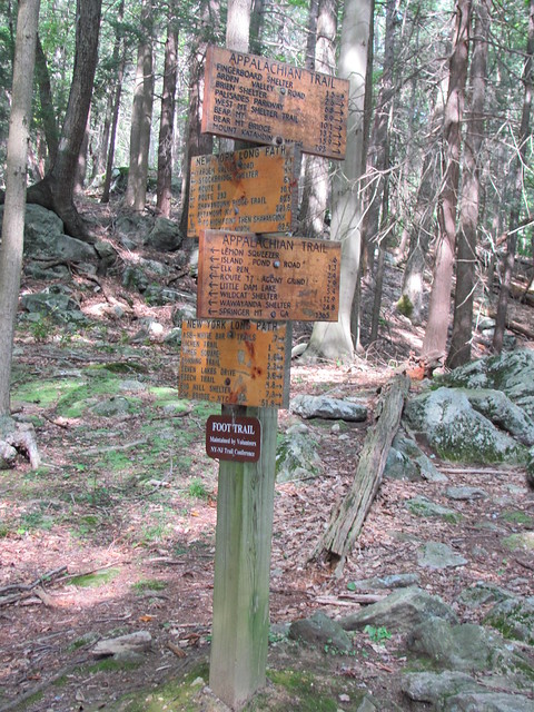
The top of the Lemon Squeezer marks the end of our scrambling for the day. We push on forward to the Appalachian Trail's junction with the New York Long Path, which surely has some of the most gratuitously excessive trail signage in all of Christendom.
IMG_2558
We turn right at the junction, and start a looping return via the Long Path, the White Bar Trail, and the Dunning Trail. The Long Path through the marsh has a huge pile of blowdown, which we bushwhack around, while observing that a 'whack in Harriman is easier than a lot of trails in the Catskills. We do pick up a few nettle stings nonetheless, and Catherine gets one boot filled with water from an incautious foot placement in the swamp.

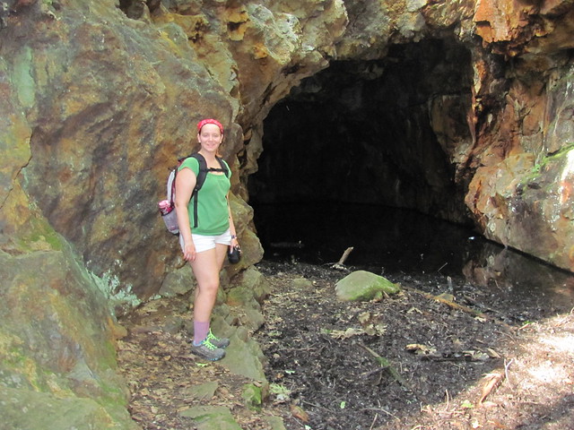
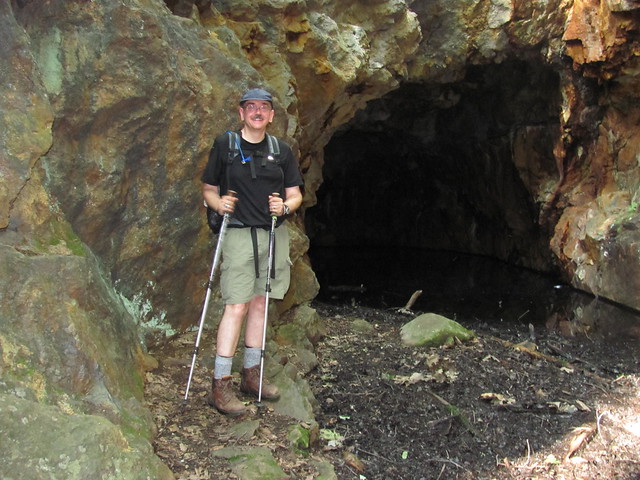
The last stretch that we walk on the Dunning Trail passes only a few steps from the flooded main shaft of the Boston Mine, where iron extraction was abandoned in 1905.
IMG_2562IMG_2563

From there we descend by an unblazed woods road (which gives us the easiest walking of the day) to the Arden-Surebridge Trail, which (the guidebook tells us) "descends a steep grade by a series of switchbacks" and returns us to the Elk Pen. About halfway down, Kevin realizes that we are committing a violation of trail etiquette by cutting the switchbacks - seriously, in all the rock we didn't notice they were there! He offers the excuse, "we're Catskills hikers and unaccustomed to such amenities."

We meet Mary Ann only about fifteen minutes off our projected time. About eight miles for the afternoon, and a lot of fun. The trash haul is light: a few candy wrappers, a couple of wads of paper towel, a tin can, and a mildewed pink tuque. Nothing like what we sometimes bring out -- it would appear that a NYNJTC volunteer had been in there recently to trash it out./p>
Read more...

Sunday, July 29, 2012

PLB [Personal Locator Beacon] or no PLB?

[Originally posted at http://www.whiteblaze.net/forum/showthread.php?86715-PLB-or-no-PLB&p=1318047#post1318047]

Under what circumstances is carrying a PLB warranted?

I'm sure this topic has been done to death here, but a quick search of the archives surprisingly turns up only a few threads, and most of the comments there are, shall we say, not exactly nuanced. (In other words, typical WB opinions. ) So, with more enthusiasm than sense, I'm going to open up my very first new thread on WhiteBlaze.

While I'm a clueless weekender, I can sometimes be a bit of an adventurous clueless weekender, and so a week ago, my college-age daughter and I went on a weekend hike trying to bag a couple of trailless peaks in the Catskills of upstate New York. For WB'ers who aren't familiar with the territory: the Catskills are New York's answer to Pennsylvania Rocks, and are in fact made, geologically, of pretty much the same stone. Off-trail hiking on that broken rock, with the blackberries, nettles, and balsam fir in profusion, can be a trifle challenging at times. Anyway, what with one thing and another, by sundown on the first night we found ourselves still on the way down from the first peak, in the rocks and prickers, and a fair distance south of the ridge we planned to be hiking. (We weren't lost in the conventional sense. We knew where we were, and where we wanted to be: they just didn't happen to match up, because the terrain offered routefinding challenges.)

The place we found to set up camp was less than ideal, but it was the biggest flat spot we'd seen in about half an hour, so it would have to do. We managed to get warm and dry, even though we were just on the tent footprint under a rainfly, because the flat space was slightly smaller than our tent. But then my daughter turned out to be really scared by the fact that we were probably half a mile of nasty rock and prickers from where hikers, even peakbaggers, usually go. She had nightmares all night, mostly of me having a heart attack or falling off a cliff. And this kid is not new to backpacking, she's weekended with me before a number of times and enjoyed it.

When we got home (earlier than expected, because we decided when we got back to the trail that doing more peaks that weekend would not be fun), she told me that she thought she'd sleep a lot better if we'd brought a personal locator beacon along. I know that PLB's are a controversial topic, at least in other forums, and in fact, I'm of two minds on the subject. I'm writing this piece partly to share my opinions, but at least as much to clarify them in my own head and get the thoughts of others. (Knee jerks - either in the direction of "the peace of mind is worth any price", or "carrying a PLB will just make you take risks, and shows you're not accepting responsibility for yourself," will not be appreciated: I've heard them before!)

So, let me try to review the arguments:

The PLB gives peace of mind. Well, maybe. Surely - all else being equal, which it seldom is - you're safer being able to call for help than having to rely on your own resources. But it will still likely take hours or days to muster a SAR party to come and find you. How much peace of mind will that really give? But that's really a good thing; out in the woods, especially off trail, you have to be ready to rely on your own resources.

At the opposite extreme - the PLB leads to false alarms, or to "yuppie 911 calls" (OMG, we've run out of Perrier! Call Search and Rescue!) Here, I'm reasonably confident that I can resist temptation: I personally am not likely to activate a PLB in any situation where I think I have a good chance of self-rescuing. And I've been in a couple of self-rescue situations: one time in the Whites, I was caught by unforecast snow in June and had to hunker down on the lee side of a rockpile until it blew over and then posthole down by flashlight through a nice layer of wet stuff; another time, I took a fall down a talus slope and had to walk out on a badly sprained knee, leaning heavily on two companions and loopy from codeine. Both of those incidents took place before there were PLB's, but I don't see why I'd have activated a PLB if I had one; in both cases, my party could rescue itself before help could have arrived, anyway.

By the same argument, a PLB could lead to overconfidence, and taking needless risks. Since I don't like even minor accidents for which I'd easily self-rescue, I don't see where suddenly having a PLB would make me go charging off and do stupid things. I'm surely a clueless weekender, but I've been a clueless weekender for forty-odd years and I've at least learnt something about weekending. Again, I think I can resist temptation.

In the event of an emergency, it's likely the victim's fault. Setting off a PLB is endangering rescuers' lives for something that the victim could have avoided. This is getting to be a thorny area. If I carry a PLB, will I someday make a series of mistakes that means I have to use it? Surely. I'm human, and we all make mistakes. But - by the time I'm in that situation, the decision will already be out of my hands. Once I'm late enough showing up, Search and Rescue is coming after me - whatever my wishes in the matter. Because they're human, too - and trying to rescue victims, as long as hope remains and even beyond, is one of the things that humans do. By far, the most expensive part of Search and Rescue is the Search. Once you've found the victim, you know where you are, and you know what's wrong, and you have resources at your disposal. Search is facing the unknown - the victim could be anywhere, you need to cover a lot of ground, and a lot of the ground you do cover will be both difficult and fruitless. So by activating a PLB in a bad situation, I'm actually mitigating damage that I've already done: SAR is coming after me anyway, but at least I can let them know where I am, come after me with a much smaller effort, and come after me in much greater safety. I like that tradeoff.

My conclusion - On the whole, the arguments favor having the signaling device. In the end, the arguments about false alarms or overreliance on the safety net, I think, represent temptations that I can resist, and the argument that actually activating the device is reckless endangerment of the SAR forces is simply wrong.

A follow-on question is: what sort of emergency is dire enough to warrant calling in the troops? I'd say that certainly anything I'd call an ambulance, the fire brigade or the police in a city for likely qualifies. But another rule of thumb might be, "assume activating the device were a crime. Would I prefer a nice warm jail cell to the current situation?" That's also a fair working definition of an emergency. Or if "I am so impeded from traveling that SAR will come after me anyway before I can get out of here," then it's safer for everyone if I activate the PLB.

The next question is what sort of signaling device to get; it basically comes down to a 406 MHz PLB or a satellite text message device (e.g., SPOT). There are advantages and disadvantages to both:

PLB: A PLB is a single-purpose device; all it can do is scream "Help!" and give a position report. But it has a very powerful scream: under heavy tree cover, it can still be Doppler-triangulated to within a mile or better; if the cover is light enough that a GPS works, then it can give its position to less than a football field. It doesn't require a subscription to a messaging service, and it will get attention. (It will get very unwanted attention if you set it off frivolously.)

SPOT: A SPOT is considerably less reliable; it needs nearly an unobstructed view of the heavens to get messages through. But it can get a greater variety of messages out: some can even do full text messaging, and all can at least send a position report and "I'm OK" or "I need help." They need a service contract.

I'm inclined to consider a SPOT considerably less useful, because of the fact that it might not deliver a message at need (because I can't get it a clear enough view of the sky). If I'm going to devote a few ounces of weight to an emergency signal, I want it to work every time. The one major advantage I can see to a SPOT is that I can use it to send "I'm OK" messages, which may make my wife sleep more easily at all times, and hold off SAR if for some reason I'm delayed but still in good enough shape to travel.

As far as I can see it, neither one is worth the weight if I'm hiking a popular trail where there's likely to be another hiker along in a few hours. But if I'm literally wandering far from the beaten track, it strikes me that a 406 MHz PLB might well be a wise thing to spend a few ounces on.

But I'm just a clueless weekender. What do the Real Hikers think? 

Read more...

Saturday, July 28, 2012

Trip report - Rusk Mountain, 2012-07-20

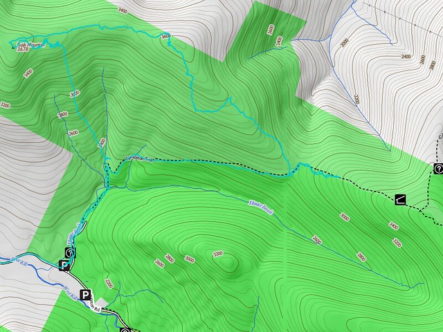
In which your protagonists bag a trail-less Catskill high peak without a guide, overcome a number of difficulties, and decide once again to abort a longer hike.

ruskmtn

The original plan was to make a large circuit up the east side of Hunter Mountain (visiting Rusk and perhaps the Colonel's Chair on the way), and back down on the southwest side (visiting Southwest Hunter/Leavitt Peak on the way), bagging three Catskill high peaks, two of them trail-less. Had the entire hike been on trail, this would have been quite easy; two nights at lean-to's would allow ample time for the whole plan. But, the best laid plans of mice and men gang aft agley!

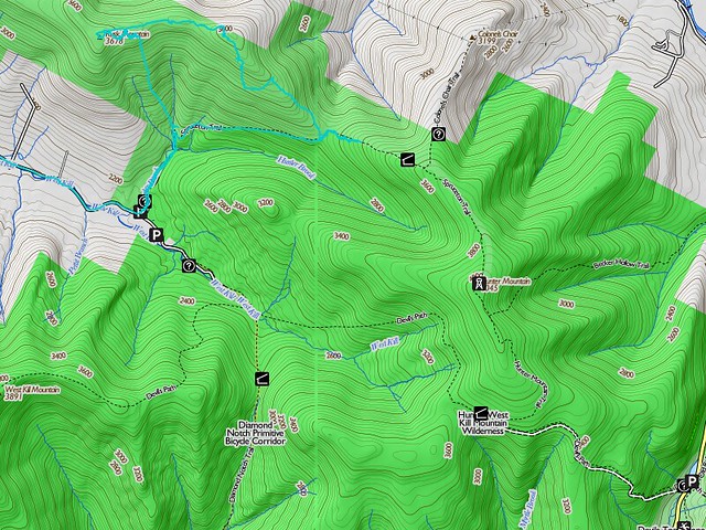
We got off to rather a late start, because of Catherine's having to work the night before. We arrived at the Spruceton Road trailhead after noon, hiked the short trip up to the hairpin turn on the Spruceton Road trail, and left the trail at the hairpin turn just after the bridge over Hunter Brook, at almost exactly 13:00. Just then, it started to rain. We continued, and soon climbed above the rain into the clouds - where a soaking mist continued all day.

We crossed Ox Hollow Brook, and started up the ridge between it and the unnamed tributary to the west. Catherine was given the job of holding us to the compass bearing, since she needed orienteering practice.

The trip up was fairly routine, except for the fact that red spruce, blackberry and stinging nettle were growing tall - tall enough in some spots to seriously compromise visibility. But we held to the line pretty well up to the ledge at 3420 feet or so.

ruskmtn2

Catherine was able to scramble right up the ledge - she's younger and more agile than Kevin. Kevin had to circle around to the east to find a more easily climbed rock slide, and carefully waypointed it on GPS against a return trip. (He had to call on Catherine to hold his baseball cap - which eventually just got stuffed in his pack - because the bill of the cap was dripping on the touch screen of the smartphone and the water drops were being interpreted as screen taps, with various unamusing results.)

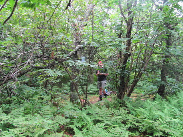
Once up on the flat ridge, we made our first real mistake with route-finding. We turned immediately west toward the Rusk Mountain summit. The next quarter-mile was utter hell, pushing through a mix of blackberry, nettle, and balsam fir growing above our heads in many spots, while simply trying to hold a line westward. All the while, a few hundred feet to the north, the ridge broke out into open forest with a somewhat indistinct but hikable herd path on the ferny floor! It must have taken two hours to get us through that quarter mile, but we eventually caught sight of the canister at the summit. By now it was about 16:30 and we were thoroughly scratched up and nettle-stung.

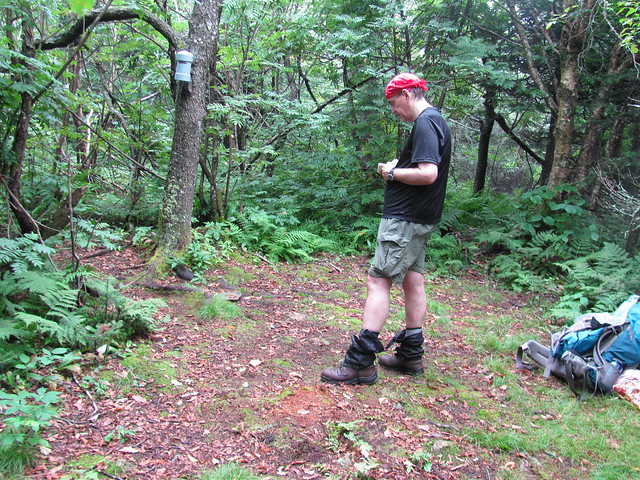
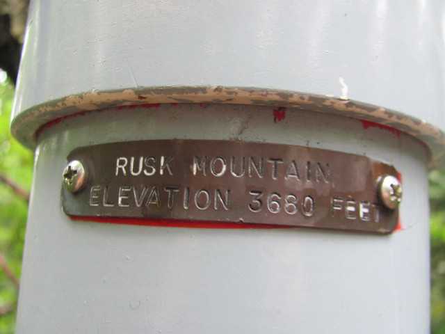
Kevin undid his gaiters to extract the various bits of vegetation that had worked their way inside, and signed in, double-checking the name on the canister to make sure we'd not got so lost as to have climbed the wrong mountain. Catherine went back up the trail with the camera to duplicate her first sight of a Catskill summit canister.

IMG_2492
IMG_2490
IMG_2493

Kevin handed the notebook and pencil over to Catherine to let her make her own mark in the summit register.

IMG_2495

We spread our fine tablecloth, unpacked our delicacies, and reverently consumed a celebratory meal. (Translation: We put a tarp on the ground so that we wouldn't get our arses muddy, and gobbled the deli sandwiches and pretzels that we had in our packs.) We shouldered our packs again, and started off on the herd path on the ridgetop, which had us moving at a brisk clip. No more than 20 minutes later, we were on - or at least near, it's pretty flat and unmarked - the summit of East Rusk.

At this point, we made another bad navigational decision - or rather a sequence of them. We allowed ourselves to fall off the ridge to the south - the trail, and Hunter Brook (our next reliable water source) were both in that direction, after all. But the talus slope to the source is a horribly steep and confused pile of broken conglomerate stone, covered with pricker bushes and red spruce (which picks up as soon as you're below the elevation for balsams). Progress became agonizingly slow again; worse, it seemed as if every rock that sprang up in the way forced us to detour even lower on the slope.

Before we'd gone very far at all, it was obvious that we would run out of daylight before reaching the trail. Kevin judged the talus to be unsafe to hike by headlamp; he'd already done one spectacular faceplant in daylight! (Catherine complimented him on falling technique, observing that he'd tucked, rolled, and taken the impact on shoulder and backpack, ready to dig in poles in need be.) We stopped on the biggest flattish patch that we'd seen in about half an hour.

Said patch was not notably big - it would hold our crash pads but would not allow our tent vestibules to be pulled out all the way. Nor was it more than flattish. Although digging out one head-sized half-buried rock and rolling it aside helped a bit, our heads were still higher than our feet. And the encroaching brush made Kevin decide not to pitch the tent proper, lest the bug netting be reduced to confetti. Rather, we made do with rainfly and footprint. Nevertheless, we managed to make ourselves a tiny warm, dry, islet in the midst of the dripping woods. Catherine hung the bearbag - she's a mean shot with a bearbag line! - and Kevin finished setting up.

There's nothing like a good night's sleep, and we had exactly that - it was nothing like a good night's sleep! Catherine grew apprehensive listening to the howls of a distant pack of coyotes, and then a screech owl right overhead started in with an unholy racket! Catherine spent the night having nightmares of Kevin falling off cliffs, and Kevin spent the night trying to sleep through Catherine's stirrings and the screech owl's cries.

To top it all off, Kevin woke up in the morning to find that the underwear that he'd hung out under the beak of the rainfly to (he hoped) drip off a little was no longer there - or anywhere else at the site as we were packing up. He suspects that a porcupine made off with it - they'll brave even hiker funk to get salt, and the skivvies were pretty sweaty! So he headed off in the morning “going commando.”

Finishing the trip off the mountain in the morning went a good bit easier. Somehow, more of the rocks led upward, and we were able to get back up on the ridge and find slopes that were hikeable without hands virtually the whole way. A little way short of the bottom, we intentionally “aimed off” a bit south to be sure of not having to search for the trail. We then set off to continue our hike, at least to the John Robb lean-to and its springs.

About halfway up the trail to the lean-to came the final straw. The waist belt buckle on Kevin's backpack started obstinately refusing to stay fastened. At that point, Kevin said to Catherine, “We're both filthy. We've both been scratched to ribbons by the prickers. We've had a poor night's sleep - you even worse than me. Everything we're wearing is still soaking wet. My you-know-what is getting chafed thanks to the missing skivvies, and my shoulders are killing me with all the pack weight on them. Hunter and Southwest Hunter are supposed to be easy - let's do them another time when it'll be fun. How about we hike back to the car?” Catherine agreed with some relief, and we turned around and started heading downhill.

A short way later, we ran into two other parties: a pair of middle-aged ladies, and a couple of younger men who were overtaking them. The ladies were making a day trip to Hunter, and one of the men greeted us with, "You must be the Kennys!"

"Uhm, yeah, how'd you know?"

The man turned to his companion and punched him playfully. "Told you so! We saw your names ahead of ours in the summit register on Rusk, and I figured that nobody would get as beat-up as you two just hiking on the trail down here!">

Catherine, meanwhile, is talking to the two ladies: "Rusk Mountain: that's a bushwhack, isn't it?

"Well, yes, it is."

"Whoa, that's way too much for us!"

A half-hour later, after tanking up our water near the bridge, we were in the parking lot, stowing our packs and explaining to a family from New York City that if they were looking for Diamond Notch Falls, they were at the wrong trailhead. One of them, to make conversation, asked where we were coming out from, and we explained that we had been bushwhacking a trail-less peak.

"Good heavens! Is that even legal?"

Catherine rose to the occasion. "Perfectly legal, but if you don't know what you're doing, it's horribly stupid. You'll get in trouble with Mother Nature, rather than the law."

This hike probably deserves a longer postmortem than most, since it went so far away from plan.

What went right: We bagged the difficult peak (even though we missed the two easier ones) and came home safely. And we did the orienteering for it without a guide. And we successfully dealt with being caught out by darkness on a rugged slope.

What went wrong: We got started late, although Catherine's schedule didn't leave us too much choice. I can live with that, but next time I might want to pick a hike with an easier way to cut the day short if we get a late start.

A couple of minor navigational errors cost a lot of time. Even in retrospect, though, I don't think they were avoidable without having someone else along who already knew the way. Knowing what we know now about the lay of the land, I think we could repeat Rusk Mountain in a third the time. So I'd say that the route-finding challenges were just part of bushwhack hiking. Perhaps more worrisome is that we displayed a certain level of "get-there-ism" in not turning back sooner at the top, to make it down before dark. There, too, though, we went into things with our eyes open. We were equipped to spend the night on the mountain if necessary, and so weren't trying to make hell-and-high-water sure that it wouldn't be necessary. Again, I'd probably make the same decision even now.

Catherine wants a PLB next time. My feelings about this are ... complicated. I think that should be the subject of another essay entirely. But Mary Ann comes down squarely in Catherine's camp, so domestic tranquility may demand that I carry one, at least off-trail.

Bailing out over the minor problem of the broken buckle felt like wimping out, but it was really the last straw. We'd accumulated too large a stock of minor annoyances, and the rest of the trip simply wasn't going to be much fun at that point. If we'd had to keep going (say, if it was going to be a day or two hike to our pickup point), I daresay we could have salvaged our spirits, but we just didn't want to make the effort.

Lessons learnt: Catherine and Kevin can spend a night in a problematic situation and come out of it unbowed. Catherine has learnt a lot about orienteering and about managing a bivouac. Kevin has got one more lesson in never lose elevation unnecessarily. That one is the lesson of a lifetime, though; particularly in situations when it's a judgment call between “go down now” and “go down later.”

It's hard to hold to a ridge when coming down it. Up is a lot easier. (But we knew that!)

I'd have liked to have come away with a lesson in how to have avoided the uncomfortable night. But in retrospect, it was a sequence of tiny factors running against us: we'd had a late start; the mist was heavy; the brush was a lot thicker than expected (because we didn't know how much it thinned out a short distance away); and in a few places we turned downhill when we ought to have tried to hold onto our elevation. I guess the big lesson is: when bushwhacking, be prepared to bivouac. (But we knew that!)

Ask us again in a few weeks. This trip has the feeling, to me, of “fun only in retrospect, but fun nonetheless!”

Postscript: Kevin was talking on Catskill Mountaineer with the guy whose name was in the summit register ahead of ours. On learning how our trip went, the gentleman replied with,

That must have been really crappy to crash on [E]ast [R]usk. That place was so wet, my stuff is still not dry even after hanging all my clothes and having a fire. How did you find anywhere that wasn't just thick prickers? The summit was completely destroyed by [I]rene too.


Read more...

Trip report - Panther Mountain, 2012-07-02

In which your protagonists abort a backpacking excursion but claim one Catskill high peak.

Kevin and Cathy originally planned for a trip spanning July 2-4 2012, making a circuit of Panther Mountain and the Burroughs range, with stops near the Woodland Valley campground and somewhere up on the ridge between Cornell Mountain and Slide Mountain.

We got off to a nice start, with Kevin trying out his Komperdell poles for the first time. We ran into a nice couple at the trailhead; he was a Modern Orthodox Jew, and she looked and sounded as if she was from southern Africa - she reminded us of a Botswanan friend from church.

We rolled - at Kevin's usual snail's pace - up to the Giant Ledge without incident. We ate lunch at one of the campsites. There was a group of about 20 kids near Catherine's age having a noisy lunch - in the trail - right at the best overlook. After they moved on, Catherine snagged a lovely panorama of the view to the east, with the Devil's Path to the left, the Burroughs Range to the right and Mount Tremper in the middle. (Bigger, zoomable version)

When we were done with eating and photography, we picked up again and continued across the swaybacked ridge to Panther Mountain proper. We passed the nice couple again, on their way back down. They mentioned disappointment that the spring below Giant Ledge was not running.

On the way up, Catherine began feeling again the symptoms of the Coxsackie virus that we thought she'd recovered from. She kept it to herself and soldiered on up to the Panther summit. As she put it, “by that point, I was so angry with the law of gravity keeping me from the top that I was not going to let it win!” Once we got there, though, she confessed to feeling quite ill and called for an abort. We ate a snack, snapped the "we made it" shot, and headed back the way we came.

IMG_2431

On the way down, we decided to check out the spring. We found the depression in the rock, full of water. While nothing was obviously flowing, the water had to come from somewhere. We noted that we would drink the water with filtration (and not without, it looked pretty disgusting), but since we were still decently supplied and planning to abort anyway, didn't bother to pump.

Kevin's toes started bothering him - rather bruised - on the steep descent off the ridge. Apparently walking with poles changes his stance rather a lot. So it was a slow-moving and hurting party that got back to the car and drove back to Niskayuna after telling Mary Ann to send the dancing boys home.

What went right. We aborted. It was the right decision. (In a close call, it's always the right decision!). Objective #1 achieved - come home safely. We bagged one Catskill high peak, and tested Kevin's new poles. (Verdict: They're knee savers!)

What went wrong. Catherine didn't feel well. No way to predict this, really, until she hit the rigors of the trail. Kevin had his boots laced wrong, and had a lot of pain from his toes because of it.

Lessons learnt. A well executed abort is better than a miserable trip. Catherine was not up to the 3000 foot climb that would have started the second day had we pushed on.


Read more...

Monday, April 16, 2012

Trip report: Echo Lake, 2012-04-12/13

Thursday and Friday, 12-13 April, Kevin and Catherine decided to do a nice, fairly easy backpack to Echo Lake in the Catskill Mountains. (Cathy had spring break from school, and Kevin was much feeling the need to be incommunicado for a bit; things have been a bit crazy at work.) We decided to hike through from Meads Mountain above Woodstock to Plaat Clove (Platt, Platte—all three spellings are correct!). Mary Ann agreed to shuttle us down so that we could spot Kevin's truck at Plaat Clove and not have to make an in-and-out or a loop out of the hike. This drive is far beyond the call of marital duty, and Kevin praises Mary Ann to the heavens for it.
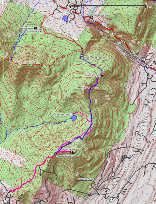
Trail map with GPS track overlay

Since we're planning a leisurely hike, we don't try to get rolling at the crack of dawn, and what with the 2+ hours of driving (including the “road closed—pass at your own risk” drive down Platte Clove Road), we wind up arriving at the trailhead around 11:00. Mary Ann snaps a picture of the departing hikers, and we start up the road to the TV transmitter and the old Overlook Hotel.
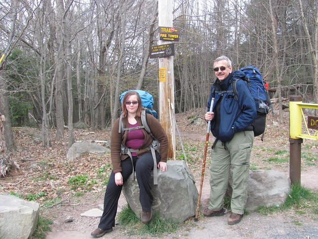
The hikers set off

The gravel road is maintained for vehicles, because occasionally a maintenance crew needs to visit the TV station (which is on State wild forest land, but with a grandfathered-in lease). But it's deceptively easy: it's gradual, but there is an unremitting 12% grade for the next 2.5 miles (4 km) to the top of Overlook Mountain. We set a sustainable pace, don't get burnt out, and fairly shortly arrive at the ruins of the Overlook Mountain House, an ill-starred grand hotel of the Catskills.
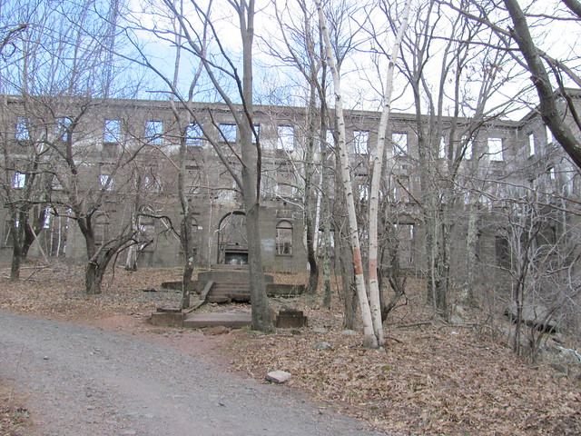
Approaching the Overlook Mountain House

Less well known than some of the other Catskill resorts, the Overlook Mountain House suffered considerable ill luck during its history. The first attempt to construct a guest house on the site was built in 1833, and changed hands in bankruptcy multiple times before the Civil War put an end to it. It was never successful financially. The first large hotel, which opened in 1871, was destroyed by fire in 1875. It was rebuilt in 1878, and continued sporadic operation until 1917, when it had its ultimate financial failure, and again fell victim to the flames in 1923. A third attempt to build a large hotel on the site commenced in 1928, but construction slowed during the Great Depression, and the hotel remained incomplete at the start of the Second World War. Much of the building survived—although the remaining construction materials had been pilfered—until the mid-1960s, when a final blaze brought down the never-finished building, leaving only the stone and concrete walls that stand to this day. The real reason that none of the attempts was successful appears to be the remoteness of the site. It is at a higher elevation than any of the other Catskill grand hotels, and had no ready rail access.[1]
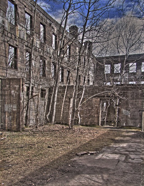
Ruins of the Overlook Mountain House

We spend considerable time sightseeing and taking pictures of the magnificent ruin. The whole site has a post-apocalyptic feel to it, as the abandoned masonry continues its slow decay in the Catskill winters. Even the signs warning of the building's condition after the fire are in a state of decay.
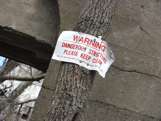
Dangerous Structure

The great fireplace of the hotel lobby now serves to hold the occasional campfire.
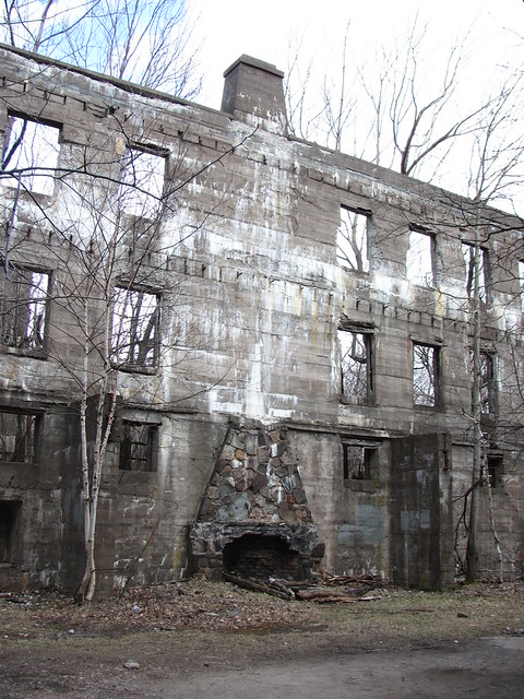
The main lobby

The dining room has stood abandoned long enough for trees to grow to maturity and themselves be toppled by storms.

Fallen trees

Twisted wreckage and half-burnt timbers fill the basement-level boiler room.
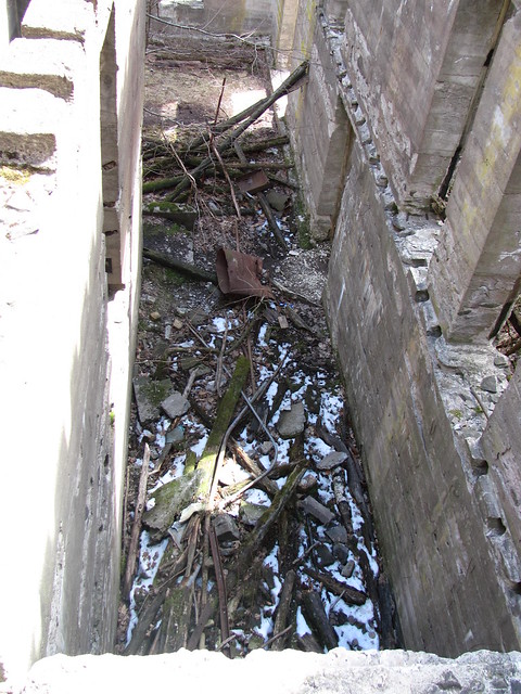
Boiler Room

A majestic stone staircase, now cracked and moss-covered, leads nowhere. The upper storeys have fallen.
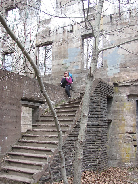
A grand staircase leads nowhere

The former vista from the front door is now grown to trees, but with the leaves down one can see how sweeping the view once was.
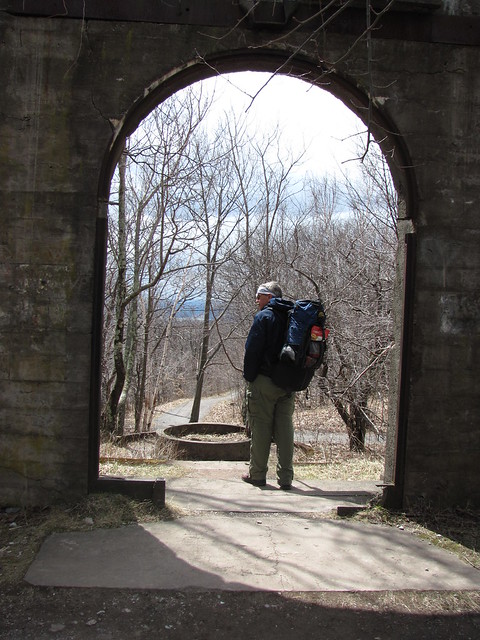
View from the front door

The squalls of sleet that continue to pelt us intermittently offer dramatic lighting for photographing the ruins.

Overlook Mountain House

The dark passage of a back door leads to the owners' mansion, also unfinished and burnt.
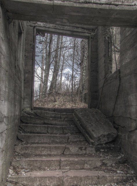
Overlook Mountain HouseOwner's mansion

Here, some of the windows retain their glazing, and are propped open as if some guests want to let in a little more air.
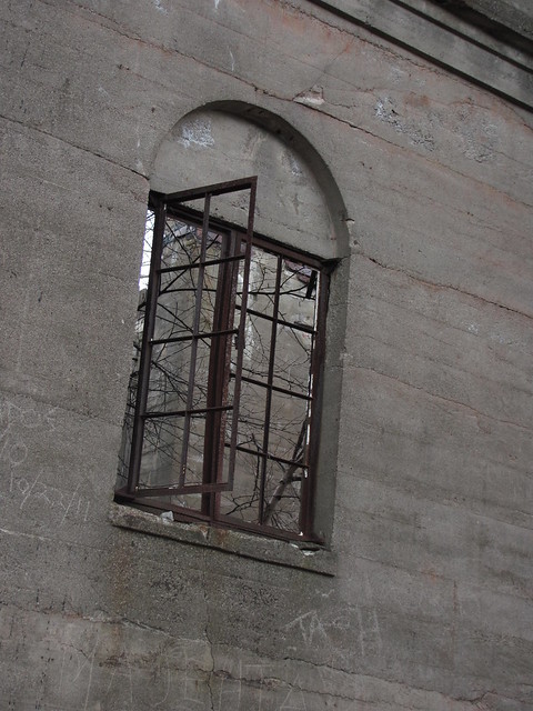
Window

And yet, inside, it is open to the weather.
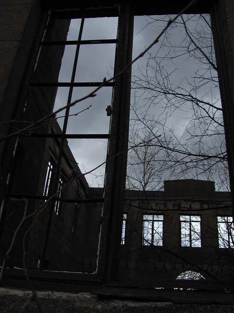
Looking into the owner's mansion

A debris-filled, claw-footed bathtub has fallen to a corner of the basement.
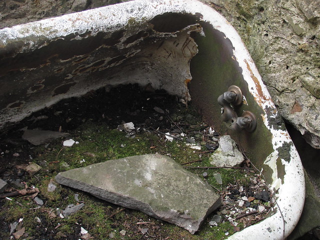
Fallen bathtub

Eventually, we manage to tear ourselves away from surveying the ruins and continue on up to the Overlook Mountain summit, where a now-unused fire tower stands.
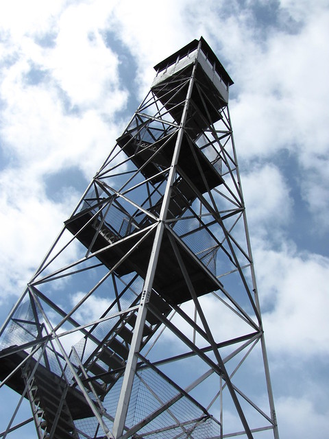
Overlook Mountain fire tower

We stow our packs on the porch of the fire warden's cabin, eat lunch (resisting the cuteness of a pair of Springer spaniels that are trying to cadge a handout), and explore the mountaintop unburdened. A few young balsam firs, normally present only at higher elevations, surround the cabin.

Fire warden's cabin

From the tower, we can see the squalls dropping shafts of sleet into the glacial cirque that will be our destination for the evening.
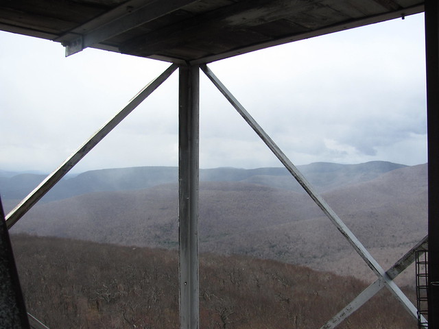
IMG_2123

And Kevin manages to snag a phonecam shot to send to Mary Ann during the few moments in which he's able to get a signal. Alas, the signal fades before the message goes through, so she gets the picture a day later.
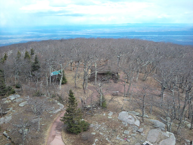
Overlook Mountain

The wind and sleet soon drive us off the tower.
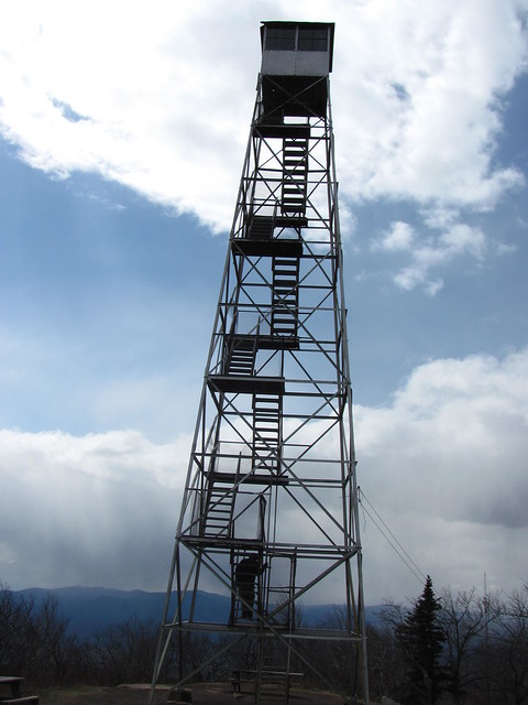
Down from the tower

We take the more sheltered path to the sheer cliff on the east side of the mountain top. Even in the sleet, the cliff top offers spectacular views of the Hudson Valley and the Ashokan Reservoir. (Zooming view)

View from the Overlook Mtn ledge

Kevin grabs the obligatory "we made it" shot of Catherine.
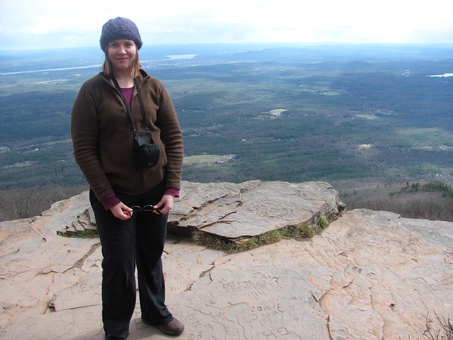
We made it

And Catherine waits patiently for Kevin to enter a GPS waypoint for the overlook.
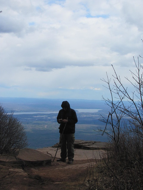
Kevin typing

Again, we manage to pull ourselves away from compulsive photography, hoist our packs, return to the Overlook Road (long unmaintained as a carriage road north of the mountain, but still usable as singletrack by mountain bikes), and hike north toward the Echo Lake trail junction. Before long, we're greeted by this little guy.
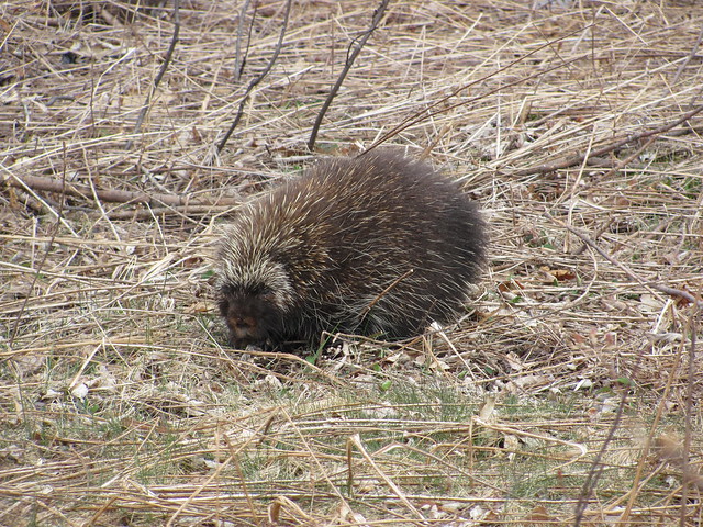
Porcupine

“Thank you for the photo-op, Your Porcupinity!” (Is that the correct form of address for a porcupine?) “Now, would you mind terribly if we were to use the trail here?” His (Her? How do you tell among all those quills?) Porcupinity graciously affords us a view of the other end of the creature:
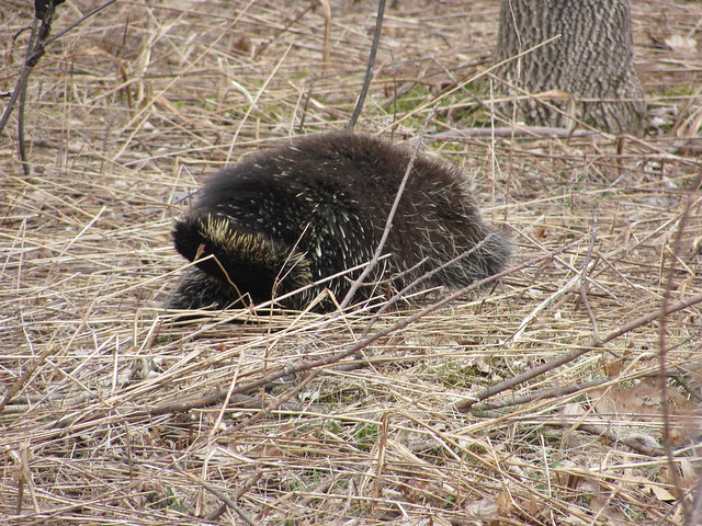
Porcupine

And we continue to the Echo Lake junction, where we turn and descend. (Our course isn't as drunken as the GPS track would indicate: the GPS signal was fading in and out because of the sleet.) Kevin doesn't spot the spring along the way (although the trail is wet at several points), and so leaves a question mark on his personal map. Before long, we catch our first glimpse of the lake through the trees.
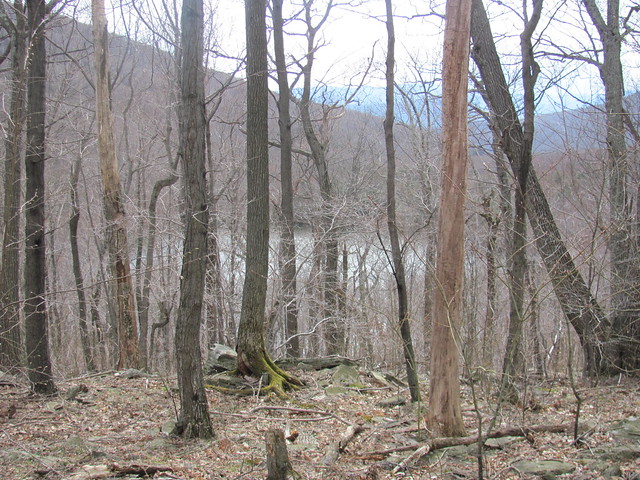
Echo Lake

By the time we arrive at the lean-to, the sleet has become pretty heavy. We decide to take time out and have afternoon tea, brewing up a nice cuppa over Kevin's alcohol stove. While we're sitting there enjoying our tea and energy bars, an enthusiastic Scottish terrier bounds up and starts nuzzling us, investigating our stuff, and generally acting amusing. A moment later, two young men appear. “Sorry! We didn't know anyone was in there! Rex![2] Leave those people alone!”

“Do you want the lean-to? We're not spending the night here, we just wanted to get out of the sleet and make a cup of tea. You're welcome to it, we're planning to tent anyway.”

“Yeah, we got caught in it up on the ridge! That was great! No, thanks, we're tenting, too! C'mon, Rex!”

By the time we've finished our tea, the squall has let up enough that we start walking along the lake, looking for the group of designated campsites that are supposed to be there. We run into the two young men again (Rex tries to follow us home, and one of the guys has to come and drag him back), but don't find a vacant spot. Finally, Kevin decides to just find someplace that's the required 150 feet (50 m) from water and trails. The first such place that's level enough to pitch a tent, he says to Catherine, “This spot looks perfect; it's lawful, and it's even flat, and, oh looky here, there's a CAMP HERE sign.”

We make camp, pump water from a nearby stream (Yuck, it tastes awfully tannic. Oh well, tannic water is generally safe), and go through the ritual of whirling and casting to get the bear bag line over a suitable tree limb. On one cast, the drawstring of the rock sack snags on the limb, and breaks as we're trying to haul back down for another try. Rock and sack are still in the tree. Kevin ties a monkey's fist arond another rock, and the very next cast is successful. So later we'll be able to hang all the food and toiletries.

Supper is mango chicken curry over rice and lentils. Kevin and Catherine both pronounce that recipe a winner. Instant chocolate pudding for dessert. Brush teeth, hang the bearbag, and it's time to crawl into the sack (we're going about by headlamp, and everyone knows that's “hikers' midnight”

Around about real midnight, Kevin and Cathy both need to visit the woods at nearly the same time. By now, the sleet has blown over, and the sky is so clear that we can actually navigate by starlight! (The Moon hasn't risen.) The beautiful weather continues for the rest of the trip.

Sometime in the wee hours, Kevin rolls over and hears the characteristic “huff whuff huff woof” of a black bear coming from the general direction of our bearbag. Reasoning that if the bear has got into our stuff, there's absolutely nothing we can do about it, he rolls over and goes back to sleep. In the morning, he asks Catherine, “Did you hear a bear in the night?”

“What does a bear sound like?” (Kevin tries to imitate the sound.) “Is that what that was? Thanks for not telling me then, I'd have been terrified!” The weather outside our tent is perfect. The bearbag is untouched (the Catskills don't have genius bears as the Adirondacks do), so breakfast of porridge, dried fruit and coffee is soon inside us. Pump more water (somehow Catherine draws sweet water out of the stream that was so tannic for Kevin), pack up, and head back up to the ridge.

While Catherine was waiting for Kevin to wake up and gather his wits, she also took a picture to show how gorgeous the campsite was. This sort of thing is why we go hiking.
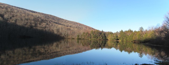
Echo Lake

On the way back up, we pass yet more evidence of the fury of Hurricane Irene, in the form of the root ball of a huge tree that she uprooted.
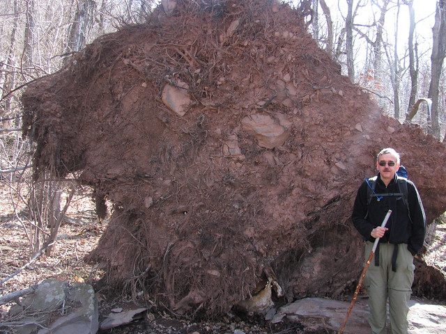
Blowdown

Heading north on the old Overlook Road again, we soon come upon the reliable Skunk Spring, where Kevin snags a GPS waypoint for his personal map. We have plenty of water, so don't bother to break out the filter and bucket.
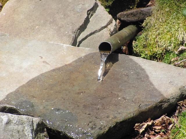
Skunk Spring

A short distance further along, we reach the abandoned bluestone quarry at an outcropping called Codfish Point. There are no codfish anywhere nearby; why is it called that? Apparently, the quarrymen ate sandwiches of canned codfish, and discarded the inedible bits in the quarry. Eventually, the quarry came to smell as you might expect. The quarry has been closed (and sweeter smelling) for over a century, but the name has stuck.

When we reach the quarry, we discover that the Quarry Gnomes have been busy preparing for our visit. We rest for a while on the throne of the Gnome King,
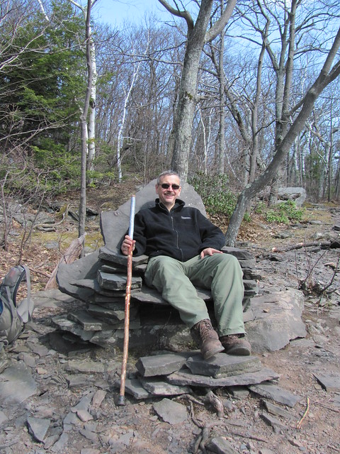
Throne of the Gnume King

preach to the wild creatures like Saint Francis,
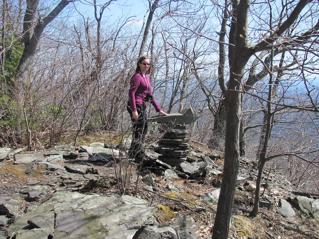
Catherine preaching to the flock

eat our lunch at a charming little conversational grouping overlooking the Hudson Valley,
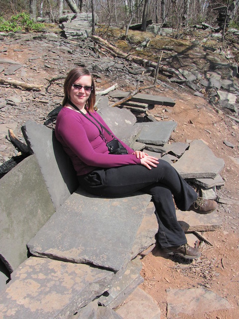
Gnomish sofaView of the Hudson Valley from Codfish Point

survey some gnome-sized benches around a gnome-sized firepit,
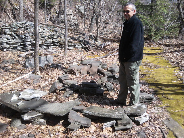
Gnomish fire circle

and try to fit Kevin's fundament into a gnome-sized chair.

Gnome chair

Back on the trail, we decide that we're going to limit our side excursions and not attempt anything ambitious, and head down toward the Platte Clove Nature Preserve and the way out. At the lower elevation, the ground has a lovely green carpet of Lycopodium..
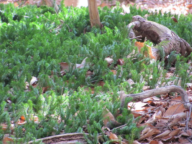
Lycopodium clavatum

On the way through the preserve, we run into two artistic ladies who are on a nature walk, sweaters around shoulders, tennis shoes, and so on. They treat us as if they're observing the local wildlife: “You've such big backpacks! Are you real campers? Did you actually spend the night in the woods?” “Yes, we made camp at Echo Lake, about five miles back.” “Wow, they told us there might be hikers traveling through here, but I never expected that we'd actually run into any!” Kevin and Catherine are able—barely—to stifle the giggles until the ladies are out of earshot.

The preserve has built a small-scale replica of the king-post bridge that once carried the wagons hauling bluestone out of the Catskill quarries to building sites all over the East Coast (and even farther, at times).
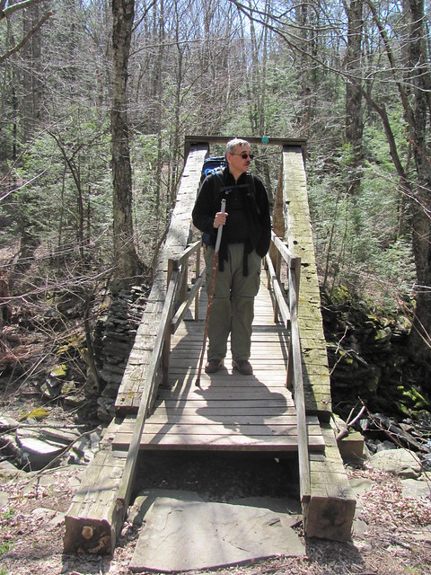
Kingpost bridge

One side trip that we can't resist is the climb down the gorge to the lovely Plattekill Falls. This waterfall is actually one of over a dozen spectacular falls in the Clove, but most of them have been seen only by climbers with technical gear—the Clove is one of the most inaccessible places in New York State.
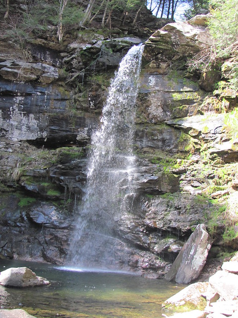
IMG_2233

So: What worked: Almost everything. The PCT bearbag hang foiled an actual Catskill bear. Meals were satisfying. Everyone stayed warm and dry, and both of us were comfortable with pack weight. The curry recipe is tasty. Wonderful scenery, some wildlife encounters, lots of history, on the whole a great trip!
What didn't work.Batteries. Kevin's phone ran out of juice a couple of hours before the end of the trip. And: We brought three sets of batteries for the camera. The two spare sets were both dead on arrival. Well, not quite dead, but low enough to trip the low-battery indicator of the camera after a couple of pictures. And yes, they were just-purchased, name-brand batteries.
Using a rock sack on the bear bag line. Rock sacks are for hikers that can't tie monkeys' fists.
Lessons learnt:Kevin has to be careful when cooking breakfast (and therefore undercaffeinated by definition). He caught his jacket sleeve on the handle of the cookpot (fortunately, still filled with cold water) and overset it on the lit stove! Fortunately, there was no real harm done. Catherine got all the food out of the way, we had plenty of water, and only the primer pan went out. The stove stayed lit, and boiled the replacement litre of water without complaint (and without refuelling).

[1] Yasinsac, Rob. “Hudson Valley Ruins: Overlook Mountain House” http://www.hudsonvalleyruins.org/yasinsac/overlook/overlook.html , downloaded 2012-04-15.

[2]Not the dog's real name, but I've forgotten the real name.


Read more...