Solo climbing is not as foolish as one might believe; the peak is popular enough that on a summer weekend, there is bound to be another hiker along in an hour or two. Kevin's been working on overcoming his training that always said, "Never Hike Alone!" - the actual rule is more like "Never get into a situation where nobody knows where you are." (Look at the "Never Hike Alone" pundits - they all appear either to be non-hikers or else they do not practice what they preach.)
Anyway, the start was a bit late, just because of messing around with things at home (and not having had the pack organized on Friday night). Anyway, armed with the usual gear, Kevin got on the trail about one o'clock in the afternoon, looking forward to an approximately six-hour hike. The aptly-named Devil's Path starts from the parking lot at the end of Prediger Road, which was very full that day with the cars of people who wanted the bragging rights of climbing Indian Head.
The first couple of miles have the nature of an "approach trail" - not at all like the rest of the Devil's Path. They climb only a couple of hundred feet, gradually, with a couple of crossings of the mighty Schoharie River,
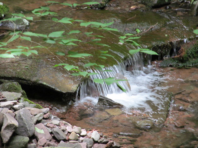
one of which traverses a magnificent stone arch:
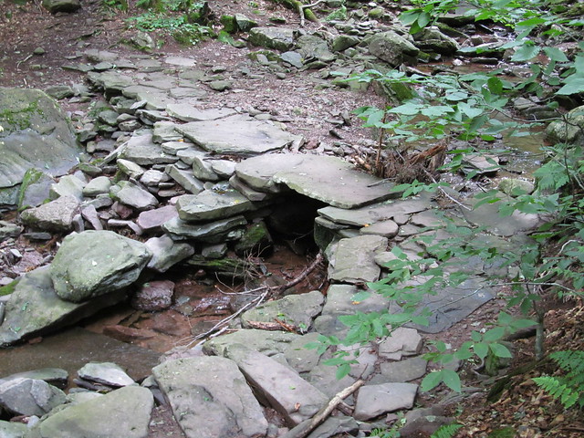
(All right, I'm being silly. The Schoharie is indeed a substantial river, but you wouldn't know it here at its headwaters!) On the way in, Kevin meets an old lady with two ancient Labrador retrievers, who turned back after the old dogs proved unable to make the climb. (This is not a hike for most dogs!)
At a trail junction with a signpost that leans drunkenly,
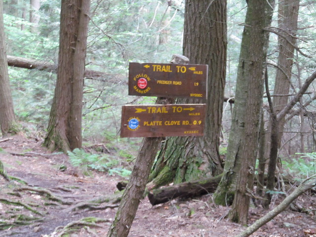
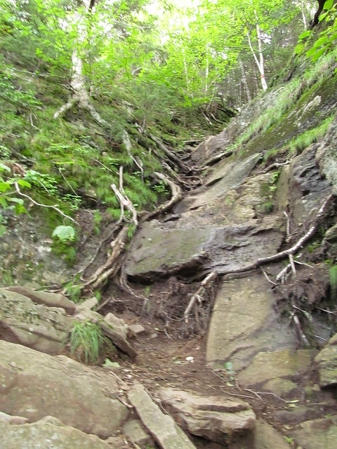
the Devil's Path turns off the old Overlook Mountain Turnpike and begins to show its true colors as it ascends the east face of Indian Head. At no point in the ascent is it anything other than "steep" - unless you want at some points to replace "steep" with "precipitous." The treadway consists of rocks and roots, with the occasional deep mud thrown in for good measure. The mud was sloppy enough that Kevin regretted not having brought his gaiters - but who would imagine that a high-elevation trail would be that wet in August?
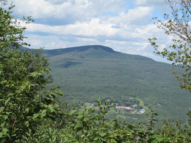
About a mile (filled with numerous rock scrambles) later, the trail makes it up to the "chin" of Indian Head. Just before the last scramble, the dense vegetation opens up just enough that a hiker can get a view of Kaaterskill High Peak to the north:
and by stepping right to the cliff edge and craning the neck, just barely glimpse the Bruderhof religious community at its base:
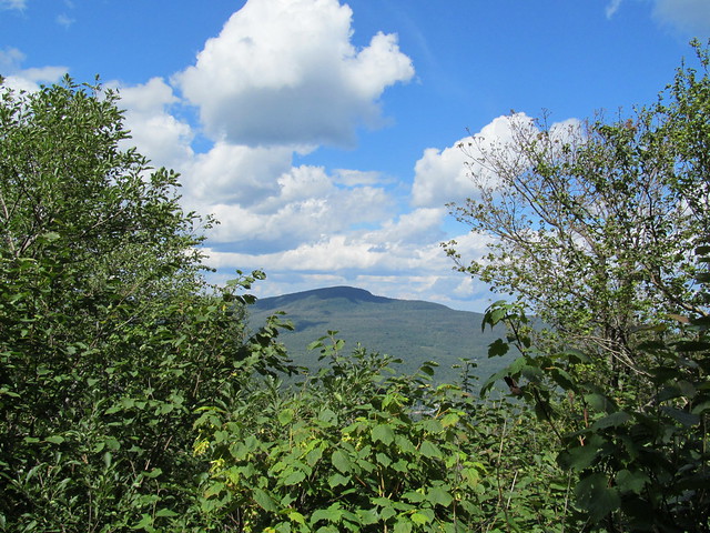
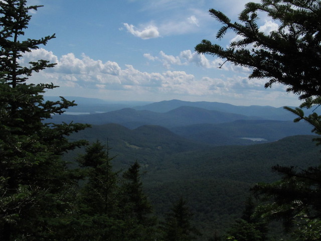
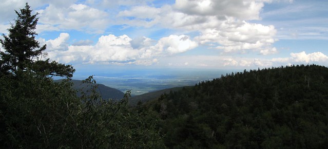
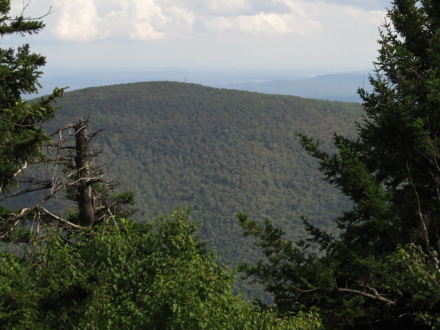
Another scramble leads up to a rock that presents a sweeping view of the Hudson Valley (and on into Vermont and even New Hampshire) to the northeast,
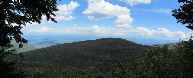
and a tantalizing glimpse of the lower Hudson past Plattekill Mountain.
Here on the ledge Kevin overtakes a group of nine university students out for the day, is overtaken by two ladies also climbing the peak, and is invited to an impromptu party by three gentlemen who are running a camp stove. Kevin observes, "A hot lunch! Traveling in style!"
"Want some coffee?" asks one of them. "No, thanks, I'm overheated already."
"Want some rye?" asks another, pulling out a bottle of the amber nectar with a very prestigious label. "No thanks," Kevin says again with some regret (believing that alcohol and solo rock climbing would be a bad combination). The ladies take him up on his offer.
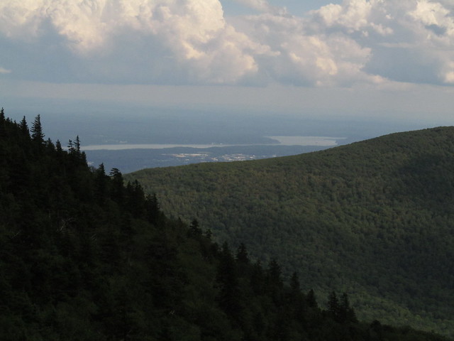
"How about a hit on the hookah?" volunteers the first, to laughter all around. (There is no hookah in evidence.) Kevin asks to step forward and block the view for a few minutes (permission is warmly granted!) and gets a panorama of the view past Plattekill Mountain.
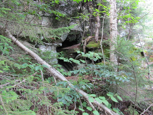
The ladies and the students hike on, "Maybe I'll see you further up! If not, have a great hike!" and soon Kevin follows. The trail turns around the south side of the rock, passes a cave shelter that is fairly obviously inhabited (there's bear scat everywhere!)
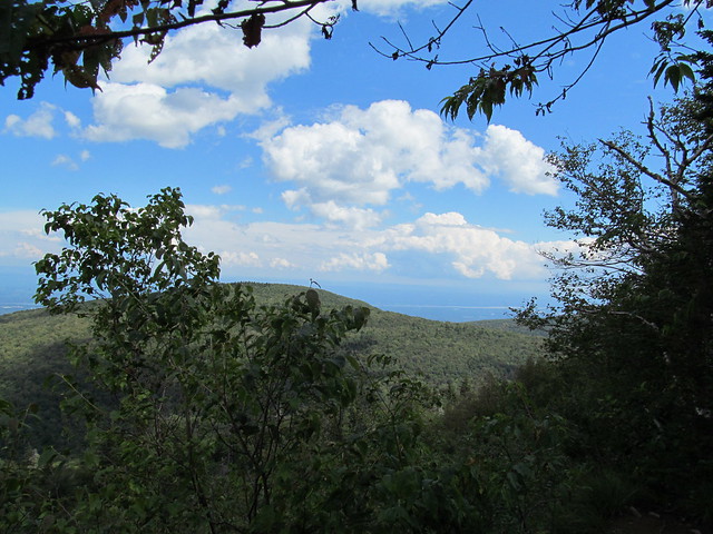
and a brief but lovely overlook of the Ashokan and Esopus valleys, with the Kittatinny ridge in New Jersey visible in the far background. (It's just barely possible that the Blue Mountains of Pennsylvania are visible beyond it. If so, that would make seven States that can be seen from Indian Head.)
Having climbed the "chin" of Indian Head, the trail makes its bumpy way across his "lips." Dodgy spots where the trail skirts hundred-foot dropoffs alternate with more level (and muddy!) patches. Kevin meets the obligatory party of twenty Korean tourists (who smile and wave but haven't much English), an elderly Polish (?) lady (ditto), and a couple of young men finishing an eastbound traverse of the Devil's Path.
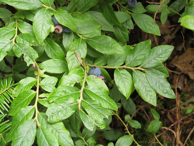
Kevin decides to skip the dried fruit he's brought for an afternoon snack because there's fresh fruit available instead: blueberries!
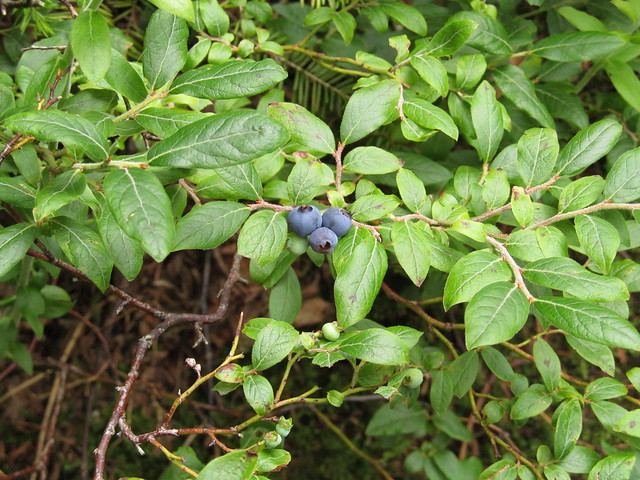
And the bears have left some for hikers!
Having satisfied his sweet tooth, Kevin ambles on, rapidly coming to the cliff under the "nose" of Indian Head. This stretch involves the most punishing scrambling of the entire hike, including a 50-foot near-vertical section up wet sandstone.
At the top of that scramble lie a couple of rock chutes, including the infamous Corkscrew Chimney. Kevin is much to occupied with climbing to take pictures, but this one from the New York Times gives the idea.

(Source: Kristen Luce, The New York Times)
The rock has water trickling over it, and is covered with algae, leading Kevin to observe that the Indian Head needs to wipe his nose, it's really snotty!
After a bit of head-scratching, Kevin works out the hand and foot positions needed to get up that crack, and comes out on the top. There's a bit more sketchy footwork on a narrow ledge over a steep drop, a little bit more scrambling, and the trail comes out at the tip of Indian Head's nose, which offers even further views of New England:
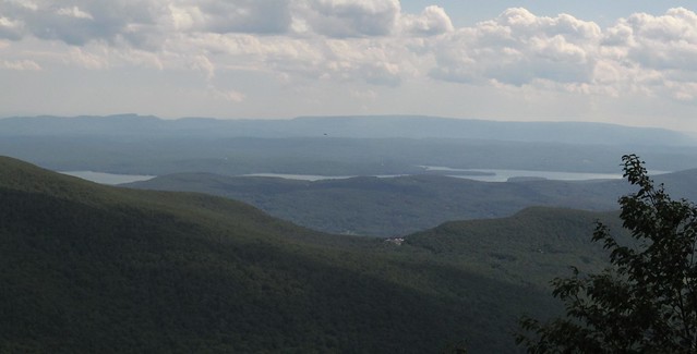
of the lower Hudson Valley,
and of the Ashokan reservoir.
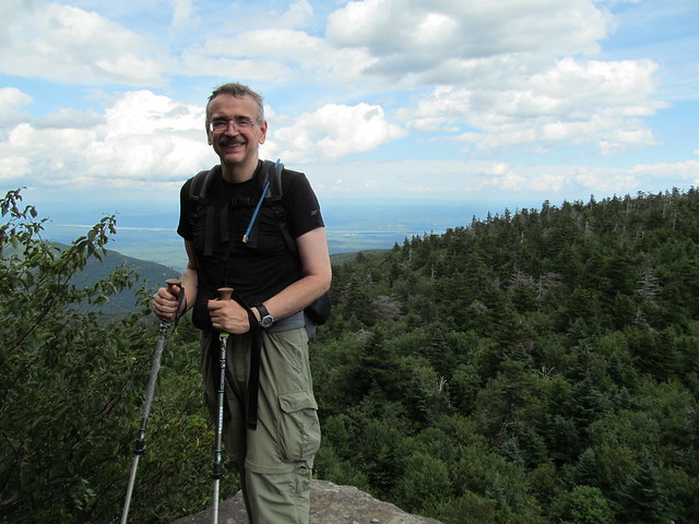
The university students are here taking a rest break (several appear to be sound asleep, no doubt worn out by the climb). One of the students offers to take Kevin's picture, to show he's won through to the nearest viewpoint to the actual summit of Indian Head.
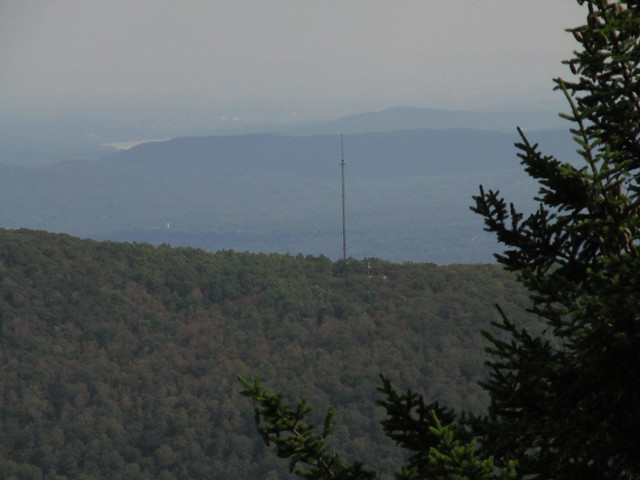
From here, the Devil relents for a few moments in his trail design, and the trail offers a pleasant walk through the heavenly perfume of the balsam forest. The walk is marred only by one spot where a huge cloud of buzzing flies is attacking the leftovers of a coyote pack's latest kill - some small creature, possibly an opossum (they really didn't leave enough to recognize). The actual summit is hard to locate - Indian Head, like all the Catskill peaks, is flat-topped, but eventually the trail emerges to another fleeting overlook on the Indian's "forehead" that sees Overlook Mountain,
with its firetower,
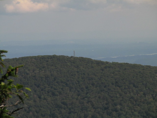
and television transmitting station,
and another obscured view of the Ashokan.

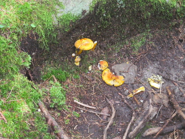
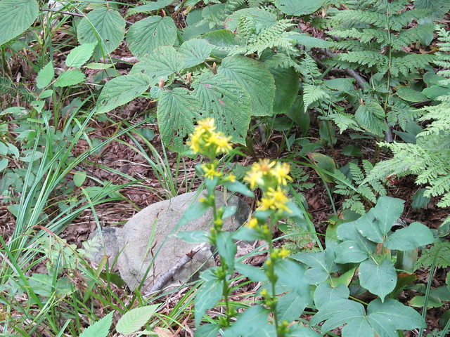
The balsam forest supports astonishing biodiversity, including a strange toadstool with brilliant yellow cap and orange stem:
and a tangled understory of perennial plants. (The subalpine growing season is too short to support annuals.)
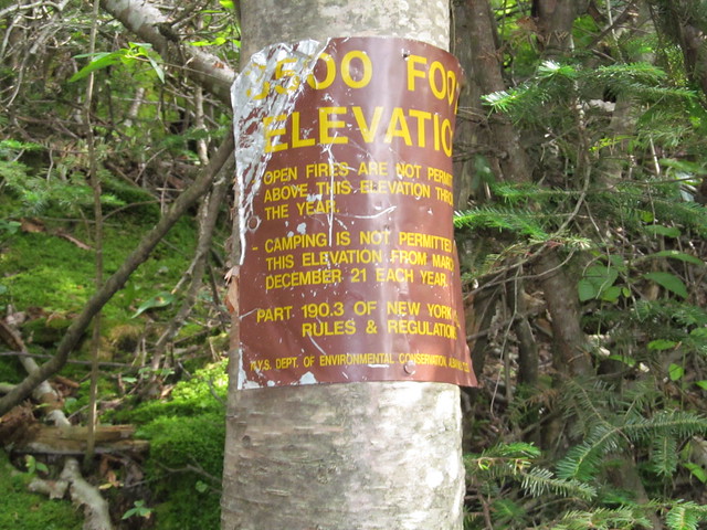
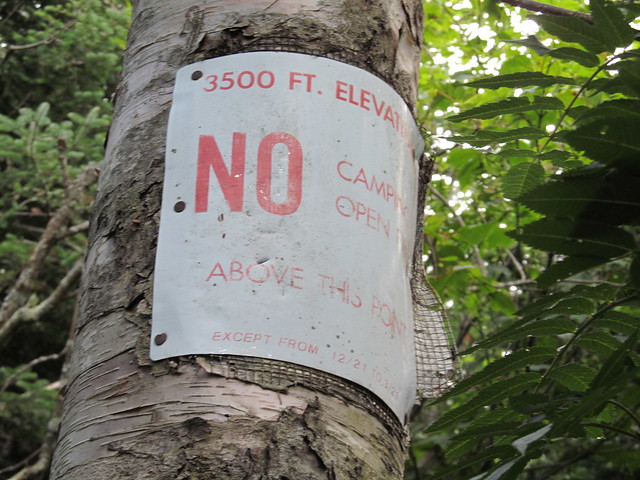
Just below the overlook, the trail passes the 3500 foot marker,
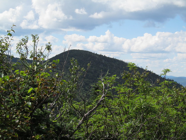
and begins to descend steeply, with a quick glimpse of Twin Mountain (the Devil's Path's next stop)
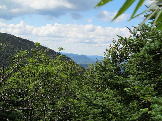
and a hint of vistas beyond.
There's a second 3500-foot marker about 100 feet in elevation below the first one, making up for the fact that Kevin didn't spot one on the way up.
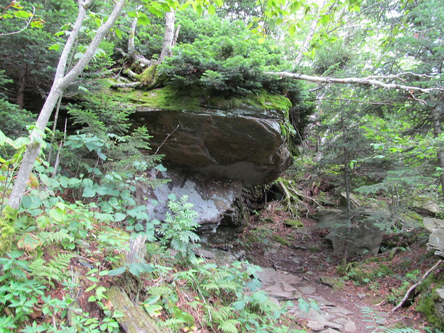
Below that is another hanging ledge, which looks as if it would make a nice lunch spot on a rainy day. There's no sign of a bear living under this one.
It drops - not quite as precipitously as on the east side - down to the col between Indian Head and Twin, where Kevin meets a party of three backpackers accompanied by an enthusiastic Yorkshire terrier. "At least that dog looks small enough that you can carry him up the steep bits!" "We haven't needed to; he just scampers up ahead of us!"
Coming out of the col, Kevin turns north on the Jimmy Dolan Notch trail, which drops another 400 feet or so of one scramble after another, and then continues at a much more gradual decline for a couple of miles along the Schoharie back to where the car is parked.
What went right: Just about everything. Bluebird-perfect weather. Challenging mountain, but not too challenging to complete. Kevin was hiking strongly - if he'd had a two-hour earlier start, he'd have felt up to adding Twin Mountain to the itinerary.
What went wrong: Kevin should have brought gaiters. No big deal, just dirty pants, socks and boots.
Lessons learnt: "Never hike alone!" is far overstated. With all the other hikers on the trail that day, Kevin felt no less safe than if a companion were along.
1 comment:
Thanks for sharing.
Beautiful landscape.
Post a Comment