He picked the Blackhead Range because he hadn't done it before, and it looked like a nice near-loop, with only three miles of roadwalk to get back to the car if nobody else wanted to come along. The plan was to head in over Camel's Hump, Thomas Cole Mountain, Black Dome, and Blackhead itself, make camp in the ravine of the Batavia Kill, and return via the Escarpment Trail over Acra Point, Burnt Knob and Windham High Peak.
 Kevin put out a call on a few hiking social networks to see if anyone would want to come along. He got a nibble from a guy on catskillmountaneer.com (since he didn't think to ask permission to mention him, he'll call the guy by the fake name of 'Jim'). Jim asked to bring his brother-in-law Fred (none of these names is real), and then his two friends Carl and Rama, all from New Jersey.
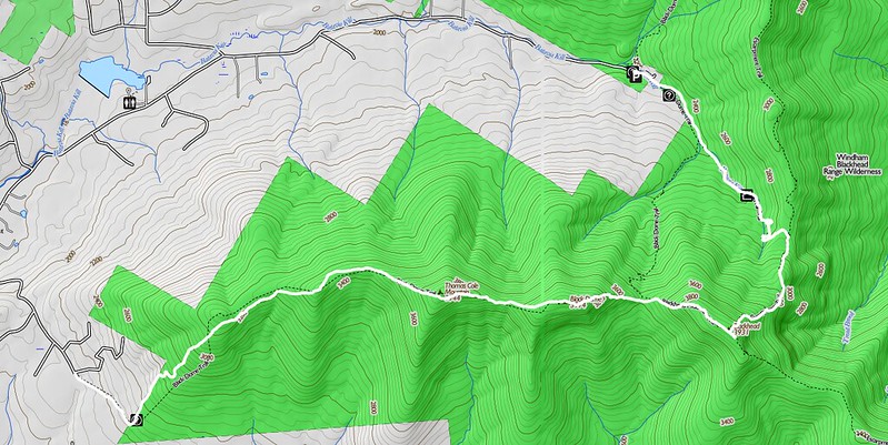
It turns out that for various reasons, the four of them wanted a less ambitious hike, and Kevin rather lost control of the itinerary. Eventually, he simply told Jim, "OK, you guys do what you like. I'll solo the first couple of peaks and meet you on the trail and at the Batavia Kill lean-to." Right from the start, he knew this might be a peculiar hike. The mileages are all wrong at the sign on the trailhead:
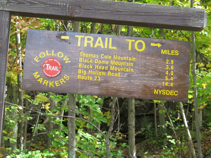
It's surely more than 0.4 miles from Black Dome to Blackhead! For heaven's sake, it's at least 0.2 mile of elevation change! Mentally adjusting, Kevin dons his backpack and heads off. The approach trail comes up an old woods road at first, badly eroded and rather wet. Kevin notices an interesting cluster of puffballs that has colonized a downed tree.
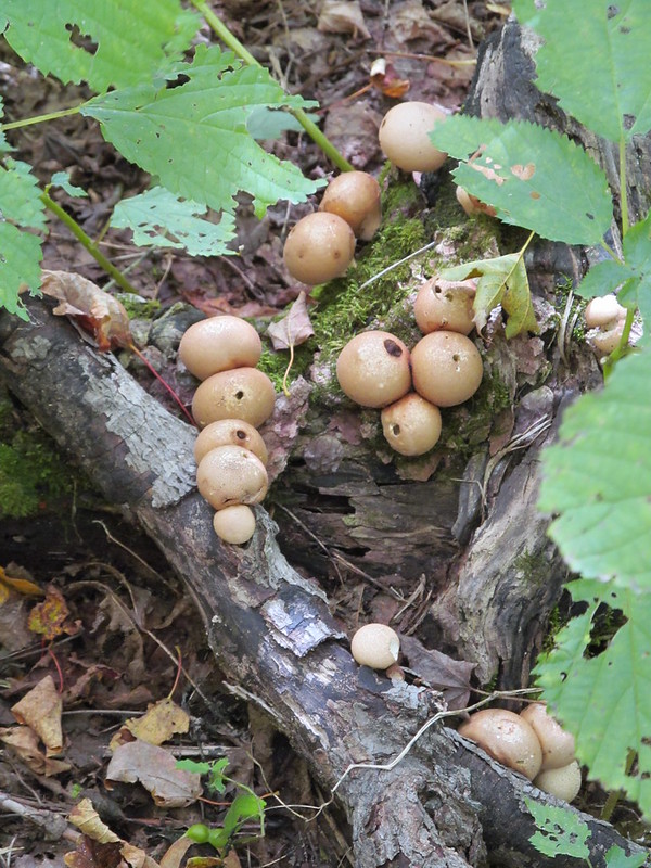
The trail turns left at the border of the state land (where the register box stands) and then climbs much more steeply up to the western ridge of the Blackheads. The climb remains moderate, though, with switchbacks and rock steps easing the steep bits. Kevin misses a turn and does one short scramble to find the trail at the top. Once on the ridge, the ascent is gradual again, through open second-growth woodland.
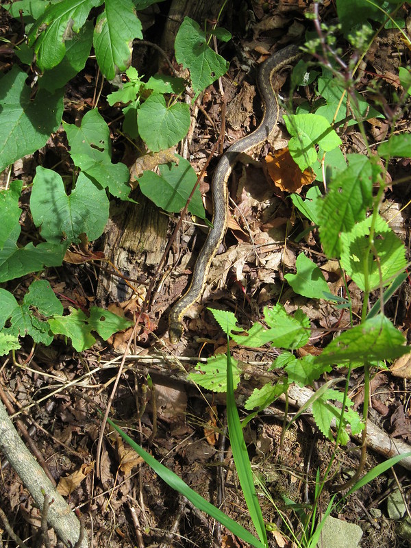
Kevin notices motion off to one side of the trail. It's another garter snake, Thamnophis sirtalis.
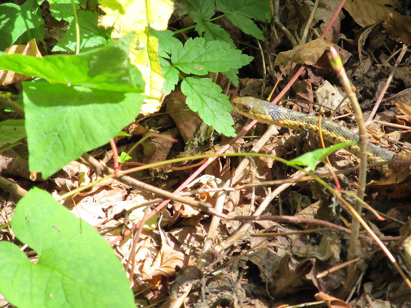 This snake comes in a dazzling variety of colour morphs. Kevin thinks this one is a pretty specimen.
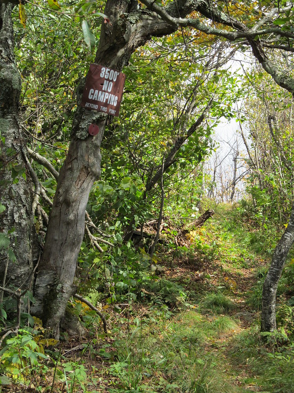
Before long, Kevin finds himself at the 3500 foot marker,
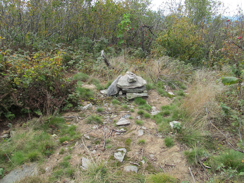
and a few feet further along is the top of Camel's Hump (a 3500-foot peak that the Catskill 3500 Club considers a false summit of Thomas Cole Mountain owing to its lack of prominence). A cairn marks the summit:
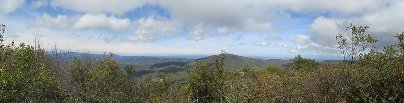
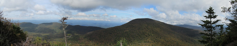
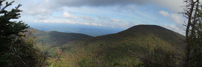
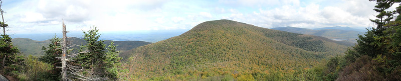
 and a rock outcropping offers a panoramic view to the north past Windham High Peak all the way to the Adirondacks.
Kevin stops for lunch at the overlook, and is overtaken by a large party of students from the University of Connecticut. One young lady with the group asks, "Is this the first peak or the second?"
He has to answer, "Not even the first one, yet, but this is the best overlook on Thomas Cole."
Another kid arrives, points to the east, and says, "that must be Black Dome, right?"
 Kevin answers, "No, that's Thomas Cole Mountain."
"I thought this was Thomas Cole Mountain."
"No, this is just an outcropping on the western spur. The hikers call it Camel's Hump. You've got another 400 feet or so of ascent to go."
Shortly after that, and after taking several pictures of the group with their cameras, Kevin heads off again up to the true summit of Thomas Cole Mountain. The summit has no view, although there's a partial view about halfway over from Camel's Hump looking south to the western Devil's Path.
Kevin pauses for a few moments at the summit rock, and the UConn party catches up with him again. He points out that they've indeed reached the top this time, anticlimactic as it may be. Again, he hikes on while they are congratulating each other.
The trail between Thomas Cole and Black Dome is a little steeper, but still not too bad - most of it is a very pleasant walk through virgin balsam forest. It's a bit scrubby, up near 3900 feet, but has its characteristic heavenly fragrance, which always brings a smile to Kevin's face. The long-stride walking passes all too quickly, and before long Kevin comes to the equally viewless summit of Black Dome.
He knows he's past the summit when the trail abruptly changes its character and becomes a serious rock scramble, full of sections best negotiated with hands as well as feet.
Just below the peak, he runs into Jim and his friends, who are negotiating their second and final climb of the day. The group exchange introductions and a few pleasantries, but everyone has more climbing to do!
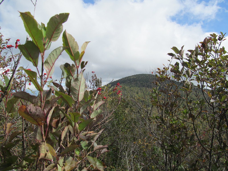
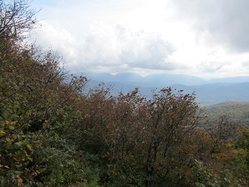
The New Jersey contingent makes its final push for the summit of Black Dome, while Kevin plunges down into the col between Black Dome and Blackhead. The rock outcroppings that he must negotiate have spectacular, if vertiginous vistas, looking ahead to Blackhead and off the top of the Catskill Escarpment,
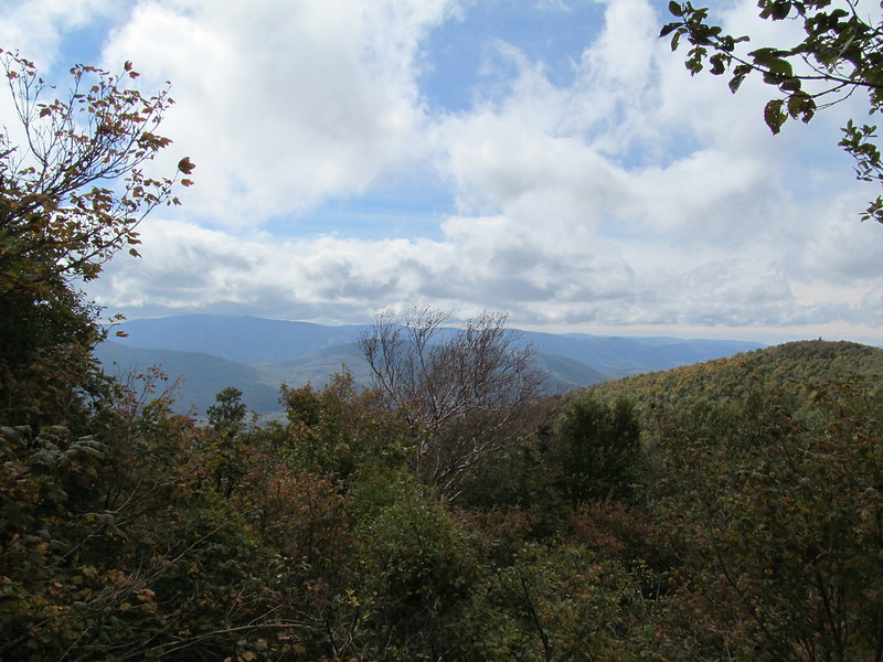
 across the Hudson Valley into Massachusetts and Vermont,
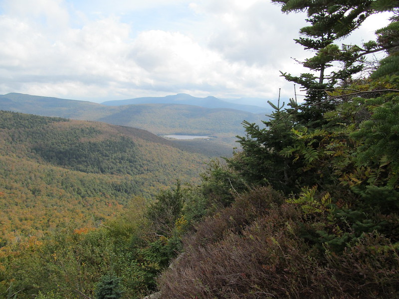
 and south across Lake Capra and Stoppel Point to Kaaterskill High Peak and Round Top
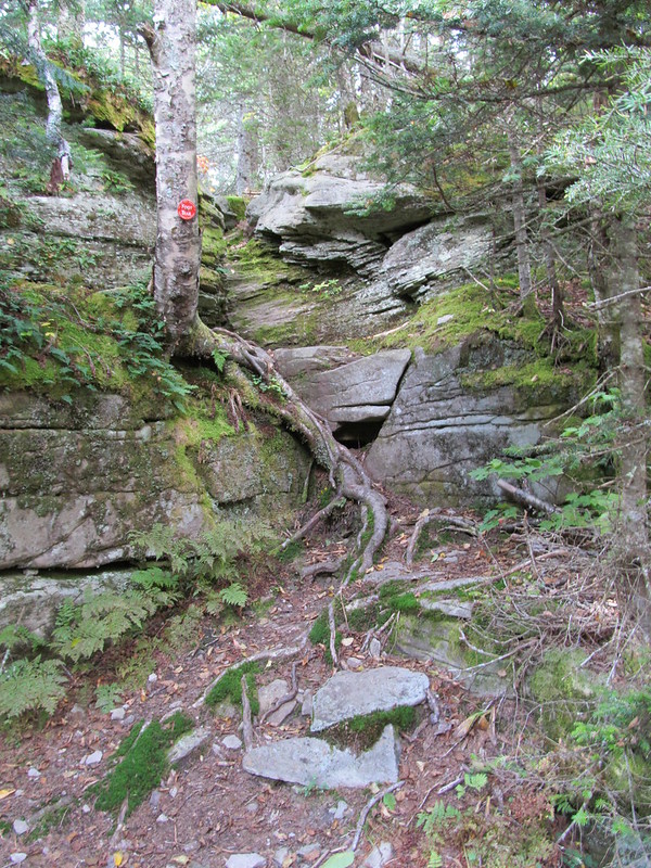
After the obligatory pause to photograph this remote landscape, Kevin continues the climb down to the col between Black Dome and Blackhead, and up onto Blackhead itself. The ridge is quite open, and the wind starts blowing away the first autumn leaves and raising the dust. The climb here is steeper still, and the trail in places is best followed by observing the scratches that years of winter climbers' crampons have left in the rock.
Part way up the exposed ridge, Kevin glances to the right, and says, "uh-oh!" The cloud base of a thunderstorm has engulfed the distant tops of the Devil's Path, which are about 3-400 feet lower in elevation than where Kevin is now standing.
He tries to snare a panorama, but the vegetation is blowing too much in the gale and the images obstinately refuse to line up for the stitcher. Then he kicks the hiking into high gear in hopes of getting to a lower elevation before the rain and lightning arrive.
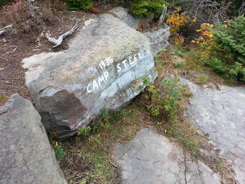
He comes panting to the summit of Blackhead, turns right momentarily to check out the Camp Steel overlook. That outcropping is now overgrown and viewless, so Kevin takes just a moment to snap a phonecam shot to show that he made it before turning north to get down the mountain.
The north side of Blackhead is by far the longest and steepest scramble of the day, being 1100 feet of near-continuous hands-and-feet scrambling. The sky is darkening ominously, and Kevin feels a few raindrops, when suddenly his smartphone gets a signal and proceeds to send out the texts that Kevin composed on each summit as he went by. Mary Ann answers, and starts up a conversation by text message. Kevin cuts her off: "I'm in an exposed position, and there's a thunderstorm coming. I'm ok, but a little busy right now, no time to chat." and continues climbing down.
At the base, a side trail leads west a mere quarter of a mile to the Batavia Kill lean-to. After looking around several of the tent sites, Kevin pulls up to the lean-to itself, and encounters the four men from New Jersey. Two of them have hung their hammocks at a tent site, and two of them are ensconced in the lean-to itself; all are cooking dinner. Kevin checks out the tent sites, finds that the nearest vacant one already has Jim's bearbag line right above it, hears a clap of thunder, and decides to share the lean-to rather than pitching. His new tent can wait for another day.
There's a roaring fire at the lean-to, courtesy of Fred and Carl. Kevin supposes he's grateful for the warmth, even though all his gear will now smell like a wet campfire. He treats a few more litres of water - he's just about out - from the skanky stream near the leanto. (He envies the New Jerseyites, whose route took them right by a piped spring with a fine flow of clear sweet water.)
Jim and Kevin make the perfect team for bearbag hanging. Kevin spots the perfect branch, but his rock throws consistently come up two feet short. (At 57, his throwing arm isn't what it once was.) Jim rapidly remedies the situation, hooking the branch on the second cast. Returning to the leanto, Kevin cooks and eats dinner, brushes teeth, repacks his bearbag, and goes out, demonstrating to Fred the ropework for a PCT hang. (It's a perfect hang, at least 10 feet below a branch, 20 feet off the ground, 10 feet out from the trunk, and nothing in reach from the ground.) Kevin's and Fred's bearbags are safely hoisted.
After that, it's into the sleeping bag (or, rather, under it - it's too warm in the lean-to with the fire going to zip it), a bit of desultory conversation (including the puzzling, "I think it's great that you're still getting out and doing this at your age," addressed to Kevin), and off to sleep as the rain starts to beat heavily on the lean-to roof as the wind whistles through the chinks in the walls.
A couple of hours later, Kevin jerks awake. What's wrong? He notices a few drops of water on his sleeping bag. Uh-oh. The roof leaks. Fortunately, the shelter isn't crowded with just the three men - no wait, there's a fourth? Jim the hammocker has noted his hammock swaying between the creaking trees, felt the spindrift coming horizontally under his rainfly, and heard the widowmakers crashing down in the woods around him, and gone to ground in the lean-to. Anyway, four hikers in a lean-to still isn't crowded; Kevin shoves over from beneath the leak, uses his pack towel to neaten up the puddle, puts his bucket under the drip, and tries to go back to sleep, until he realizes that he's not going to make it to morning.
After the unenviable task of pulling on his rainsuit and boots, tromping off into the woods, digging a hole in the now-sodden ground, and exposing his fundamentals to the thunderstorm, he feels much better, obeys Deuteronomy 23:13, returns to the lean-to, washes his hands and sleeps through to daylight.
In the morning, while Kevin is having his coffee and porridge, Jim goes back to the hammock and discovers that his outer clothing is thoroughly soaked, and decides that if he's going to be hiking in his one dry T-shirt and compression boxers, he's just going to hike back to his van. Rama makes an appearance after sleeping in - and he'd been the first to retire the night before - and reveals that he's nursing a sore knee. (Kevin is able to provide Vitamin I.) Fred announces that he has a concert in New Jersey that he wants to get to, so the decision is made to simply hike down to Big Hollow Road, where Jim has parked his van.
Kevin's not too distressed by this, since the Windham High Peak section is one that he's just done; he'd simply picked it as being a more pleasant return route than the road. The group load up, proceed to the other trailhead to drop off Kevin, say, "let's do this again some time," and split up.
On the whole, a successful trip. Kevin manages to bag three Catskill peaks in a single day, a feat he hasn't managed before, and gets the reward of a night in camp with a congenial crowd.
No comments:
Post a Comment