Showing posts with label plotter kill. Show all posts

Sunday, February 10, 2013

Weekend stroll on snowshoes, Plotter Kill Preserve

I don't trouble to blog all my trips, but I thought I'd mention yesterday's, because it was fun.

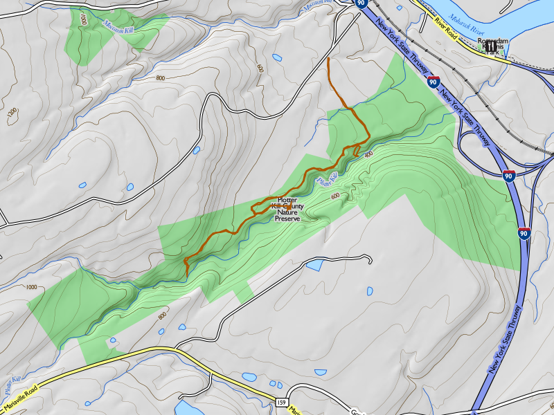
After Niskayuna dodged a bullet with the Nemo snowstorm (we got maybe 6-8 inches of snow), I cleared the driveway and had time at least to spend a couple of hours out playing. The weather was so gorgeous that I couldn't resist heading over to the Plotter Kill Preserve and pulling on my snowshoes.

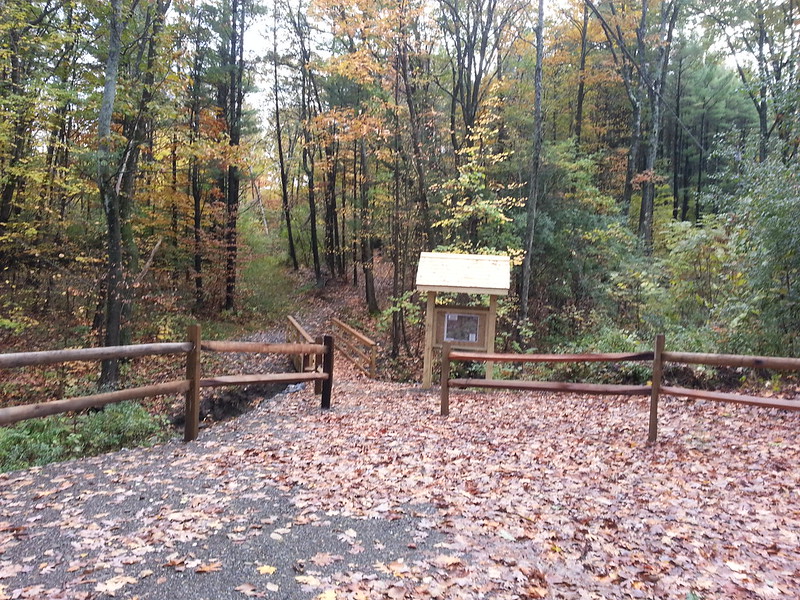
The Mariaville Road entrance hadn't been plowed, and there wasn't a lot of room to park, so I went down to Coplon Road instead and parked at the roadside trailhead there. I could see that someone had broken trail for me, and in fact I met them coming out as I went in: a nice couple with a big shaggy mutt having a strong strain of Malamute.
Coplon Road trailhead 

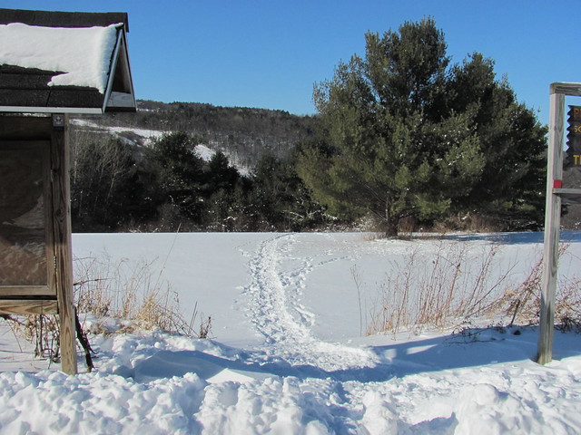
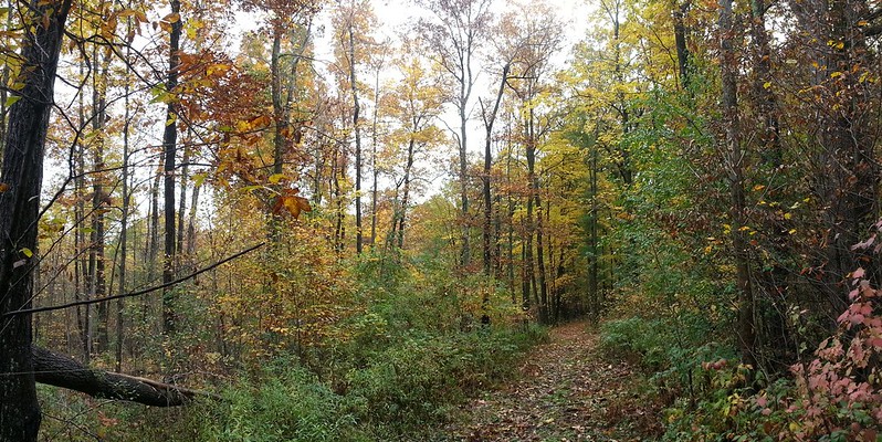
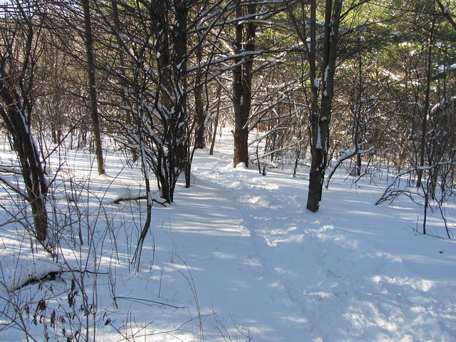
The trail across that field drops rapidly into the pleasant woods.
Coplon Road access trail
 

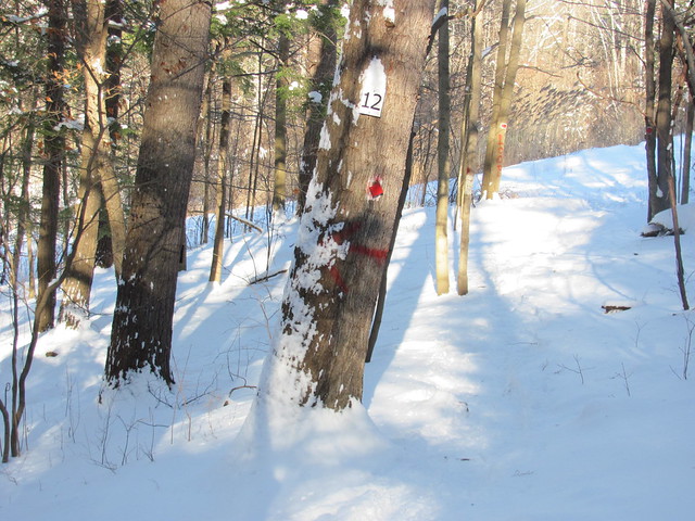
It joins the south rim trail just where the rim trail goes down into the gorge to the crossing by the stone wall. At the junction there is one of the puzzling numbered signs that show up here and there.
South rim trail junction
 

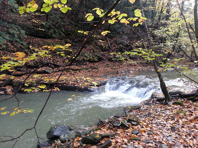
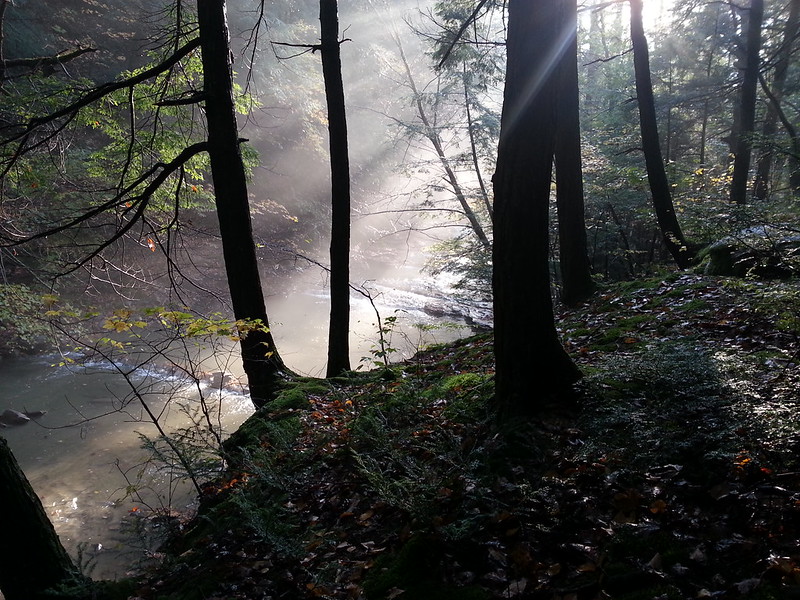
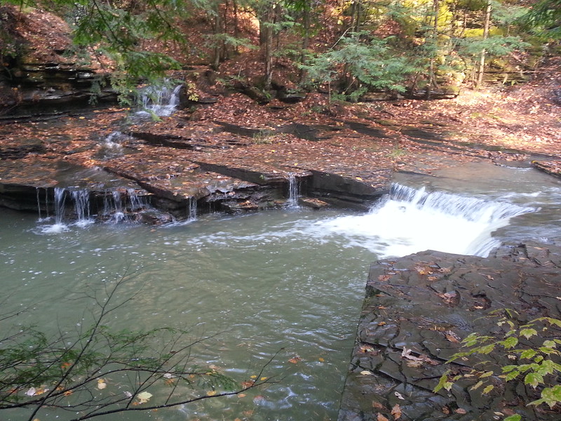
Both ways were broken out nicely, but I followed the trail down into the canyon, coming out by the stone wall. The ice was sound, and snowshoeing the stream was no problem. Once across, I saw that the tracks I was following angled right where the red trail goes straight north up the rim. I found myself on a red-and-blue blazed trail that I hadn't noticed before: every time I go in there, I spot something I'd missed. (Sure enough, I looked and it's there, shown as an unblazed herd path, on Ed Atkeson's map.)


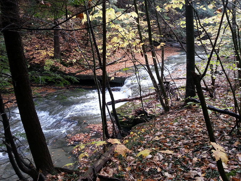
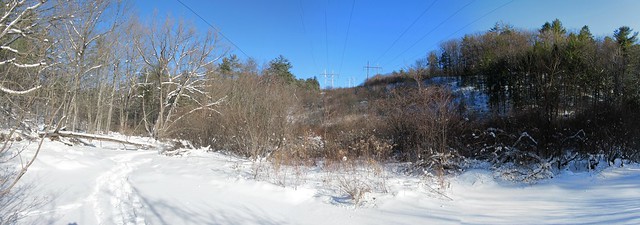
Right where the power line crosses, there was a pile of blowdown on the bank, and whoever was hiking in front of me crossed the stream to circle it. I followed. The ice gave way underfoot in a spot or two, but there's only a few inches of water, so I didn't get my socks wet.
Stream crossing by power lines

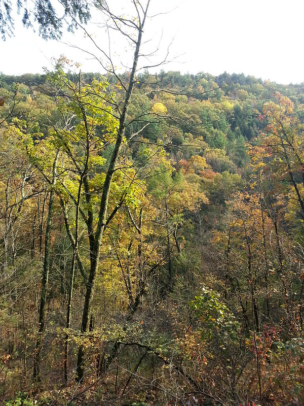
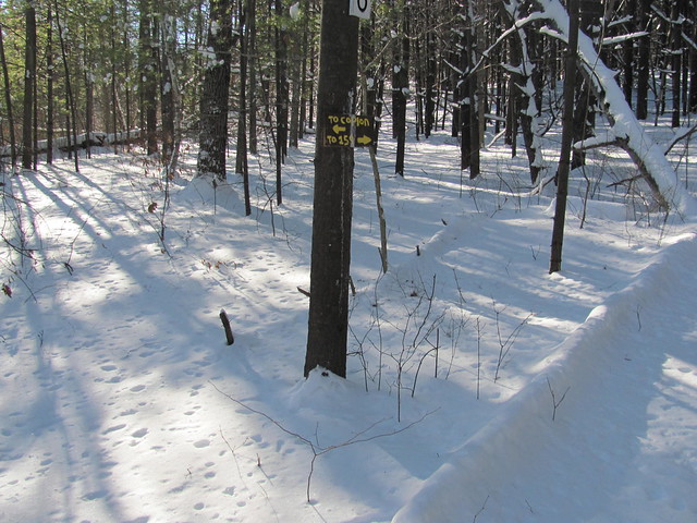
The tracks I was following turned right toward the Lower Gregg Road trailhead and the lower preserve, but I turned left and headed upstream. I broke the north rim trail as far as the junction with the trail to the crossing by the landslide.
Unbroken trail on north rim

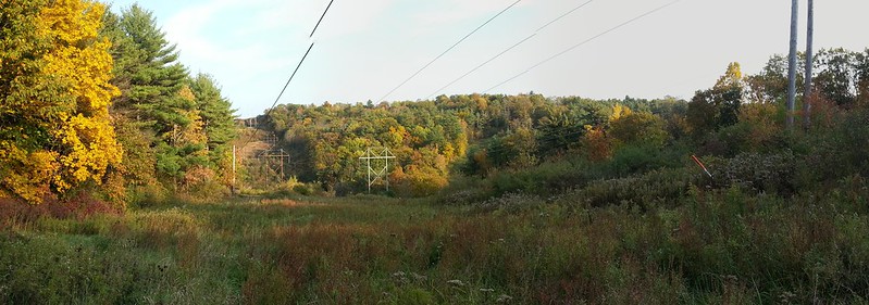
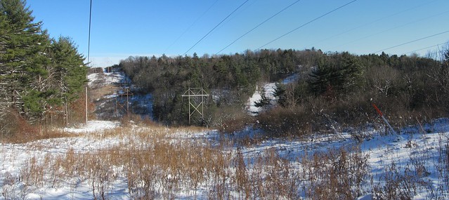
Right by there, I met another nice couple with two Labradors. (I think I was the only person in the park that day without a big shaggy dog!) I paused to grab a picture of the powerline view on the way.
North rim view by the power lines
I was going to finish the waterfall loop, but I had had a late start and was starting to worry about running out of daylight, so I just went a little farther, turned around, came back over the landslide crossing and back out. It turns out that I had nothing to worry about; somehow I moved much faster on the way back out and was out with at least an hour of daylight to spare.

On the way out, I chatted with a nice old man who was coming off the south rim trail walking with his Samoyed. (I told you, I was the only one without a big shaggy dog!) The dog was very friendly, and when we got to the trailhead, he trotted to the tailgate of my truck and sat there waiting to be let in! The dog's owner had to point out to beast that he was at the wrong truck, as I was telling him that I'd love to take him home, but the cats would have another opinion entirely.

All in all, a fun day out. It was nice to have a day that actually called for snowshoes. I'd have done it again today, but was a trifle short of time.

Now I've got the Coplon Road access and that red-and-blue trail uploaded to OpenStreetMap. Every time I'm in there, I seem to miss getting the trail on the north side down to the stone wall. I'm going to have to make it a point to get down that one.

All in all, a fun outing.


Read more...

Wednesday, October 17, 2012

Sunday Stroll - Plotter Kill Preserve, 2012-10-14

On Sunday, I awoke to pouring rain, and thought that it would be yet another day where I wouldn't get out. But after church, the weather cleared, and I thought, "well, here's a chance to go walking for at least a couple of hours." Since I didn't have time to drive down to a distant trailhead, I headed off for the Almy Coggeshall Plotter Kill Preserve, just west of Schenectady. This small park offers a deep gorge leading into the Mohawk, several small waterfalls, and an assortment of walks. (The longest loop is about six miles.) I decided to check out the new trailhead at Lower Gregg Road, which now allows hikers to walk between opposite sides of the preserve, and moves a couple of miles of the Northern Excursion of the New York Long Path off road.

Since the outing was done on impulse, I didn't have a proper camera along, so I apologize for the phonecam shots. The new trailhead has parking for four or five cars, a kiosk, and a bridge over a little stream.
The new Gregg Road trailhead
The access trail in from there is a pleasant level walk, and the fall colours were at their peak. It has a few wet spots, but there are bog bridges over the really bad mud.
On the new access trail

Once I reached the red-blazed north rim trail, I turned right (west) and headed upstream. Since this was just a nice stroll without a specific destination in mind, I was willing to spend some time lallygagging, and took a couple of the side trails that lead down to the stream. They were wet and steep, and one goes down a knife-edge ridge with steep drop-offs on both sides, but I didn't take any spills. The first one goes down to a cascade of at least three little waterfalls, that I'm told is called Step Falls.
Riffle in the stream
The other, farther upstream, comes down to a beautiful little glen, with a cascade that I'm told is Sergeant Falls. Walking down into it, the mist rising from the recent rain made the light just magical.
Plotter Kill in the mist Pleasant little glen
I continued up the rim trail to the second stream crossing (the one by the landslide), and was going to try to bushwhack up the stream bank to the bottom of the two tall waterfalls, Lower Plotter Kill Falls and Rynex Kill Falls. But by the time I got down there, the sun had sunk below the rim of the gorge, and reasoning that I still had a 45-minute walk back to my car, I simply turned around and walked back. The low-angled sunlight offered some dramatic vistas as I recrossed the two power line cuts.
Power lines in the Plotter Kill
Fall colours in the Plotter Kill
The walk out, like the walk in, was over the fresh leaf litter, making a colourful if slippery carpet underfoot.
Fall colours on the trail
All in all, a great way to spend a few hours on a Sunday. Not big miles, but harder than it looks because of the three slippery descents to the stream from the rim of the gorge.
Contour map of the walk

Read more...