We got on trail in good order on Saturday. The plan was to hike Lone and Rocky on Day 1, Balsam Cap, Friday, and the plane crash on Day 2, and try to explore a route up to the Garden Path (the Burroughs Range trail between Slide and Cornell) on Day 3. Of course, my plans are always too ambitious. This is intentional; I almost never will go beyond what I've put in the safety plan, but have few qualms about cutting a trip short.
We came in to the bridges where the Peekamoose-Table trail crosses the Neversink, and got on the unblazed fishermen's path. On the way in, I started coaching Elf on pace counting and reading a sighting compass. (Not that either is all that useful on a Catskill bushwhack, but I try to follow the Army syllabus for land navigation. I gave him a ranger-style protractor, a couple of map scales for NYNJTC maps, and a set of ranger beads.
The path was reasonably easy to follow—it does get a little thready in spots—down to Donovan Brook, where I had my first goof with a rock-hop, and wound up with my boots full of water. Water-filled boots were to become the norm for this trip.
On the way in, we passed some fresh beaver activity. Seeing them that far up the Neversink surprised us a bit. The gorge there is pretty narrow, and the beavers can't get very much pond area. We wouldn't have thought they'd be interested.
We turned off a little bit past the brook, and started up the northwest spur of Lone.
The forest is fairly open there, and so I was able to show Elf the trick of sighting on a tree as far away as possible on the compass heading, walking up to it, and repeating the process. We got fairly easily up to the ledges around 2900 feet. The rock chutes that get around them are pretty obvious, and the herd path above them is fairly clear (although you'll still get scratched up by brush when you follow it).
The path leads right to the canister.
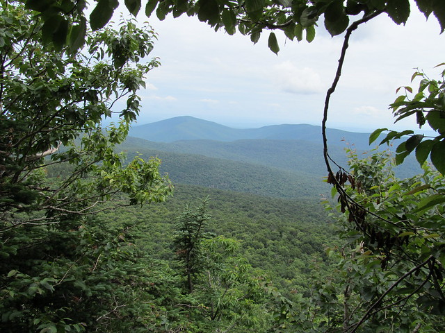
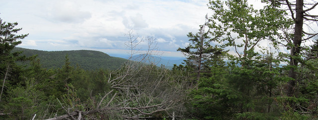
We signed in, checked out the viewpoints south of the summit (which don't totally grow in, even in high summer),
and then made for Rocky.
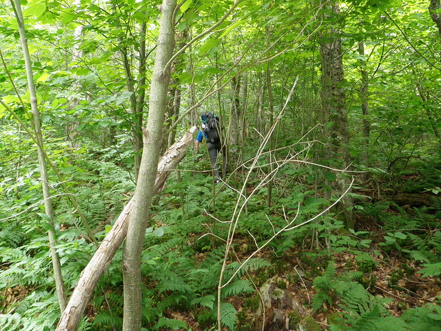
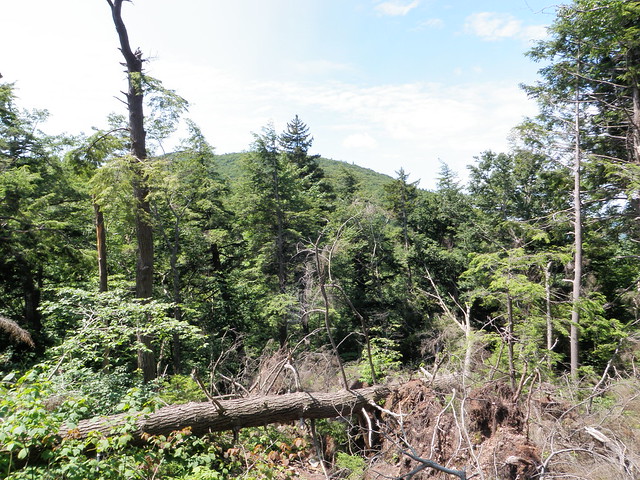
The herd path drops down the northeast spur of Lone for a couple of hundred vertical feet, then veers abruptly right, angling downhill to cross below the base of the cliff on the southeast side of the summit. That drop places the hiker in the broad, flattish, col between Lone and Rocky. Here, of course, we lost the herd path in the woods. Sighing, we pushed forward into the balsam and spruce.
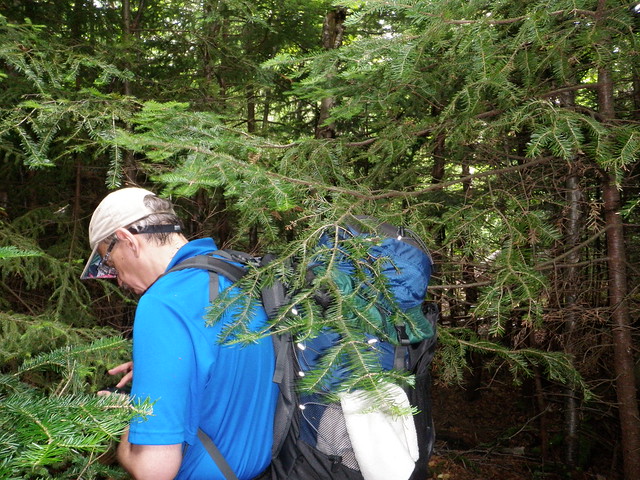
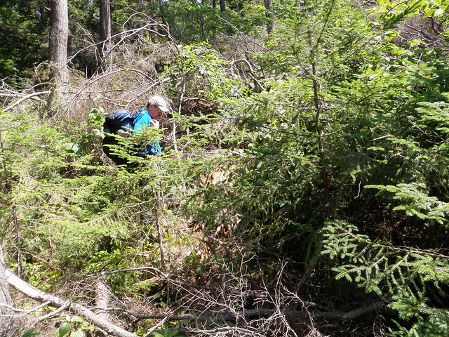
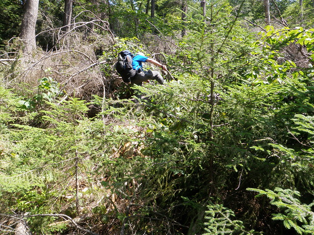
Spruce. Ouch. More spruce. Lacings on gear caught on the twigs. Christmas trees, two feet apart with their branches interwoven. Needles down the back of the shirt. Needles in the pocket of the pack. Branches suddenly breaking, allowing the branches next to them to swing into the hiker's face.
"Hey Kevin, did I tell you what an awesome idea it was when you told me to bring safety glasses?" becomes the tag line for the entire hike.
I do try to zig and zag a bit climbing the ridge, but spot very little in the way of paths until we're just about on top of the canister. This time, I walked right past it—it's on the back side of the tree from that direction—but the Elf spotted it right away. Once again we signed in, and saw that the hiker before us had claimed he got from Lone to Rocky in 37 minutes. We shook our heads in incredulity, barely believing that such a feat was possible.
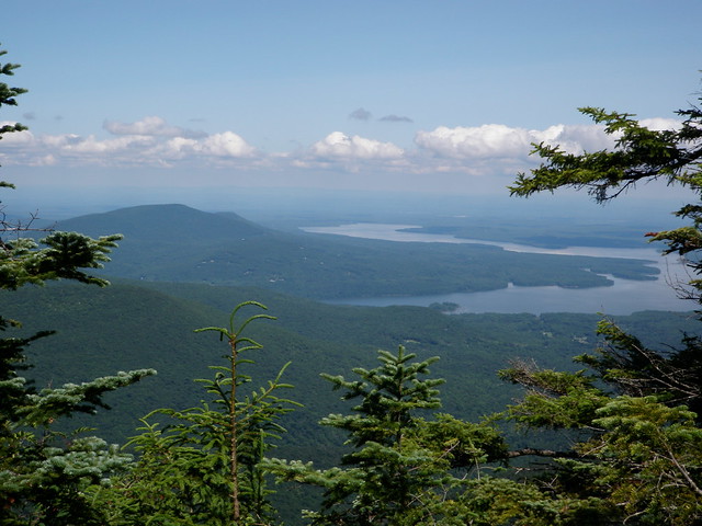
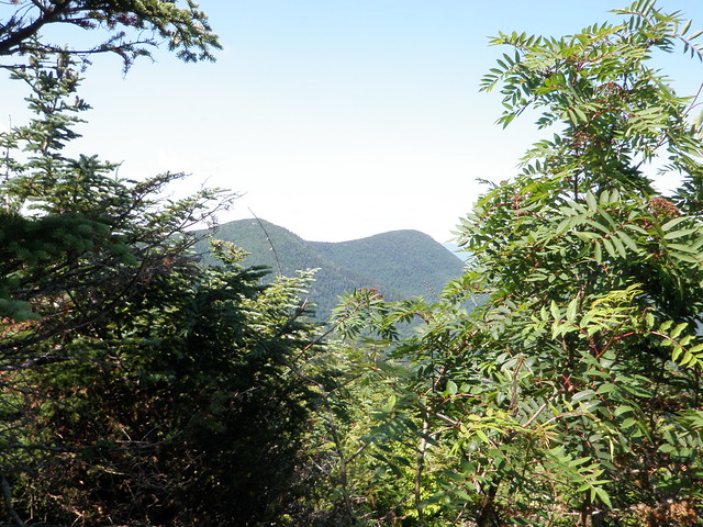
On checking out the viewpoints, we saw why nobody gets onto the northeast spur of Rocky. The cliffs there are definitely top-rope territory. Rocky has nice views, though. The descriptions in the guidebooks underrated it.


We took the advice from Catskill Mountaineer, and backtracked back down toward the col. We were able to follow a faint herd path a fair way down, but then lost it and dropped off the ridge to the north. We were able to angle laboriously down the slope into the drainage there.
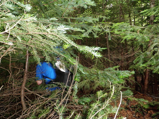
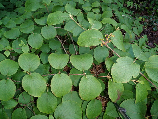
The spruce was replaced with Viburnum. Viburnum runners getting wrapped around your ankles and tripping you. Viburnum branches at ankle level untying your boot laces and unzipping your pants legs. Viburnum leaves hiding the stiff branch that's about to stab you in the knee, and the gap in the rocks that is about to grab hold of your other foot. Not for nothing is the stuff called hobblebush.
"Hey, Elf, did I mention how glad I was that we remembered safety glasses?"
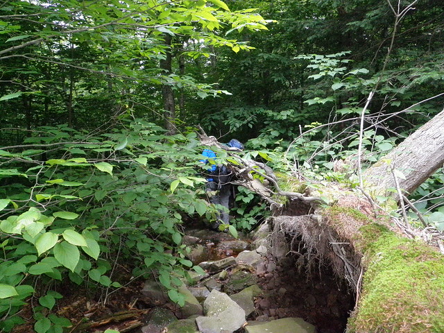
The drainage was slightly clearer than the stuff around it, in that very few things grew right in the center, so we could rock hop down that while pushing the rest of the stuff to the side. After a while, there was too much water to use it as a path. (Elf: "Uhm, Kevin, this isn't a wash any more. It's a creek.")

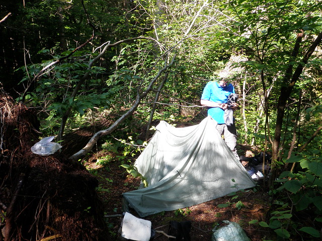
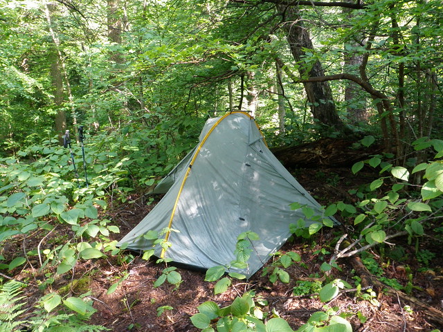
We scrambled the bank and pushed through the dense mat of vegetation near the stream. We found the occasional game trail to aid progress, but all of them petered out really quickly. Progress was slow enough that daylight was fading by the time we got down to the river. We found a spot to make camp off the path. It was just far enough from the river to be legal, and just big enough to pitch two Tarptents.
I'm sure that my bear bag was very attractive, since when I sat down to eat, I discovered that not only had my little plastic bottle of olive oil ruptured, but so had both of the Ziploc bags that were supposed to contain any spills. There was olive oil everywhere. Oh well, my shrimp primavera was still tasty. Elf lent me another Ziploc to at least contain what oil was still available, since I still wanted to have some for the next day's cooking.
I had checked the higher-summits forecast for the weekend right before I left Niskayuna around 0600. It said "Precipitation: nil. Lightning: nil" for both Saturday and Sunday. So what blew in on Saturday night? A thunderstorm, of course!
"Kevin?"
"Yeah, Elf?"
"It's storming."
"Uhm, I kind of noticed."
"Just thought you might want to adjust the pitch of your tent."
"Just did."
"OK. Good night, again."
Next morning dawned hazy, but no rain. The only wet gear I had was my tent, socks and boots. We ate, packed up, and headed for the col between Balsam Cap and Friday.
The NYNJTC map, and Google Maps, show only one stream coming from that direction, but in fact there are two. This map shows both. The larger one is shown as the intermittent stream, and that's the one we started off trying to use as a guide to take us up the mountain. It took a little walking upstream, with careful compass reading, for me to be confident we were on the correct one. During that process, I stepped in the water again. My boots couldn't have gotten any wetter than they already were, but now I had wet feet again.
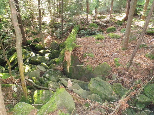
The streambed turns into a canyon pretty quickly, and we thought it was prudent to scramble up the wall to the ridge between the two streams.
Viburnum. Alternating with patches of spruce. Worse even than Rocky.
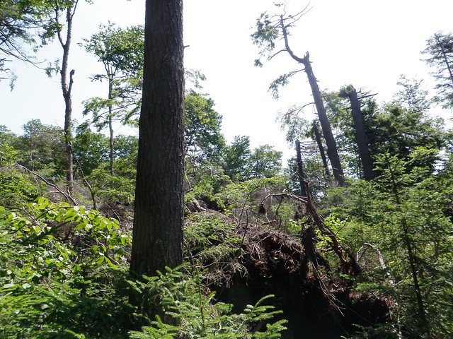
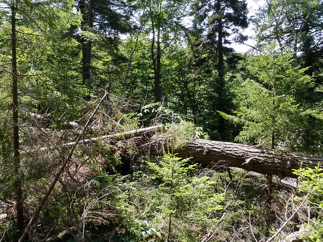
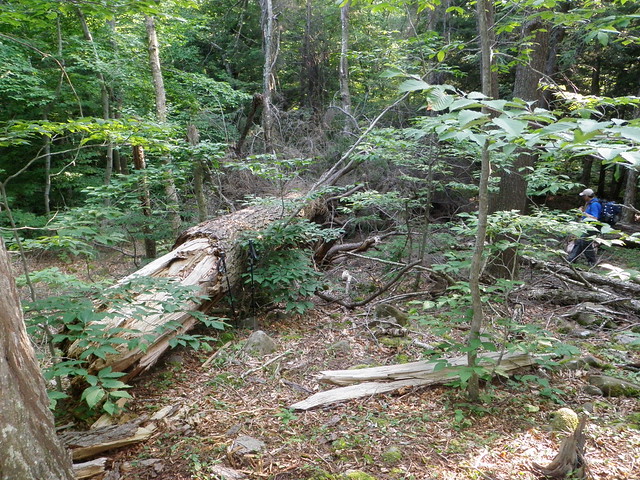
And then—the biggest field of blowdown that I've ever seen. Starting at about 2840 feet on that ridge, there's a bunch of trees piled helter-skelter like matchsticks, witth nary a one left standing. Elf suggested that it might have been a microburst that did it. I speculated that it had been a full-on tornado. The blowdown looked to be a few years old. It also looked to me as if, with the uprooted trees loosening the soil, there had been rockslides down both sides of that ridge. The slope on the side toward the brook we'd been following surely didn't seem stable.
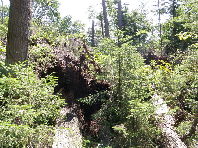
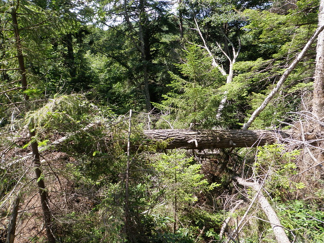
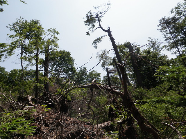
If we wanted to get up to Balsam Cap, then, we'd probably need to go over, under, around or through the blowdown. We started clambering about in it. At times, the ground was a long way down, as we'd climb up on one huge log lying across another that is in turn supported by, who knows what? I think it took us the better part of an hour to go a couple of hundred yards through all the debris.

Then it was back to the spruce.
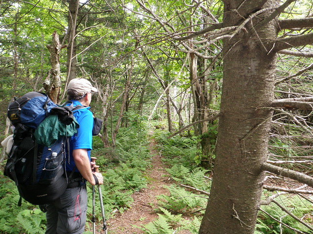
We worked our way along the canyon rim, sometimes catching a glimpse of lovely waterfalls below. (I suspect that the intrepid waterfall photographers of Catskill Mountaineer are making a note of this!) The canyon got progressively shallower, eventually turning into a dry streambed that we were able to hike up to about 3400 feet. Imposing ledges loomed before us, so we turned left and fought the spruce approximately on the contour line into the col.
Right at the edge of the cliff to the east, just as promised: a well-trodden herd path! We turned right, and with renewed energy tackled the three or four ledges between us and the summit, knowing we had good places to scramble because the rocks were covered with crampon scratches.
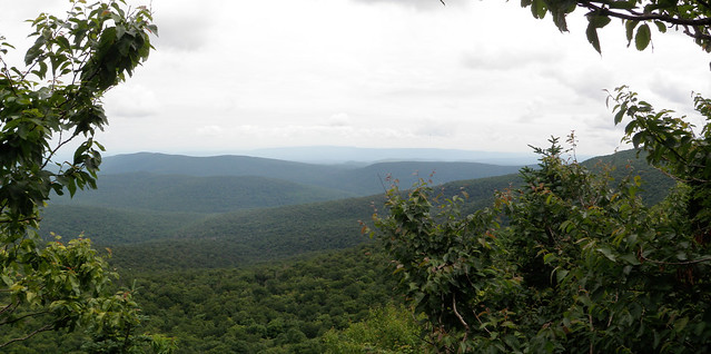
We paused only a moment at the overlook, planning a longer stop there after we'd signed in. We then proceeded to spend the next half hour crisscrossing the summit of Balsam Cap searching for the canister. Apparently we weren't the only hikers with the same problem, because the place has a labyrinth of herd paths everywhere. Elf found it eventually, and we signed in and went back to the overlook to eat lunch while drinking in the view out over the Ashokan valley.
Then came the inevitable strategy conference. It was already midafternoon. We'd got started late, because we'd both overslept after the storm. We'd taken about twice the time we thought we would up to this point, between the tornado and the hunt for the canister. And we were down to about a litre of water apiece. Friday and the plane crash, we decided, would still be there another day. We walked back down to the col and headed west.
We spotted a dry stream bed almost immediately, going in the right direction, We followed it, and others (the streams go underground at times), back to a larger gully that led into the canyon we'd skirted on the way up. It joined the stream well below the waterfalls (which had looked dangerous) but still above the debris field. We were able to walk carefully above the steep bank, sometimes clinging to tree roots or scrambling a ledge, below the mess, needing to dodge only a couple of trees and boulders that had slid off the rim into the gorge. If you're going to sneak up on Balsam Cap and Friday from behind, this is definitely a better route.
When we got to the Neversink, we decided to try to hike out on the fishermen's path. We were thinking that perhaps we'd make camp late at one of the campsites by the bridges and try for Peekamoose and Table in the morning. By this time, the thought of reclimbing Friday and hiking out in a day was out of the picture for both of us. Before long, we were hiking by headlamp, and eventually we reached a point where we faced the choice—in the dark—of fording or rockhopping the river, or finding our way on the bank around the intersecting creek that the path was crossing the river to avoid. We decided that safety dictated that we camp where we were. We got as far as we could from the water, set up, had a cold dinner (neither one of us felt disposed to cook), and crashed. The Bushwhack Range had done us in for this trip.
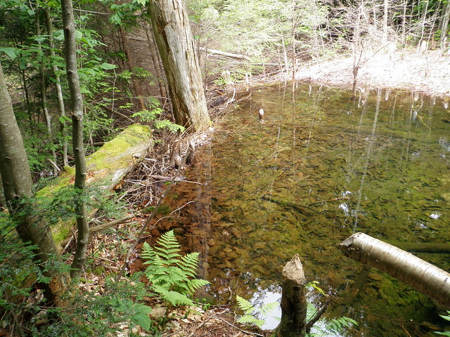
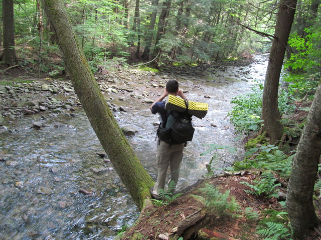
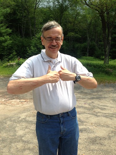
On the morning of Day 3, I found the skin on my feet all red, cracking and peeling from two days' immersion in the alkaline river water. Climbing Table did not sound like a pleasant possibility, even if it is pretty easy as these things go. I promised Elf to treat him to lunch, and we agreed just to hike out to the cars. We took our time, pausing to admire some nice trout along the way,
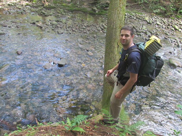
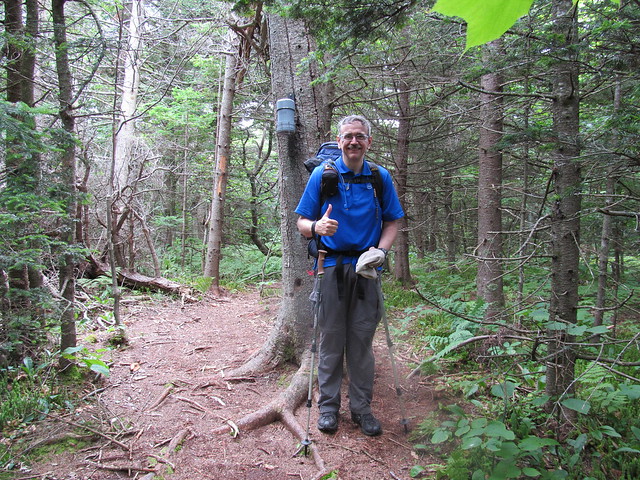
gave 'two thumbs up' for a successful trip (showing, of course, a few battle scars)
and drove out to Ellenville for a hamburger at the diner there.
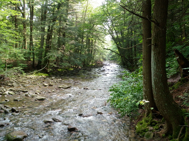
So, what went right? Practically everything. Our names in three canisters. Elf's a great partner for me. We've got a similar style and he's content with a slow pace. Balsam Cap has a great view, and the Neversink is one of the loveliest trout streams I've ever seen. Did I remember to mention how glad I was to have thought of safety glasses?
What went wrong? Running out of time on Day 2. Because of the storm, we both overslept, and then got further slowed by the huge blowdown field. But we didn't give in to 'get-there-itis' and were back down to a safe campsite rather than getting stuck on the mountain. (I've slept on a ledge on a Catskill peak before. I don't recommend it.) Friday (and the B-25) will be there another day.
Lessons to share: The big one is: if you're doing Balsam Cap or Friday from the west, avoid that tornado-damaged spot. (It starts around 3840 feet on the ridge between those two streams.) It's bad news. Even the spruce is better than that. Aside from that spot, the climb from the west, although unpopular, isn't a bad route at all. It's got a lot less elevation gain than from the east, and no scrambling to speak of. There's very little spruce to speak of: the tangled brush is mostly hobblebush and beech saplings. And we ran into no nettles at all.
Read more...