Wednesday, June 25, 2014

Vly and Bearpen Mountains, 2014-06-21

On Saturday, June 21, Catherine and I decided to hike Vly and Bearpen Mountains in the northwestern Catskills. These two peaks are the only ones of the Catskill 3500's that are outside the Blue Line of the Catskill Park. We parked where the pavement ends on Greene County Road 3 south of the ridge joining Bearpen and Vly.

Map of the hike

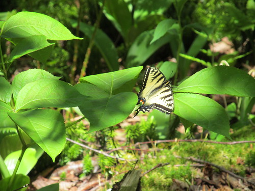
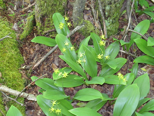
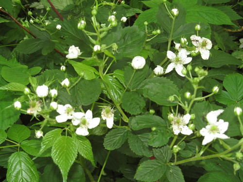
The prickers are starting to grow pretty thick, but are offering a promise of a good crop of berries later in the summer.

Blackberry canes

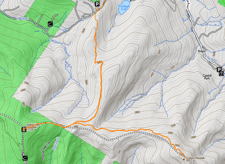
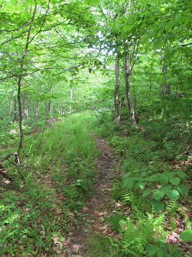
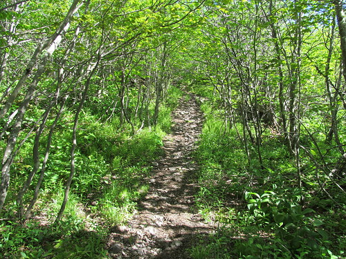
We hiked up the stony road ("paved" in loose rocks ranging from pea-sized to house-sized, but with a hard and dry surface) up to the pass, where there is a hunter's cabin just to the left of the road. About fifty feet past the cabin, there are the posters marking the state land, and a fairly well-beaten herd path turns off from the road here and follows the state property line up to the summit of Vly.

We followed the herd path without too much difficulty, losing it only once when several deer paths crossed it in a fern meadow; we took the one that appeared straightest, when in fact the true path turned left. Before long, it became apparent that the deer had led us off the ridge, which was above us to the left, so we turned and followed the "double the angle of deviation" rule to rejoin the herd path at the 3200-foot level.

I noticed Catherine getting the "umbles" (stumbles, fumbles, mumbles and grumbles) about this point and demanded whether she'd been drinking enough. After pushing about a litre of water over the next 15 minutes, the spring was back in her step, and we arrived in good order at the summit of Vly.

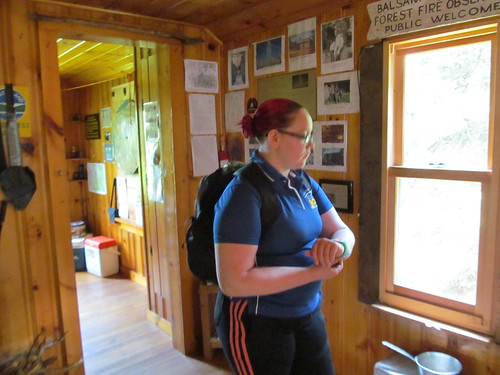
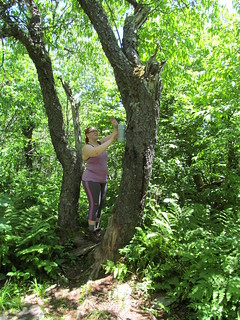
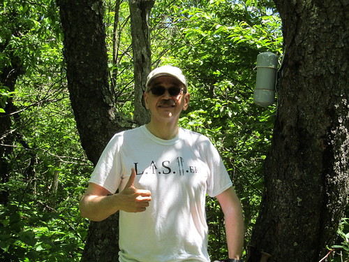
Catherine asked to retrieve the logbook from the canister this time, since I'd done it on our last trailless outing or two. She did make a remark or two about "I just climbed a mountain, now I have to climb a tree?" but got it out without trouble, and we signed in.

Reach...Up there...Got it!

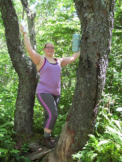
The Vly trip is not very photogenic. The vegetation is fairly dense, not allowing any good views. Moreover, the deerflies were buzzing us, and there were also clouds of other flies buzzing about coyote scat and the remains of coyote kills. We were disinclined to remain atop Vly any longer than necessary, and decided that it was not a good lunch. We gave 'thumbs up for the summit' and started back down the way we came.

Thumbs up for the summit!

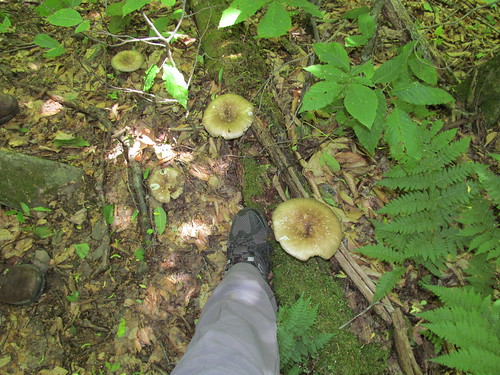
On the way back down, we noticed that Vly grows some enormous mushrooms. My size-12.5 boot gives the scale.

Mushrooms

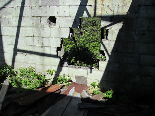
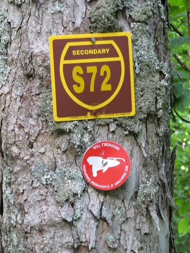
Once back to the road, we crossed in front of the cabin's front porch, on an old road blazed 'Secondary Snowmobile Route S72.' (I hope the snowmobilists don't look like the picture on this blaze!)

Snowmobile trail

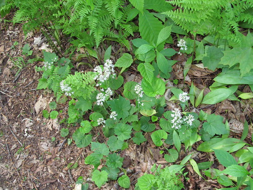
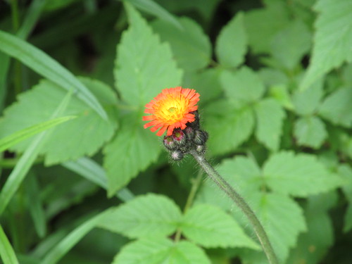
The road climbs evenly but fairly steeply up the side of Bearpen's east ridge. On the first couple of hundred feet of ascent from the pass, there is a small stream running right down the road, fed by two springs on the uphill (west) side. We noted the flows as a possible place to treat water if we ran short, and continued up the road, which then makes a couple of switchbacks around 3200 feet elevation. Catherine noticed a patch of pretty orange flowers there, and I spent a little bit of time in photography. Alas, pretty as they are, they're orange hawkweed (Hieracium aurantiacum), a noxious invasive.

Orange hawkweed

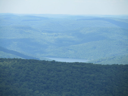
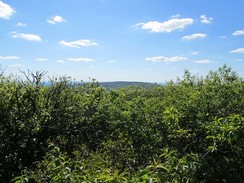
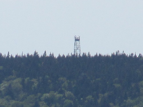
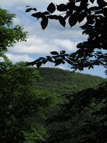
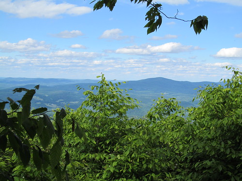
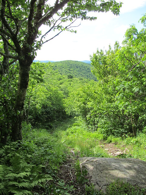
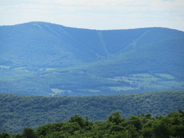
The switchbacks also gave us a view back at Vly Mountain, which we'd just climbed. This was our first (poor) view of the day: the first part of the hike was truly in the Green Tunnel.

Looking back at Vly Mountain

Just above the switchbacks, the snowmobile trail turns right from the road and climbs a rocky slope with a moderate grade. At the top, the grade lessens and remains slight all the way to the Bearpen summit.

At about 3400 feet, an obvious herd path branches right from the snowmobile trail and heads northwest. This path is said to cut about 0.3 miles off the trip, and we took it. When it rejoins the snowmobile trail, it's on the old Johnson Hollow Road (now closed to motor vehicles other than snowmobiles). Despite the fact that the closure was posted at intervals along the entire route, some ATV riders have been up here, and their bikes have churned the trail into a lake of mud. I resisted the temptation to rig a trip wire (resistance was easy; I don't carry piano wire in my backpack!) and we plooshed through the deeper parts and soon arrived at the summit.

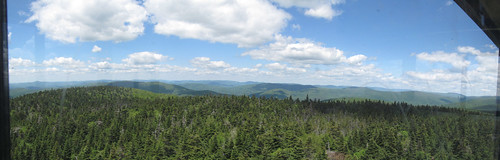
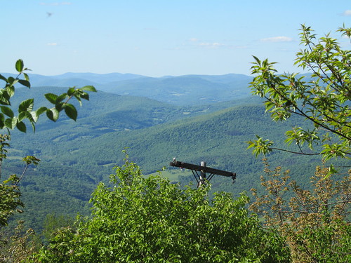
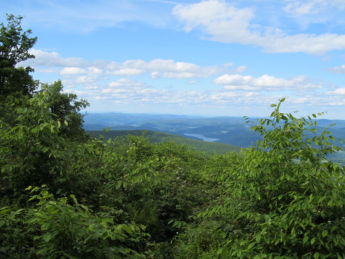
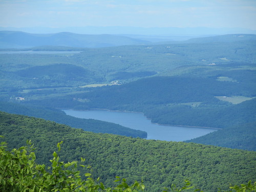
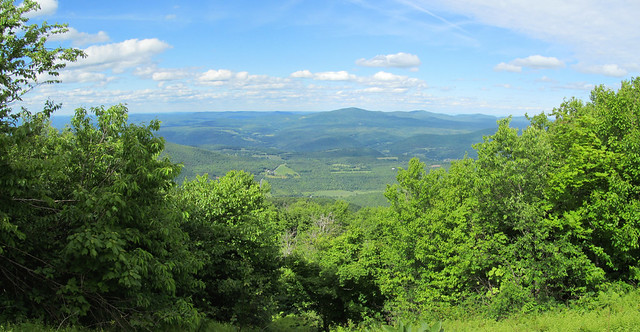
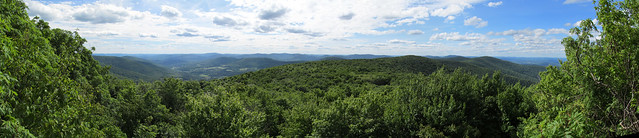
Just before the summit, the trees open to the right, and give some views that are a promise of what's to come.. The Schoharie Valley is visible through a gap in the trees, and by standing on a rock and craning one's neck, one can get a good look at the Schoharie Reservoir (with the Blenheim Power Project and Vroman's Nose beyond) and at Huntersfield Mountain.

First glimpse of the Schoharie valley
Schoharie Reservoir
Huntersfield Mountain

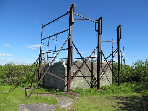
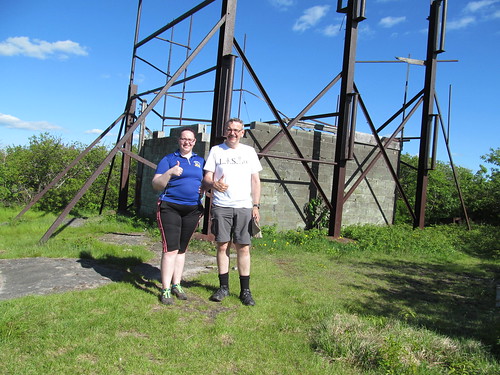
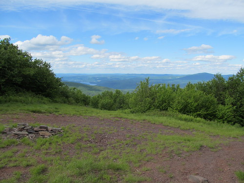
At the summit itself, the woods open into a clearing, once the top of a ski tow.
The summit of Bearpen Mountain

Why the ski run? The mountain was once the Princeton Ski Bowl (associated with Princeton University only in that its founders were alumni) and is reported to have had awesome skiing until its demise in the 1960's. The locals tell a tale of legal jiggery-pokery in which the owner of a competing resort and the state surveyor contrived to move property lines, cheating the owner out of title to the acreage he thought he'd purchased. One version of this tale is told by Russ LaChapelle (as told to James Michaud) "Bearpen Mountain: The Original Beast of the East", Harvey Road: The New York State Ski Blog, March 15, 2011. Not having heard the other side of the story, I shan't comment further, and I suppose that however it happened, having more Forever Wild land is most likely a good thing in the long run.

Stepping out to the top of the ski run, one gets a view to the north encompassing the entirety of the Schoharie Valley.

View from near the summit

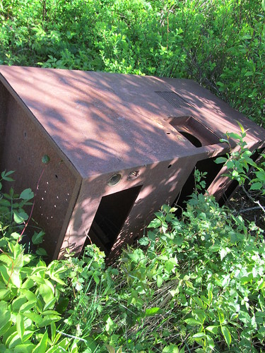
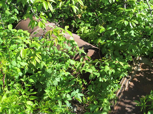
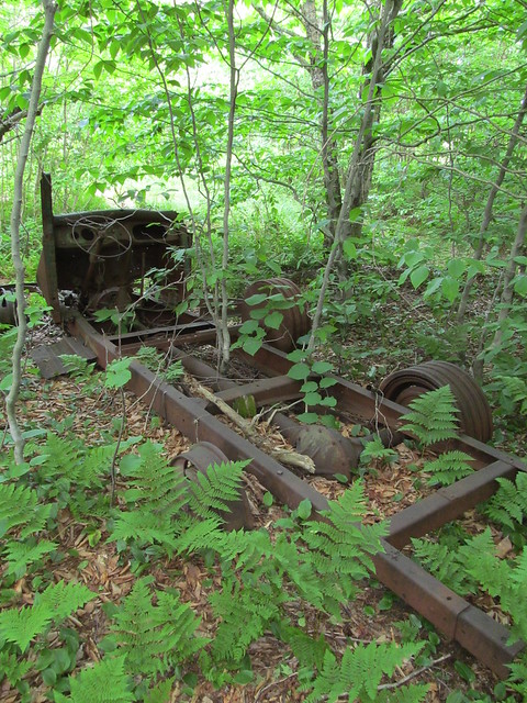
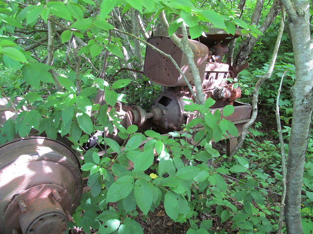
Just off the clearing is the carcass of a truck that had apparently seen a second life as the engine for a ski tow, driving it by means of a windlass attached to a rear wheel.

Rope tow machinery

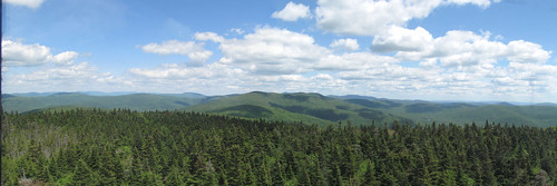
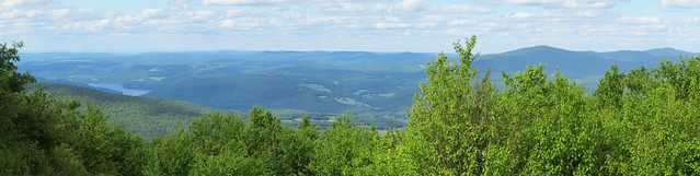
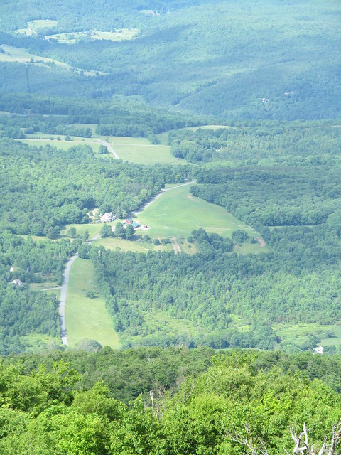
Farther west, there's another clearing with another fine view to the north.
View from near the summit

The run that starts here must have been an expert-level one. It drops quite precipitously, with a vertiginous look at the farmlands near Great Gorge.
Looking down an old ski run

The trail sees foot traffic, and looks as if it might still be skiable with a decent snowpack.
Old ski run

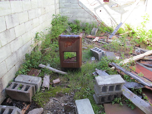
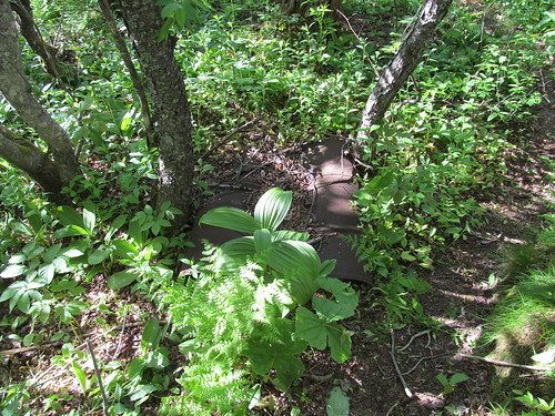
Once again, there's abandoned tow machinery. This time, it looks to have been a farm tractor. Kevin wonders about the wisdom of using even a long-abandoned gas tank for target practice, and shrugs his shoulders.

Rope tow

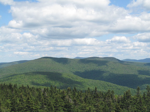
Just a few steps to the west, an undercut ledge has even more spectacular views across the valley of the East Branch of the Delaware, including the slopes of Ski Plattekill.

West ledge of Bearpen Mountain

I found stepping out on the ledge a trifle disconcerting, since I very nearly stepped out onto the crown of a full-grown ash tree.

Stepping out to a viewpoint

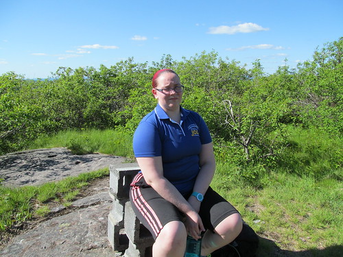
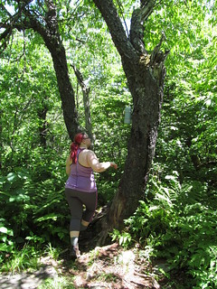
Catherine took it in stride.

National Hike Naked Day

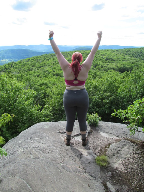
Once out on the ledge, we noticed the runs of Ski Plattekill, across the valley of the East Branch of the Delaware.

Ski Plattekill

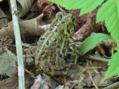
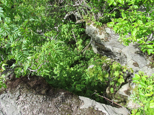
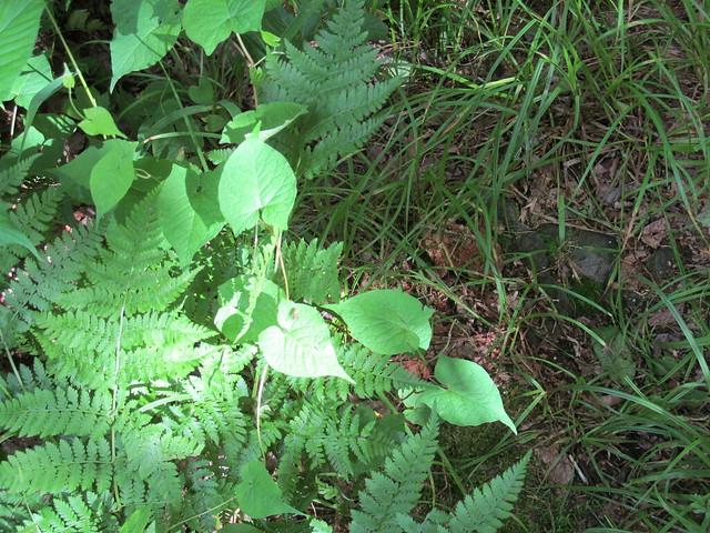
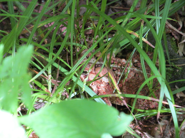
Catherine and I made the mistake of not proceeding down the snowmobile trail a trifle farther, because I learnt only later that further ruins (including a pond dug for ice skating and an even larger ski lift engine) lie in the col to the west, before the trail climbs again to North Bearpen Mountain. Instead, we bade farewell to Bearpen, turned around and made our way back down the snowmobile trail, again taking the unblazed cutoff to get off the muddy road as soon as possible. The trail is wet enough that there are lots of amphibians. Can you spot the fellow in this picture?

Can you spot the animal in this picture?

It's hard, isn't it? I'll zoom the camera in for you. Here he is, well camouflaged. Look for his eye, dead center in the picture. He's facing to the left.

Toad

Below the cutoff, I kept following snowmobile blazes, which Catherine now tells me proceeded in two directions, the way we had ascended and the way that I turned. We made our separate ways, she skipping down the way we had come and me wading down a blazed trail that was an ocean of nettles and prickers. Because of the vegetation, it was quite hard for me to see my footing, and I wound up perhaps fifty feet below the trail on steep and broken rock before realizing that I'd lost it and scrambling back up. She hove into view and directed me (being able to look along the trail I'd missed) just as I was managing to climb up onto the switchback that I'd accidentally dropped off. I continued on the trail and rejoined her.

The trip back to the car was uneventful, with Catherine informing me that this trip was fun even at the end of the day: more often, she says, our hikes are fun only in retrospect!

General impressions: Vly has little to offer: no views, many bugs, and a ton of bear and coyote scat stinking up the place. It's steep enough that it might be a bit of a slog even on snowshoes (although quite possibly easier in winter than in summer's growth). Bearpen more than makes up for it with its views and archaeology. Bearpen is a surprisingly easy walk, entirely free from rock scrambles even at 3500 feet (where it seems that every other mountain in the Catskills has a big step).

Surprisingly, given the altitude, neither moountain has any balsam, and the ordinary mixed-deciduous forest continues right to the summits. I suspect that the deeper snowpacks here (which are the stuff of legend among the ski community) protect the beech, birch, maple and ash from freezing in the winter and allow them to grow all the way to the top.

Progress toward Catskill 3500's:
Kevin: Summer: 22/35 peaks climbed. Winter 3/4 reclimbed.
Catherine: Summer: 7/35. Winter 2/4. (She's been away!)

I need to find more hiking partners: except for three or four, the remaining peaks are ones that are outside of my solo-hiking risk tolerance. I figure I can solo Peekamoose, Table, West Kill, maybe Big Indian. The remainder are the nine hard bushwhacks, plus Blackhead in winter. I'm good enough with land navigation that I'm willing to lead a trip to a place I've never been, but I do want company..
Read more...

Sunday, June 8, 2014

Balsam Lake Mountain and Graham Mountain 2014-06-07

On Saturday, 2014-06-07, Catherine and I decided to hike Balsam Lake Mountain and Graham Mountain in Dry Brook, NY (near Arkville, in the western Catskills). Balsam Lake Mountain is the westernmost of the Catskill 3500-foot peaks, and Graham Mountain is adjacent to it, on a ridge with a couple of formally unnamed less-than-3500-foot heights of land in between, that local hikers sometimes call East and West Schoolhouse Mountain.

Map of the hike

We started up from the DEC parking area on Mill Brook Road. This parking is nearly unique in the Catskills: first, you can drive right up to it on pavement, and second, it's at an elevation of 2,600 feet, so the ascents to the two mountains are only about 1,128 and 1,275 feet respectively. The trails are also unusual in the Catskills in that they involve no rock climbing. We didn't need to put hands to the rock, even for balance, all day.

The trail in to Balsam Lake Mountain runs over an estate that once belonged to rail baron Jay Gould, and still in the hands of his descendants. The state has a permanent easement for the trail to the fire tower (dating back to when the tower was staffed), and the family is also magnanimous about granting permission to hikers to cross their land. I had earlier telephoned the caretaker of the estate and got permission to climb Graham Mountain just for the asking. All that he asked in return was that Catherine and I carry out our trash and recognize that the family was not liable in any way for anything that happened to us on trail. I replied, "I understand that I'm a tolerated trespasser, not a welcomed guest, and will behave accordingly." (Somehow, I don't think the people who ask for permission are the ones that the Goulds need worry about!)

On the way up, we ran into a fair number of Tiger Swallowtail butterflies (Papilio glaucus). Of course, we took the usual excessive amount of time trying to photograph them. One individual had a behaviour that I hadn't seen before. On this windy day, when it alit on a flower, it used its hindwings to grasp the stem, giving rise to a photograph that looks as if the flower is passing right through the butterfly, and showing the unusual sight of the ventral wings displayed.

Tiger swallowtail, Papilio glaucus

In this species, the dorsal and ventral sides look pretty much alike. There are diffferences, but they're subtle.

Tiger Swallowtail, Papilio glaucus

The trail makes an extremely gradual ascent over switchbacks to about the 3200-foot level, and then follows a contour line (which is a former road, named Old Tappan Road) to the DEC gate and public land. A side trail then branches off to the right and climbs 600 feet in five big steps to the fire observer's cabin, with the fire tower beyond.

Fire observer's cabin

Observer's cabin and fire tower

As on most summer weekends, there was a caretaker at the summit. I passed some time in congenial conversation with him: he's a fellow electrical engineer and Long Islander. He also had a very nice Australian Shepherd dog - a well-trained trail dog - who got a bit of my salami as a treat and is now my friend for life. He lent us a pair of binoculars, and we mounted the stairs to the cab of the tower, which is a standard Aermotor steel model - the iconic American fire tower.

Balsam Lake Mountain fire tower

I happened to note at the site that there are bolts in several of the rocks. I suspect that whatever preceded the Aermotor tower, or some other facility at the summit, required guy wires. The Aermotor towers are free standing.

Base of the fire tower

The tower enjoys a spectacular 360-degree view. Using the binoculars, Catherine was able to spot the Lackawaxen mines in far-off Pennsylvania and the obelisk at High Point in New Jersey.

Cathy in the fire tower

For the closer views, we were much helped by the plotting board attached to the Osborne alidade in the center of the tower. By aiming its sights on a peak or lake, we could see on the map where we were looking.

Alidate and plotting board

We squeezed around each other in the cramped quarters of the 7x7-foot cab, and I managed to get a few decent pictures of the views. To the north, the Blackheads and the Devil's Path can be seen,
View north from Balsam Lake Mountain

while to the east, Graham and Doubletop dominate the view, with the Big Indian ridge and the Burroughs Range beyond, and even some far-off glimpses into New England.

View from Balsam Lake Mountain

The television tower can just barely be seen on Graham if you click through to the big image, and ask for the original size from 'View all sizes.'
Graham Mountain

We can see down to the tiny lake that gives Balsam Lake Mountain its name:
 Balsam Lake

and the enormous Pepacton reservoir, part of the New York City water supply system.
Pepacton Reservoir

After coming back down from the tower and eating lunch, we were treated to a tour of the cabin, which features on the inside a display of all sorts of fire-fighting, search-and-rescue and land-conservation memorabilia.
Inside the observer's cabin

We then headed back down the mountain. About three hundred yards beyond the DEC gate, an old woods road branches right. This road was part of the Jeep trail that was used to supply the television tower atop Graham. We take off on it. For an unmarked and unmaintained trail, it is extremely easy to follow. We were never once in doubt of our route.
Old Jeep road

On the way up, I noticed some frilly all-white wildflowers that I don't think I'd seen before. Anyone want to venture an identification? They don't seem to match anything in a couple of on-line identification guides that I consulted, but I know that these mountains play host to some very unusual species.
Wildflowers

There are abundant Clintonia borealis in bloom, with butterflies busily at work around them.
Clintonia borealis

The trail goes over some pointless ups and downs (the shoulders of the two Schoolhouse Mountains that I mentioned earlier, and then climbs in earnest to the summit of Graham. The summit ecosystem is different from any of the other Catskill peaks I've visited. There is virtually no balsam fir nor red spruce: I spotted only a handful of individuals, none bigger than a domestic Christmas tree. Instead, the mixed forest of the low elevations continues right to the top, with beech, ash, white birch, maple, sumac, and even hickory appearing. But the trees are stunted. None of them is above about fifteen feet tall.
Pygmy forest

At the summit, there stands a ruin with an intriguing past.
Transmitting station on Graham Mountain

In 1961, Oneonta Video, Inc. raised funding to construct a microwave relay to start an early cable television system serving Oneonta, Sidney and Endicott, N.Y, bringing the signals by microwave relay from New York City. Part of the funding came from Instructional Television, a predecessor of PBS, to bring programming into the local schools. After multiple failed attempts, a power line was built along a bulldozed path to the top of the mountain, and a transmitter building and tower-mounted antennas erected. ("High TV tower nears completion." Mountain Top News 90:51 Margaretville, N.Y., June 21, 1962, p. 1)

Less than six months after its completion, the system was brought low by damage from a winter storm. Service technician Albert Bagnardi of Oneonta was sent up the mountain to repair it, making an attempt with a snowmobile on December 31, 1961, and again on snowshoes on January 2, 1962. He failed in both attempts to climb the mountain. Oneonta Video then hired helicopter pilot William DeJohn of Ilion to fly Bagnardi to the relay station to make the needed repairs, and the helicopter crashed atop the mountain in the treacherous winds of a Catskill January. The pair, unhurt, were stranded atop the mountain, but were able to take refuge in the transmitter shack and start its auxiliary generator. They were also able to use its equipment to radio Oneonta Video for help. They had neither extra food nor snowshoes, but could melt snow for drinking water on the hot generator engine, and could amuse themselves by watching television on the monitor in the shack - Bagnardi, while awaiting rescue, had succeded in repairing the microwave equpment. (Dobinsky, Pete. "Pair survive copter crash, await rescue." The Press, Binghamton N.Y., January 4, 1963, p. 3)

The pair were rescued on the evening of January 4 by a team of six rangers and policemen in a Sno-Cat driven by Frank Sherwood. They were brought down the mountain through a 4-5 foot snowpack, treated to a big meal at the Inn Between in Margaretville (still a going concern), and sent home for a much-needed rest. ("Cat that did the job." The Star 72:167, Oneonta, NY, January 5, 1963, p. 1)

I don't have any information about when the tower finally was taken out of service (and the dilapidated steelwork removed for safety), but if it lasted into the 1970's, it was surely irrelevant after Westar 1 launched in 1974 and RCA Satcom 1 in 1975. Those spacecraft provided video distribution for the major networks and a dozen or so new ones with names like Home Box Office and Entertainment and Sports Programming Network. Immediately, the old microwave video links were cost-prohibitive to maintain, and they have all fallen into disrepair. AT&T's microwave network hung on for a few more years, but eventually shut down with the breakup of the company in 1984.

What remains on Graham Mountain is a ruin, and Catherine was unimpressed.
Catherine on Graham Mountain

The now-empty equipment racks have been yanked out, and are simply fallen in the dirt outside the shack.
Equipment rack

The door of the shack is gone, and the roof has collapsed, leaving debris inside exposed to the elements.
Door of the transmitter shack
Inside the transmitter shack

Electrical conduit and wiring are torn off the walls, and the walls themselves have been torn apart in spots.
Wreckage inside the transmitter shack
The east wall of the transmitter shack

The drums of the station's fuel dump are rusting and overgrown with saplings.
Fuel dump

Among the wreckage, Mourning Cloak butterflies (Nymphalis antiopa) flit about unconcernedly.
Mourning Cloak butterfly, Nymphalis antiopa

The area around the station, which had been clearcut, is now growing up to trees, and the view is largely obstructed. (I hear that there's still a good view to be had by climbing the station structure, but did not care to chance my weight on that crumbling hulk.) There's still a sight line to the west that sees Balsam Lake Mountain, and the camera, zoomed in as far as it will go, or a pair of binoculars, can pick out the fire tower.

View west from Graham Mountain
Balsam Lake Mountain fire tower

By now, Catherine had grown quite impatient with all Kevin's photography, so we set up the tripod to give "two thumbs up" for the summit,
Two thumbs up for the summit!

and started back down the trail. This time, we noticed a fuel drum set beside the trail in place of a cairn, and a side trail to an overlook. The overlook looks east down where the power line had been. (Even with a bulldozer, I'm amazed they managed to string the line up that cliff!) It has a nicely framed view of the Big Indian ridge.
Oil drum in place of a cairn
View east from Graham Mountain

On the way back down, it was Catherine who lallygagged for photography, finally getting one of the many amphibians that hopped out of the trail at our approach to model for the camera.
Amphibian

It was a tired pair of hikers who got back in the car, picked up a pizza in Arkville, and drove home up the East Branch and down the Schoharie valley. At sunset, we ran into an incredibly dense swarm of moths that sounded like a rainstorm against the windshield. The front of my car now looks furry with squashed bugs. I need to get it in for a wash soon!

Lesson learnt: Don't inflict 10 miles and 2500 feet elevation gain on a kid who hasn't been hiking in almost a year. Catherine's a trouper, though; few words of complaint and she soldiered on through the whole trip. Maybe sometime next week she'll decide that she had fun.


Read more...