Fortunately, I found online that someone had snapped a photograph of an old copy of the map that had once been posted at the Whitmyer Road parking lot, and posted it to a mountain bike forum. The picture looks to be output from a CAD system, or perhaps an early GIS. In any case, it appears to have been done to scale, and have just enough points that we can reference it to the map. Let's give it a try.

Pull up ‘Plugins->Georeferencer->Georeferencer’ from the QGIS menu bar.
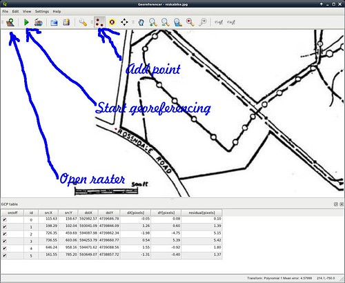
Select the ‘Open Raster’ button in the toolbar, and load the ‘niskabike.jpg file that we downloaded from the mountain bike forum. Zoom in a couple of levels; you can use the ‘hand’ tool to pan around, just as you can with the map.
Now we have to identify corresponding points in the two maps. Click the ‘Add Point’ button in the toolbar, and click a point for which we can identify a corresponence. (I used the intersection of Whitmyer Drive and River Road as the first point.)
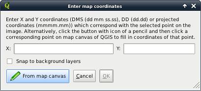
A dialog appears asking what corresponding point in the map to use. Click ‘From map canvas’ and select the point on the main map. The co-ordinates will be filled into the dialog box. Click ‘OK’
Continue this process for identifiable points that cover the map over a wide area. I used the turn of Whitmyer Road, the right angle in the upstream breakwater above the lock, the junction of the lock's retaining wall with the dam, the turn of Lock 7 Road near the parking area, and the junction of River Road and Rosendale Road.
Once you have a data table of corresponding points, you can let the georeferencer do its job by selecting ‘Start georeferencing’ in the toolbar.
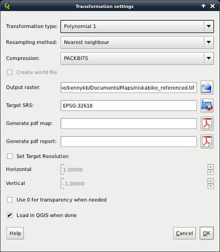
You will need to fill out the dialog that appears, at least giving it a TIFF file for the output, and a projection to use (which should usually be the projection of the main project). The rest of the choices should be filled out as shown.
Clicking ‘OK’, we get the old map loaded up as a layer in the QGIS project. Lowering this layer in the stack (I put it below the contour lines), we can see that it aligns nearly perfectly. The retaining wall of the lock, the roads, and the bike path all superimpose nicely. The stream appears to have meandered a little, but it's pretty soggy around there, and I'll say that it's good enough.
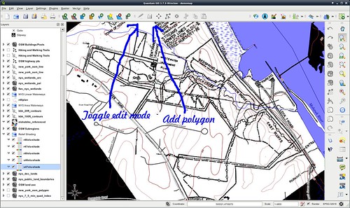
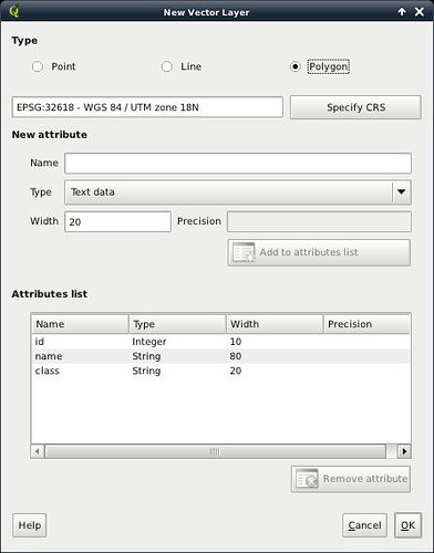
Now we can start transcribing data by tracing over the old map. Create a new shapefile layer, choosing a Polygon layer, and adding a few attributes.
In the new layer, turn on edit mode (‘Toggle Editing’ in the toolbar). Create polygons that outline the land parcels of interest. Save the newly-created shapefile, and turn editing mode back off.
Lower the layer below the relief shading, style the land use appropriately, remove the temporary layer with the old map, and we're done.
(I could have transcribed the walking tracks, and so on, but I have other data sources for them. So read on to the next installment to see where that material is coming from.)
No comments:
Post a Comment