The first additional data source is a set of GPS tracks that Andy Arthur obtained under Freedom of Information laws. These show the trail routings in New York state park lands, much as the DEC files do for the state forests. (I may at some point discuss the data quality of those files; they're available in several redundant formats, and the data do not match.)
The second additional data source is that I tried walking the trails about a month ago with a GPS receiver. Unfortunately, it was the GPS on my Android phone, which suffered an operating system crash partway through the walk. But I was able to recover my tracks for at least one of the trails, the blue trail (marked as 'purp' in the DEC files) that runs from the entrance by the Lock 7 parking up to the east power line near River Road.
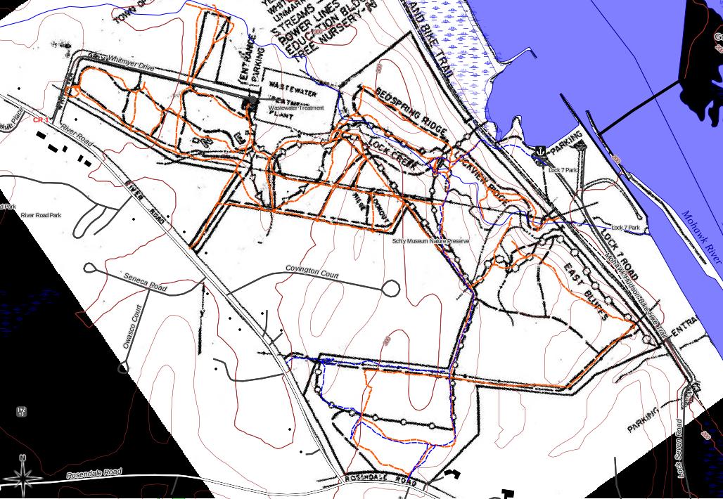
To compare what I found, I added vector layers with the KML file of the park (orange) and with the GPX file from my phone (blue). Looking at them superimposed in QGIS, I note the following.
- In the southern part of the preserve, the old trail map is largely schematic. I know from experience that the white trail follows the ridge top on the east bluffs and always has. The orange tracks match my memory, even if the phone had stopped recording.
- Similarly, the orange GPS tracks and my tracks (I *know* that I was following the blue blazes) largely align. on the blue trail, placing it a bit to the south of where the old map puts it.
- It also appears that whoever laid out the orange tracks missed a double blaze at one point and just bashed north to the power line. The blue blazes weren't hard to follow, and I have confidence in my track at that point.
- The orange tracks look a good bit better aligned with the map up at the north end near Whitmyer Drive. (There were better defined lanes through the old tree nursery, so this doesn't really surprise me.)
Conclusion: I have a lot of confidence in the park outline that I traced and in the alignment of the blue trail in my GPS tracks. I need more ground data for the rest of the trails before I'm willing to make my map available as something nearly definitive.
Before the snow gets too deep, I hope!
No comments:
Post a Comment