I realize that I'm over a year behind on trip reports. This post is
the start of a series where I'm blogging the 'back catalogue' of
stuff I've done, so that I have something electronically searchable,
and so that I no longer have to puzzle out the smudged handwriting
in my journal.
On August 10, 2018, I decided to go hiking and try to get a
view for a change. I had been kind of 'taking a reset', because all
my eye and foot problems had me mostly off the trail for a few
years. Because of this, I kind of wanted some intermediate-level
stuff to get back on my feet: hard enough to be challenging, enough
views to be rewarding, but something less than the trips I'd been
accustomed to - multiple bushwhack high peaks in a single day is
surely something I need to work back up to!
This is where I'd ordinarily insert some observations about history
of the names, but I'm coming up blank. My best guess is that the
'Thomas' of Thomas Mountain is a family name, and that Cat Mountain
is named for the cougars (Puma concolor) that formerly
inhabited New York State. The two mountains are the most salient
features of a preserve that was purchased by the Lake George Land
Conservancy in 2003, less because of its recreational value than to
protect the water quality of Edgecomb Pond, the reservoir that
provides the Town of Bolton with its drinking water. Ten years
later, the conservancy sold the land to New York State, and it's now
part of the Lake George Wild Forest.
Forecast weather was usual for August, “25% chance of late-afternoon
showers.” I can live with that!
I chose the Edgecomb Pond parking area simply because it's less
popular. The trail started out on a woods road, still used by the
township for maintenance, that circles the pond. The waterworks are
in a pretty, park-like setting, glimpsed here from across the reservoir.

Just after the pond, I started up Cat Mountain on a red-blazed
trail. The trail started out pretty clear (except for my
color-blindness!) but pretty rapidly faded to a level of marking
typical of a wilderness trail. Going a couple of hundred yards
without seeing a marker or paint blaze was not uncommon. Still, it wasn't
hard to follow. The trail is on DEC's map, but isn't in the preserve's
brochure,
probably because the conservancy doesn't want newbies getting lost there, or
falling off a cliff.
Nearing the top of the mountain, the trail gets steep and scrambly
among the cliffs. It starts to give glimpses of the southern end of
Lake George, with the Tongue (the large peninsula that juts into the
west side) at left, Lake George Village to the right, and the ridge
of Black Mountain, Mount Erebus, Sleeping Beauty, Buck Mountain and
Pilot Knob across the lake.

The summit had a number of other hikers on it, so I didn't get a
really good capture of the panoramic views. I found a spot to sit
and eat lunch, and was joined a little way off by a nice couple with
an even nicer dog. I think I made a friend for life when I gave the
pooch the last bite of my sausage. (With the owners' permission, of
course!) In place of the last bite of sausage, I gathered a handful
of blueberries from the bushes growing from cracks in the rock.
There's a survey benchmark in there somewhere, but I didn't trouble
to search for it.

As I started down, I corrected my altimeter, and noticed that the
barometer was falling. As I enjoyed the fine view of the southern
Adirondacks spread out before me to the west, I also mentally upped
that “25% chance of showers” estimate: those clouds were
starting to look a bit ugly.
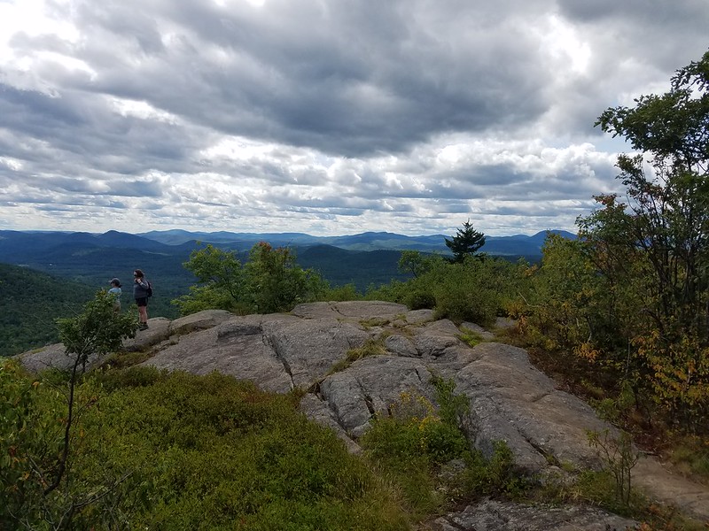
I continued circling the preserve on
the yellow-blazed Richard Hayes Philips Trail, which is a strenuous
walk along a ridge line with occasional scrambles. I continued
keeping a literal weather eye out. Those clouds looked to be getting
closer.
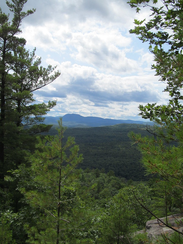
Just before the summit of Thomas Mountain, the trail made a couple
of quick switchbacks up a cliff face, the sketchiest footing of the
day. It then came up onto a cleared ledge, again with a nice view
south over the lake. This clearing had been the site of a cabin
until the conservancy bought the land. For several years, the cabin
was open to hikers as a campsite, but it was abused, and became a
health and safety concern. When DEC took over the land, it was also
declared incompatible with a Wild Forest. It was of negligible
historic value, having been built in the 1990's. DEC eventually
demolished it
at the end of 2017.
From the cabin site, the trail makes its way out on the cabin's
gravel driveway. As I trundled down the driveway, I suddenly was
glad that the rock scrambling was over for the day, since suddenly I
was in a downpour. I donned my rain jacket and continued, making the
turn back onto the blue-blazed woods road that leads back to
Edgecomb Pond. There were a couple of spots of wet footing where the
streams were starting to flow, and few photo opportunities, although
I managed to grab one shot of a beaver pond in the pelting rain.
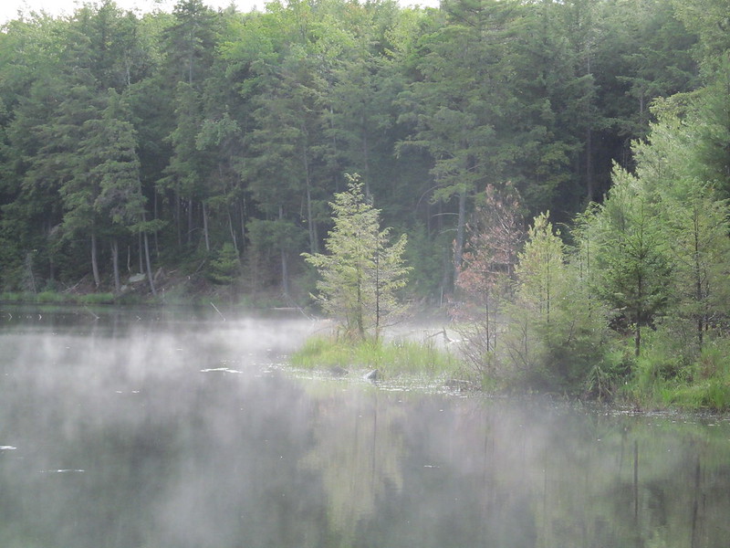
I got to the parking lot as the storm was blowing over and daylight
was starting to fade. I found that I was the only car there, except
that I was surprised by a local cop turning into the lot
just as I was changing out of my sodden hiking gear into
dry “town clothes” If they noticed that they'd caught me
in an em-bare-assing position, they chose not to say anything, or
even acknowledge my presence, and drove on. Whatever they were
looking for, it wasn't a wet and tired hiker getting ready to leave.
I'd had in mind the secondary possibility of checking out the view
from
The Pinnacle,
another knob of rock just a mile away, but I'd got a late start and
then been slowed by the weather. Maybe another time. [Post
hoc: The Pinnacle is now closed to the public. I presume that
it's because of the Great Plague, and at some point it can
reopen. It would be a quick side trip if I happen to be in Bolton
Landing with a couple of hours to kill.]

