Thursday, May 21, 2015

2015-05-16 Mapping Trips

2015-05-16 Mapping the Helderbergs

There's been too long a hiatus in blogging here, but I've been kind of busy. Still, I've recently had the opportunity to get in a little bit of walking (on easy trails: I won't dignify it with the term, 'hiking') and mapping for OpenStreetMap.

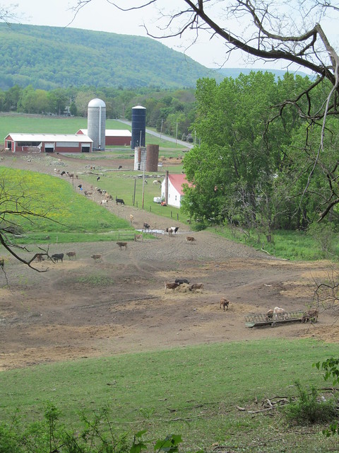
The last few mapping outing, I've been concentrating on the little nature preserves that are strung out like beads along the rim of the Helderberg Escarpment. Many of them are fairly new, since Albany County has been pursuing conservation easements and outright property transfers in recent years, to try to preserve the view as well as the unique environment of the Heldebergs.

2015-04-18 Wolf Hill

On 25 April, I did the first of these mapping expeditions this spring, starting with the
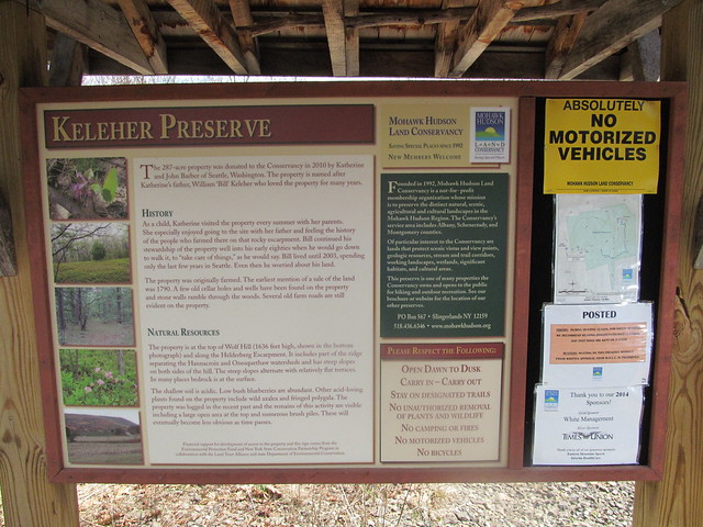
 Keleher Preserve atop Wolf Hill. 
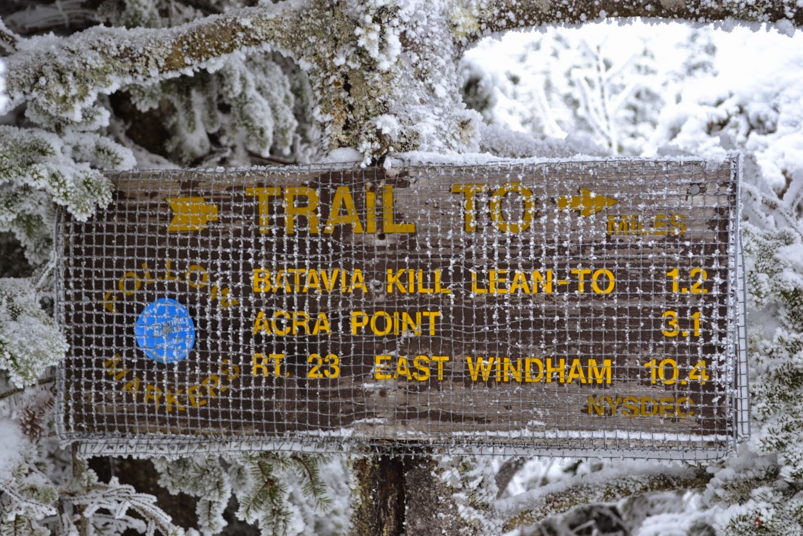
This is a smallish (447 acre) plot, with a few miles of moderate trail. Like all of the Helderberg preserves, people tried to farm this land once upon a time, despite the shallow and poor soil. There is ample evidence of ruins. The land was in private hands until two parcels were conveyed to the Mohawk Hudson Land Conservancy in 2010 and 2014.
Kisosk

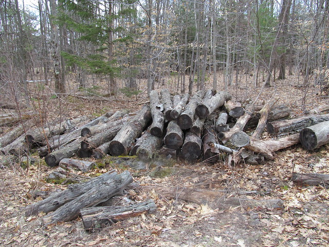
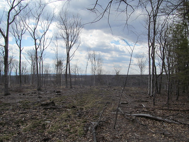
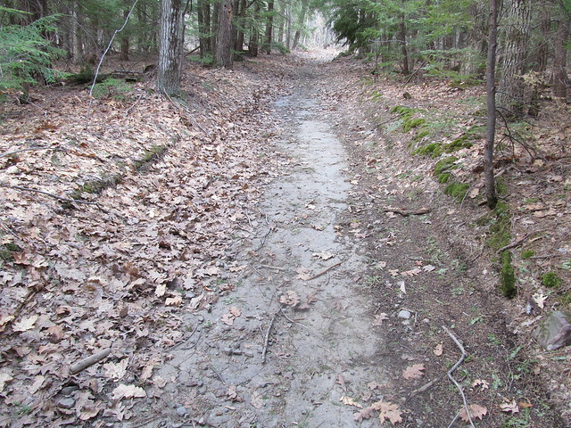
I hiked in past evidence of recent logging,
Cordwood

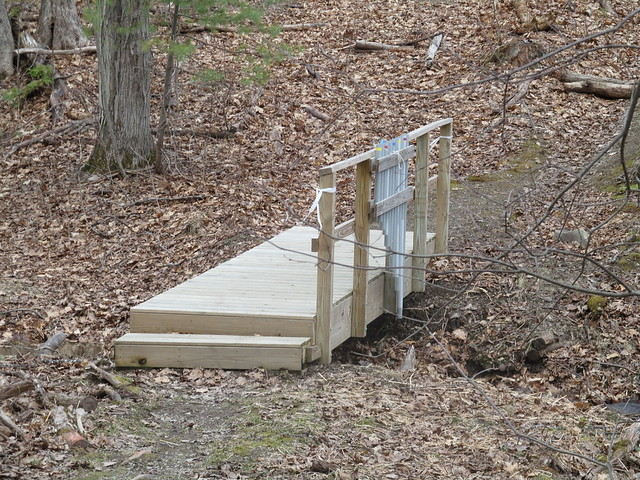
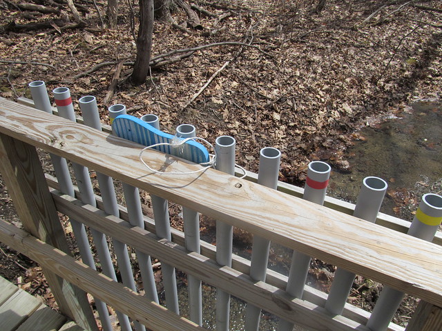
I quickly came to an interesting conceit that I've now seen in several of the preserves: a bridge fitted with lengths of PVC pipe tuned like organ pipes. You play it by beating on the tops of the pipe with flipflops that are tied to the bridge. I tapped a couple of bars of a Mozart melody and continued, smiling inwardly, but still more pleased with the babble of the brook.
Bridge
Organ bridge

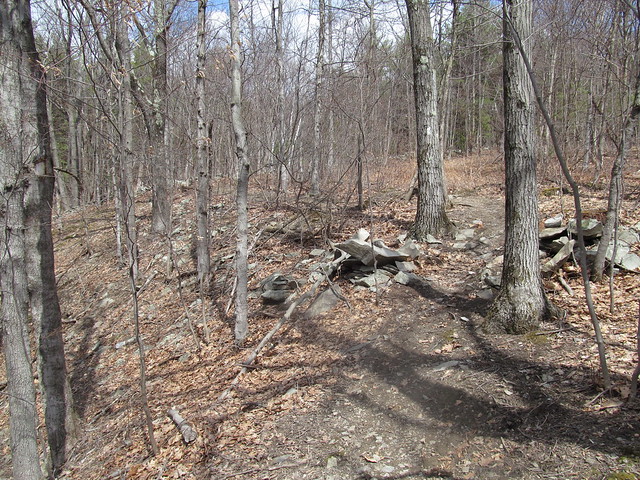
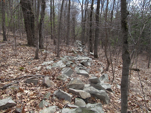
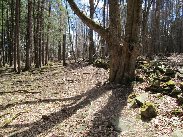
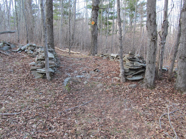
The trail steadily ascends the hill, past a number of stone walls that once bordered fields and pastures.
Old stone walls
Old stone walls

I thought that I'd follow the abandoned Wolf Hill Road to the south end of the preserve, where there are reported to be some nice views. Because of the road's being unblazed, and my unfamiliarity with the preserve, I turned off too soon, down an abandoned logging road. I lost the road a couple of times, but each time I found it again and followed it south - inadvertently straying off the preserve to the best views I had all day. Just southwest of the preserve, the whole area has been recently clearcut and has a sweeping view, where the distant horizon shows the Blackhead Range, Windham High Peak, and the ridge ascending to Huntersfield Mountain.
Clearcut
Huntersfield ridge

When I arrived at the clearcut, I knew I'd gone astray, and made my way up the ridge to the correct road - which was, of course, 
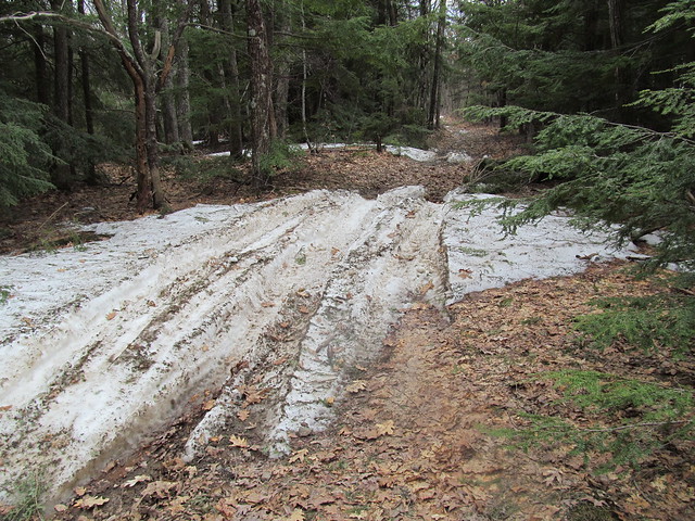
perfectly obvious, The road was still blocked in spots by drifts of patchy wet snow, much churned by ATV's. Snow on the trail
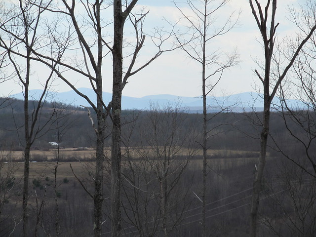
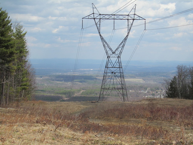
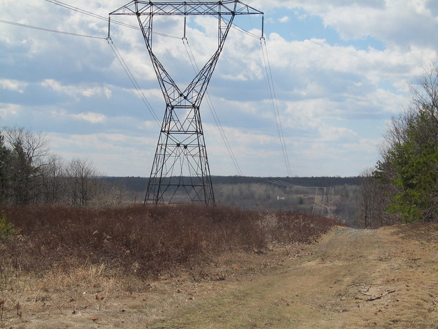
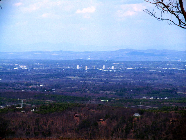
I soon reached the powerline cut that forms the preserve's southernmost extreme, and it did indeed offer views, both east toward the Hudson Valley and the Taconic Mountains beyond: View east
and west across a little valley to the next hill, with the flanks of one of the Catskills (Bearpen Mountain?) just barely visible through the trees at left. View west

I turned around and made my way back up the road into the preserve. Where the snow had melted, I could see just how poor the acidic soil up here is: only a few inches of erosion have exposed the bedrock. The rock here is a limestone pavement, and the Devonian stone to be found here is some of the most fossiliferous on the planet. I noted the odd brachiopod and crinoid without even stopping. Bedrock
In the spots where the limestone dips or is beginning to form sinkholes, the water stands, and the ATV traffic has churned the trail into a lake of mud.
Mudhole!

I followed the white and red trails around to where a strategically placed bench overlooks a fine view of Albany Overlook
Overlook

I then walked a series of loops to pick up the routing of the other trails. I noticed at the end of the green trail that the maintainers have placed flagging in the woods, apparently marking a route up the hill to the east. I followed their flagging for a hundred yards or so, but recalled my promise to Mary Ann that I wouldn't bushwhack solo. I turned around and hiked back to the car. A nice afternoon stroll.

2015-04-25 Huyck Preserve - Hiking the Huyck

Trail marker

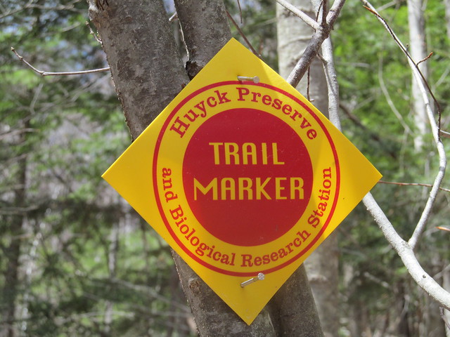
A week later, feeling more energetic, I went down to the Huyck Preserve, a considerably larger tract 
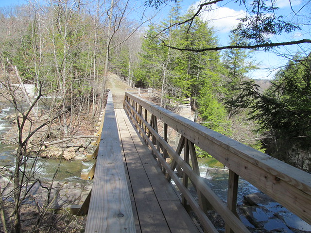
surrounding the village of Rensselaerville. Very close to the 
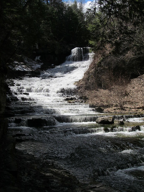
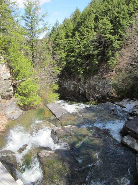
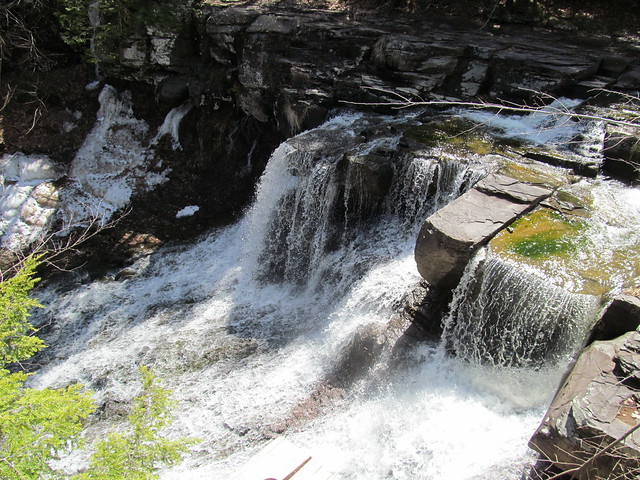
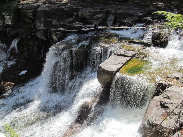
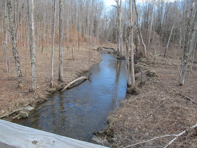
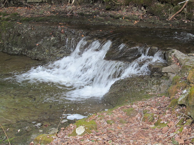
south entrance, the trail comes to a bridge,
Bridge over Tenmile Creek
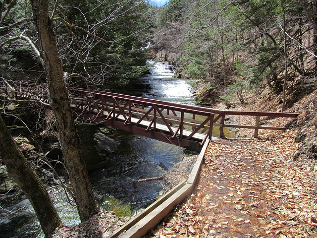
that offers a view of lovely Rensselaerville Falls.
Rensselaerville Falls

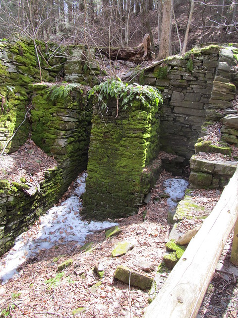
On the far bank stands a ruin of what I presume to have been a mill, probably exploiting the falls for water power. I make a note to explore that further another time, and continue with recording my GPS tracks - I've some miles to make today if I'm to map the whole preserve!
Ruined mill
Ruined mill
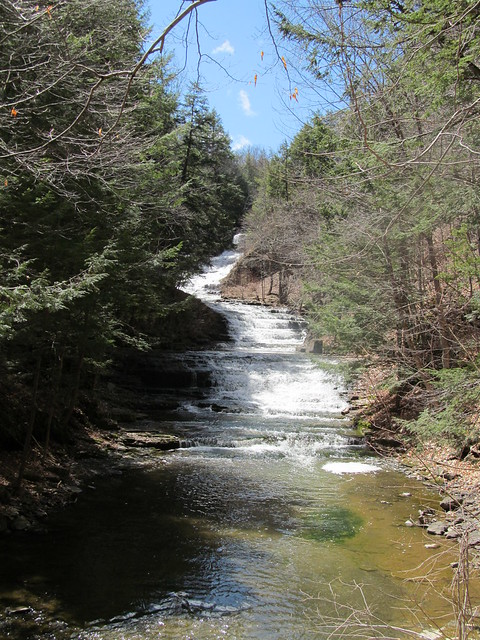
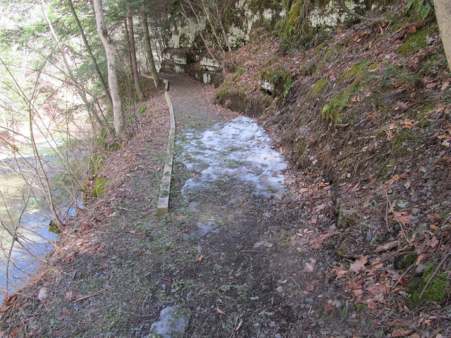
A side trail leaves the mill to the middle section of the falls.
Rensselaerville Falls
The trail has patches of ice. I'm careful about my footing. Sliding into the gorge of the Tenmile Creek at the falls would not be pleasant!
Ice on the trail

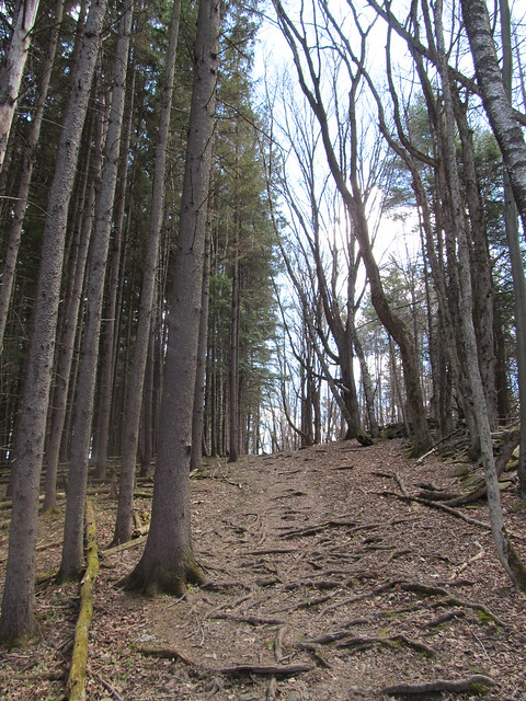
Backtracking to the ruin and heading up the hill puts me on the Falls Trail, which climbs moderately but steadily through a fine stand of hemlocks, most likely planted as a Great Depression reforestation project after the local farms failed.
Trail up to Rensselaerville Falls
A handful of much older trees were probably beloved of the farmer.
Trail up alongside Rensselaerville
      Falls

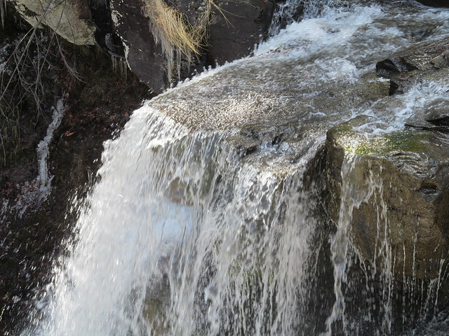
Once on top of the massif, the trail bends back to the river and recrosses on a wooden bridge that looks downstream over the lip of the falls.
Bridge over Rensselaerville Falls
Lip of Rensselaer Falls
A stairway down from the far side goes to the edge of the falls at the top, another spectacular overlook. Beyond the falls, the "snow cone" of frozen mist is still apparent, even in late April.
Plaque at the overlook
Rensselaerville Falls

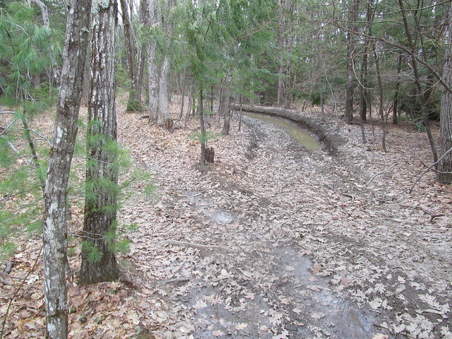
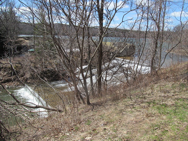
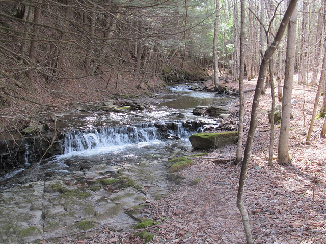
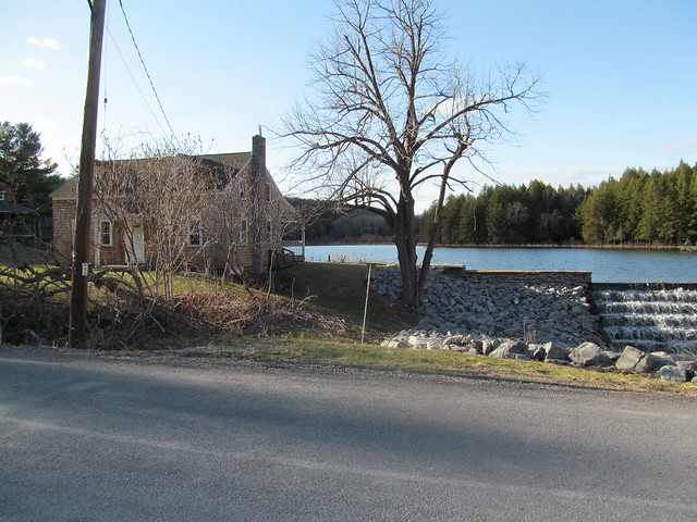
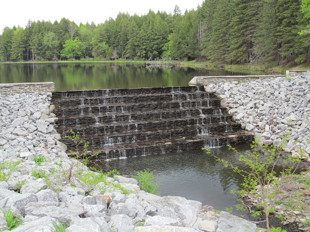
The trail then goes up the east bank of Tenmile Creek along the 
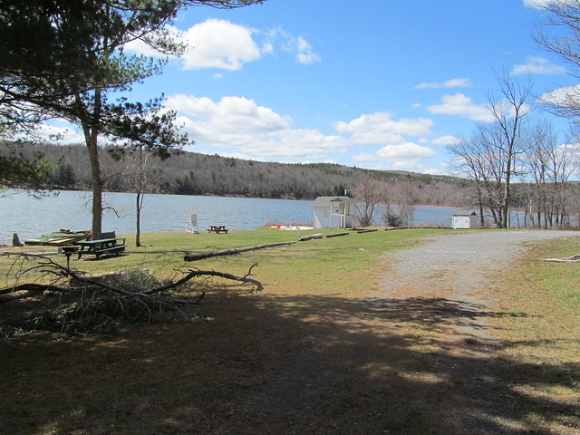
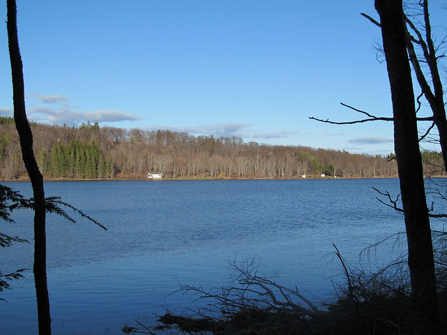
spillways of Myosotis Dam, arriving at lovely Myosotis Lake.
Lower spillway of Myosotis Dam
Myosotis Dam
Myosotis Dam

It passes the picnic area, swimming beach and boathouse, the Jessie Huyck building, and the Ordway house (which now serves as part of the preserve's conference facilities.
Huyck Preserve swimming beach
Ordway House

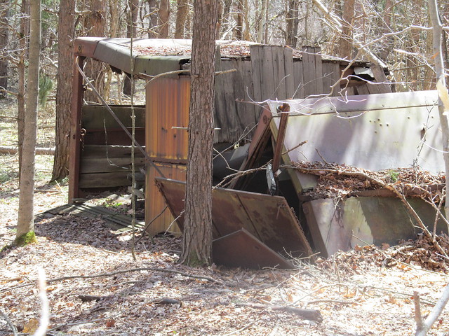
From here I proceeded up on the Ordway Trail, around the Race Track, and onto the Partridge Path. From time to time, I passed some ruins, including some wreckage whose purpose was ... uncertain. (It's too wide to be a trailer, but seems to have 
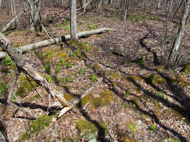
been made of parts of several. I've no idea what it was for.)
Wreckage

There are no wild flowers yet, but the corn lilies ( Clintonia borealis ) are starting to emerge. Corn lilies, clubmosses, and moss

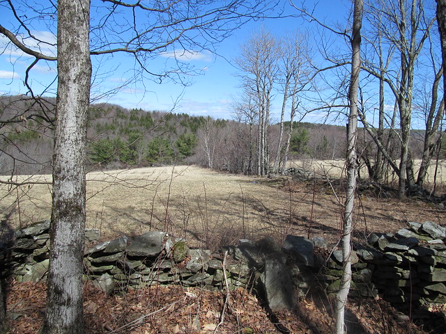
Farther up, the first loop of the path brushes the edge of the preserve. Someone has managed to cling to his farm, and there's a hayfield right over the wall. Pasture

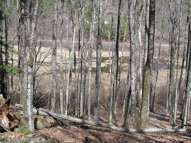
With the leaves off the trees, there's also a view down into the marshes, with County Road 6 beyond. The water is high from snowmelt.
Beaver swamp

The trail recrosses the Tenmile Creek on a bridge, and follows an unnamed tributary upstream toward Wolf Hill.
Tenmile Creek
Tenmile Creek
Tenmile Creek

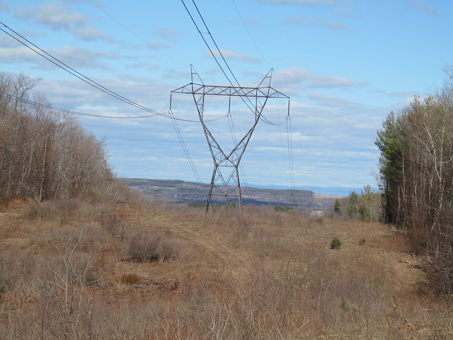
When it reaches the Schoharie power line, there's a view toward the Taconics. Wolf Hill, which I explored the previous week, is visible in the nearer distance.
Power line cut

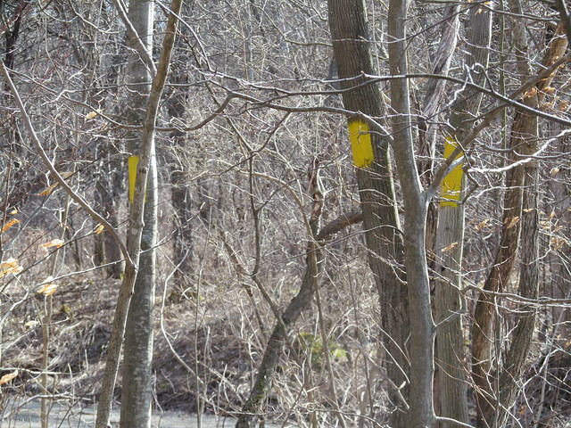
At the north end of the preserve, yellow survey blazes mark the boundary of the Partridge Run state forest. Survey blazes

I signed the Wood Road register, and continued around to finish the other side of the loops. On the way, I passed a gate in an ancient stone wall. Some mason took pride in his trade. A wagon would still have a smooth ride on the pavement today. Old gate

This early in the Spring, the less developed parts of the trail were still sometimes running with water and full of blowdown. I tossed aside what I could of the lighter brush. Some of the heavy stuff will just have to await a chainsawyer. Washed-out trail

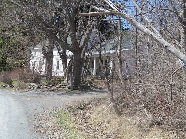
I followed the Wheeler-Watson trail out, which goes by the Lincoln Pond dam and the adjoining cottage, another part of the preserve's facilities, used to house visiting scientists. While there's a trail around Lincoln Pond, and another connector across the north end of the lake, I decided to bypass them. The day was starting to get late, and I still had a few miles back to the car.
Lincoln Pond Cottage

I signed the trailhead register across from the cottage (I don't pass a register without signing in!) and followed the trail on the west side of 
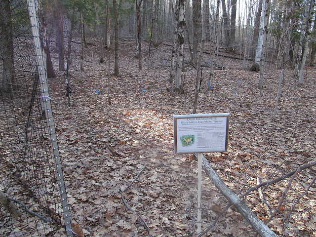
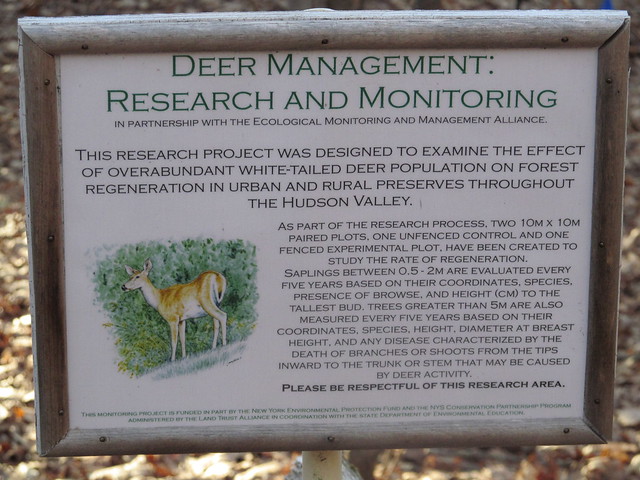
Lake Myosotis past someone's experiment. The preserve is an active biological research station.
Experimental plot
Experimental plot

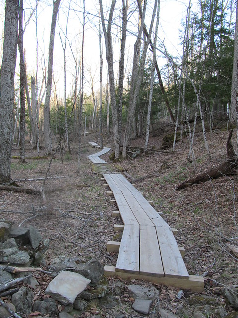
The wet spots are handled nicely by fine new bog bridging of dimensioned lumber. Bog bridging

The Jessie Huyck center, the boathouse and the swimming beach stretch out along the far shore. Myosotis Lake

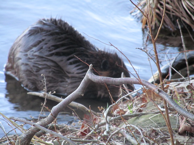
On the way, I was surprised to see a beaver working away. The beaver was too busy to notice me, and let me photograph for a few minutes, so I came away with a couple of, you should excuse the expression, wet beaver shots.
Castor canadensis
Castor canadensis

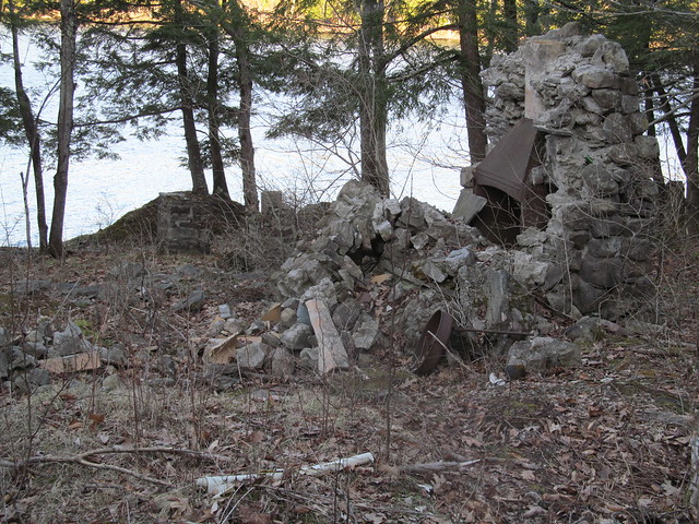
A little farther down the lake stands the ruin of another farmstead. Ruined farmhouse

I rapidly made my way back to the car, and arrived with a good half-hour of daylight, having put in roughly a 12-mile day on easy trails.

2015-05-16 Bennett Hill, and return to the Huyck

Bennett Hill Preserve

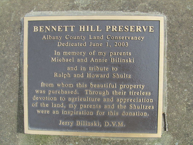
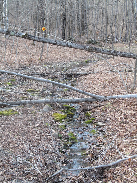
I felt as if I had to get out again today, even though the weather looked dodgy, so mapping another one of the little preserves seemed a good idea. I could always cut things short, or if the weather held, go back and do the unfinished trails at the Huyck or start mapping another one. I chose Bennett Hill, another one of the newer (1998) preserves in the Helderbergs. Like all the Helderberg hills, this one has a lot of interesting geology. Those who are interested in the complexities can find a lengthy discussion elsewhere. Suffice it to say that springs, sinkholes, and fossils are among the karst features in abundance. In fact, the entrance to the preserve is right near a cluster of four sinkholes, only one of which appears to be active (with a stream running into it that originates at a spring farther up).

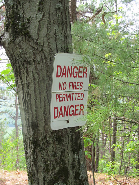
On the way in, I got a reminder that the last few weeks have been bone dry, even though we started with a good snowpack. This has been a bad fire year. Fire danger

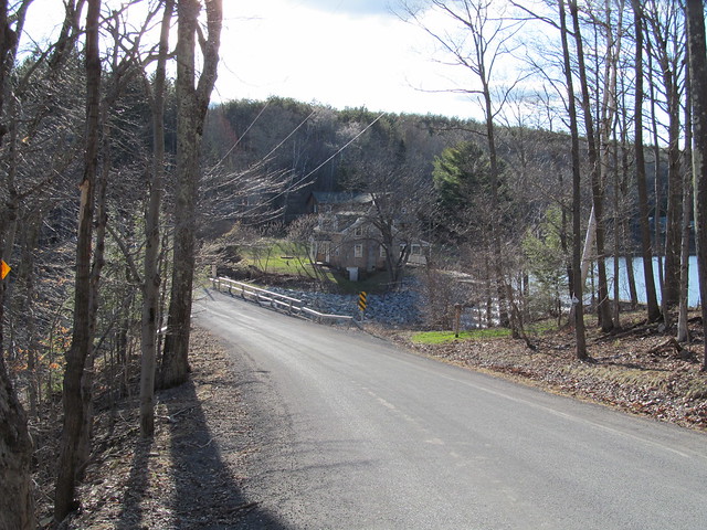
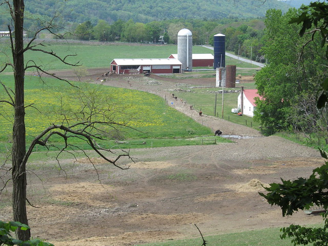
The entrance trail overlooks a dairy, with fairly good views beyond when the trees are not fully leafed out. Its nicely benched into the side of a hill, and follows a contour line for about a quarter mile before it ascends steeply about 200 feet up a couple of switchbacks.
Dairy

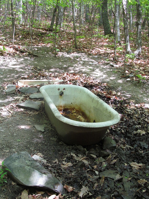
Near the top of the climb, I caught sight of a strange object in the woods. "What's that bathtub doing there?" I said to myself. It turns out that the preserve builders, or perhaps the former landowners, thought it would be amusing to have a piped spring feed a bathtub faucet, so they set one up that way. I didn't sample the water, knowing that it will most likely taste as if it will rust your teeth!
Bathtub spring

Right at the top of the last switchback, a hiker can rest for a moment. There's a tree with bent branches that's perfect for sitting on.
Nice sitting tree

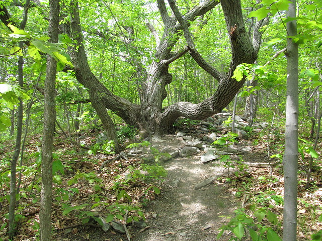
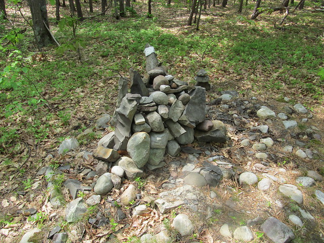
I made a complete loop of the hilltop on the yellow trail. Over on the east side of it, there's a cairn just built on a straight and level bit of trail, with no turnoffs, good blazes, and good visibility. I have absolutely no clue why anyone would have gone to the trouble of building one right there.
Cairn

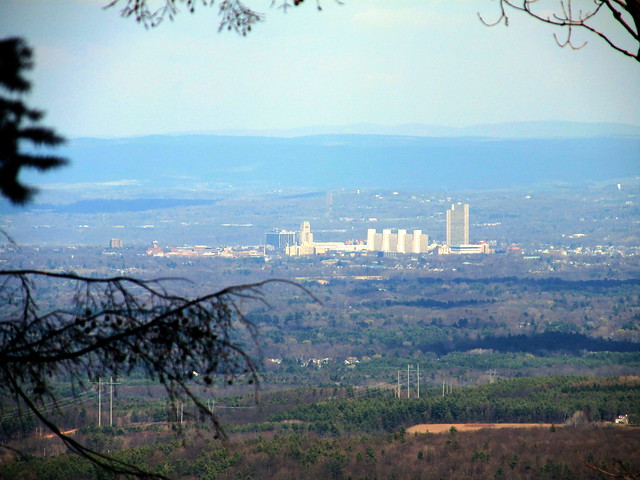
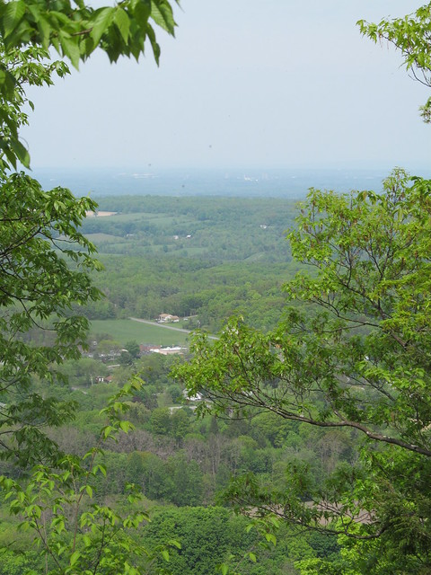
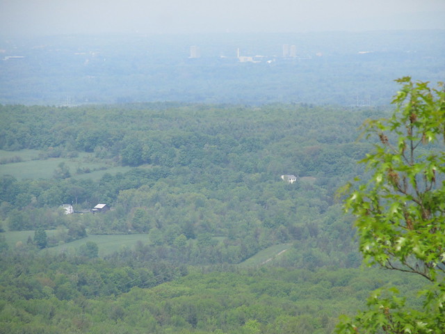
On the north side, there's a nice overlook with a view toward Albany and the Green Mountains. The view left a little to be desired on such a hazy day.
Approaching the Bennett Hil
      overlook
Albany

I finished the loop one-and-a-half times around the yellow trail, and descended the hill on the steeper and less well-maintained red trail. There's a lot of loose soil on steep slopes on the red trail; I suspect it may be headed for an erosion problem if the maintainers aren't careful. On the way out, I heard a strange sound. "What is that?" I said to myself. "It's not a motorcycle revving..."

The farmer had let the cows into the nearby field. I was hearing them arguing over the haystack. "MOO!". My, the sound carried.
Dairy

This bit of mapping had taken me only a couple of hours, and the weather still looked as if it would hold off for a bit, so I headed back to the Huyck Preserve to map the bits I'd missed. 
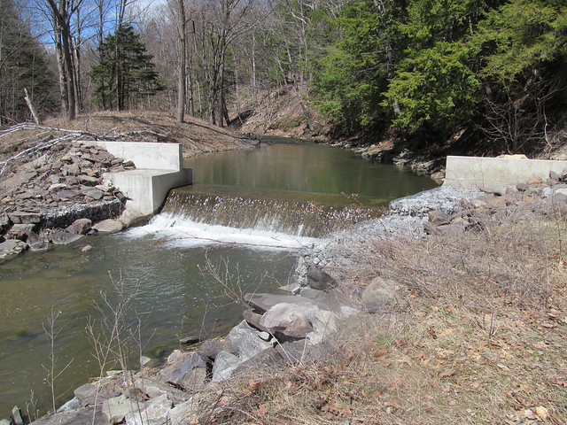
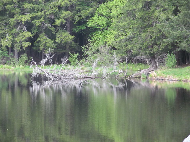
I parked up by the Lincoln Pond dam this time, and started hiking around the pond (after some delays, such as replacing the lens that fell out of my spectacles). The pond with its dam is a pretty sight, and vegetation and driftwood made interesting reflections in the water.
Lincoln (Hicks) Pond

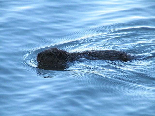
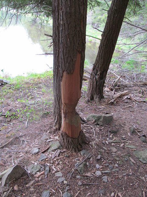
My beaver friend from a few weeks ago wasn't working while I was there, but I saw that he or one of his colleagues had been about.
Beaver damage

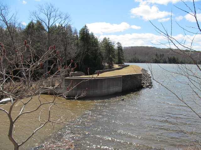
After going around the smaller pond, I walked around Myosotis Lake to map the connecting trails that I also had missed on the last visit. I found I didn't have to turn back at the dead end at the dam spillway, because the spillway was completely dry. I jumped down into the concrete gully, walked across and scrambled the 
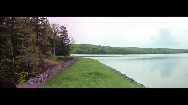
other side. I grabbed a panorama of the lake from the center of the dam. Click the image for video.
Myosotis Lake I went back to my car up the east shore, getting the crossover to the north of the lake, and got back just as it was starting to rain.

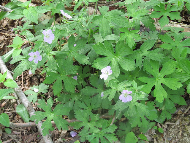
The day had wildflowers in abundance, while just two weeks earlier there had been none at all. Among the ones I spotted were Geranium maculatum, which gardeners call a 'false geranium.' The 'true geranium' to a gardener, to a botanist isn't a geranium at all, but in genus Pelargonium. Go figure. 
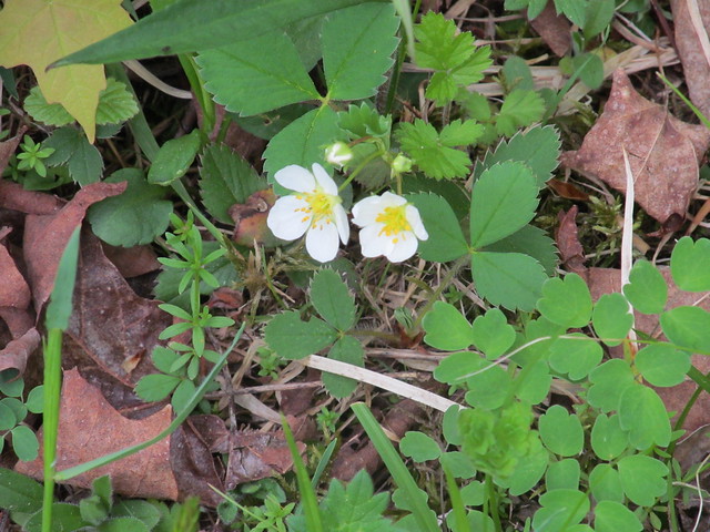
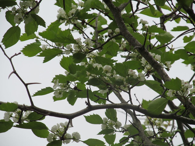
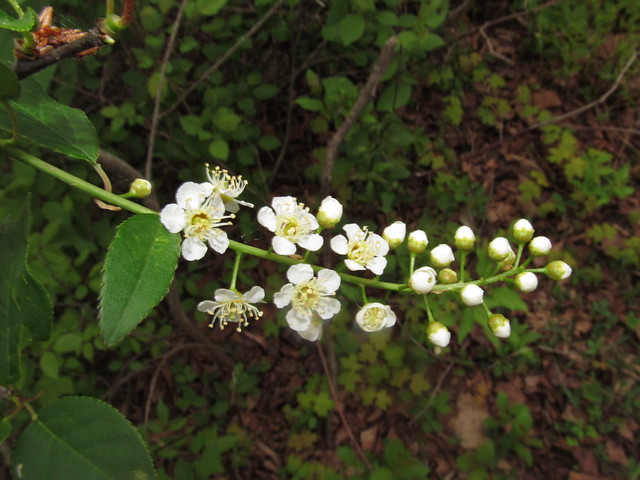
I also saw wild strawberry, violets, and apple and black cherry in bloom. It was a pretty day.
Geranium maculatum
Wild strawberry
Apple in an abandoned orchard
Black cherry in an abandoned
      orchard


Read more...

Saturday, February 14, 2015

2014-02-14 Book review: Lying on the Trail, by Just Bill

Tall Tales under Tall Trees

"Never let the facts get in the way of a good story," Sam Clemens is widely reported to have advised an aspiring author, "unless you can't think of anything better." In this volume, Just Bill takes Clemens's advice to heart. From the very moment that he introduces himself, he boisterously proclaims that he is a liar.

He then launches in on a series of stories - lies, if you will. They range far and wide: in his own words,

This isn't your typical ball of yarns concernin' life on the trail. No step by step story of a single walk taken. It's a haphazard collection of bright and shineys for your entertainment. Keep in mind that I may offend, disgust, or displease you from time to time and for certain; I'll lie to you.

A few common threads bind the tales. There are moments shared of a southbound thru-hike attempt on the Appalachian Trail from Maine to Georgia, aborted in Pennsylvania with a combination of injuries and Lyme Disease, of another aborted attempt to make a record time completing the Vermont Long Trail, of grand canoe outings in the Boundary Waters and of climbing Colorado Fourteeners.

Interspersed among them are extended meditations upon Nature and our relationship with Her, couched in the framework of Native American stories. In these, Just Bill attempts to create a mythos for our time, a spirituality for Twenty-First Century wanderers. Do not expect to find him telling the traditional tales of any nation. Coyote the Trickster appears often, sometimes as Just Bill's alter ego Coyote Thunder Owl. Nevertheless, Bill is not telling the traditional takes of Coyote; he is telling his own - either made up out of whole cloth, for Just Bill is a liar, or else whispered to him by Coyote himself, or heard in the breath of the Spirit That Moves in All Things.

There's the occasional tale shared at second hand - lore passed from hiker to hiker, with the tales growing in the telling. These tales are like their subjects - gifts given for the sake of the trail, and repaid by the trail with interest in surprising ways. Borrowing and repaying a spoon turns into a magnificent adventure in minimalist backpacking in the Hundred-Mile Wilderness of Maine. A gift of a few fuel tablets for an Esbit stove turns into a long chain of "trail magic" given and received. "It was something special," stammered out by a reminiscing hiker, is the inadequate but true sentiment as what goes around, comes around again and again.

Younger and more sensitive readers will not enjoy these tales: sexual innuendoes, scatological stories, and Rabelaisian accounts of overindulgences will be found here. Readers with a hiker's earthy sensibilities, nevertheless will find that like Paul Bunyan, Just Bill walks with his boots in the mud (or some other, more unpleasant substance) and his head in the clouds. From the lofty perspective he dispenses truths, in the guise of lies, to inform the side of his being that remains anchored to the dirty ground.

"Just Bill, are you really a liar?"

...

Finally, he turns to answer your question. With the last gasp of firelight dancing in his eyes, he gives you an answer.

"Sometimes."

"Just Bill" (Townsend, William M., III)
Lying on the Trail: a collection of lies told by a liar
Self-published, 2014
ISBN 13: 978-1503193871
ISBN 10: 1-503-19387-X


Read more...

Saturday, January 17, 2015

Harriman "Leave No Hiker Behind" trek

I headed out yesterday on the WhiteBlaze "No Hiker Left Behind" trek in Harriman State Park.

The trip started well, with me walking in with "Just Bill", an 'imaginary friend' that I was meeting for the first time in person. Fellow hikers "1azarus" and "Malto" hiked in to meet us. Malto slept in the shelter with me, while Just Bill and 1azarus hammocked nearby. We settled in companionably, spinning tales by the fire as hikers do.

This morning, I bailed out on the rest of the trip.

It wasn't because of the cold, although up on the ridge it fell to near 0°F (-18°C)  if not below. I was bundled up, warm and dry. I was close to the limit of what my gear can handle comfortably, but still within it.

It wasn't the fact that I awoke when Malto decamped in the night. I got right back to sleep after he left. He was back in the morning.

It wasn't the raccoon dragging my (empty) pack out of the shelter, although it's a bit starting to wake up in the wee hours to find a raccoon six inches from your nose dragging your pack away. He also got quite a head start on me, since I needed to work my way sleepily out of a completely-battened-down sleeping bag (How do these draft collar, hood, and zipper things work, anyway?) don spectacles and headlamp, and put on frozen boots before I could give chase. I found that he'd also stolen Just Bill's pot. In which he never does anything but boil water. Well, they do like shiny things.

It wasn't the subsequent awakening by some other campers coming by the shelter wondering what the hollering was about.

It wasn't the subsequent return of the raccoon looking for something else to steal. Everything was out of his reach.

It wasn't the commotion of the other campers as the 'coon decided he'd find easier pickings in their tent.

It wasn't even that all of these things combined to a night of much-interrupted sleep.

No, it was the early rumblings of a stomach bug that finally convinced me to call it quits. Combined with the fact that the little marauder had stolen my toilet paper. And the fact that my various medicines, along with a few other very important small items (spork!) had not made it into my pack.

I'm glad I came home to rest. Today would have been uncomfortable in the woods.

If by some chance I'm feeling much improved in the morning, I'll try to meet the remaining stalwarts in Doodletown.

Just Bill proposed a new trail name for me: Sleeps with Raccoons.

Every trip an adventure... 
Read more...

Sunday, January 11, 2015

Telling inside from outside using PostGIS and Mapnik

Nice labeling of administrative boundaries appears to have been a challenge for Mapnik users, and I've certainly not seen a good summary on the Web of how to render administrative boundaries attractively and legibly. In some recent experiments, I found what appears to be a scheme that others can leverage. Read on for the details.

I recently did an update to my work-in-progress of a hikers' map of the US Northeast, and decided to revisit how I handled the shading of the map. Another mapper had shown me a project of his, where the background of the map was rendered according to the National Land Cover Database - and it clearly provided useful information for a hiker, particularly those of us who occasionally venture off the marked trails.

Using landcover (overlaid with hill shading) as the base shading of the map left me with a problem: my previous map had used fill colours as a way to distinguish land ownership and regulatory status. In addition to answering the question of, "will hiking up this ridge have me pushing through the spruce?" I wanted to answer questions like, "is this area designated as Wilderness?" (Different camping regulations.) "Do I need a New York City Watershed permit to hike here?" and so on.

One way that I've seen printed maps handle the desire to overlay multiple types of area features is for them to outline an area and then use some special treatment (hachure, stipple, shading) along the inner side of the outline to indicate the information. Trying to use this sort of treatment with Mapnik raises the question: which side is the inner side? That's where I got to the last time that I thought about using this sort of treatment, and got no satisfactory answer. OSM's polygons do not appear to be wound in a consistent direction.

But this time, I stumbled upon a PostGIS function that I'd previously missed: ST_ForceRHR. This is a call that accepts a geometry (polygon or multipolygon), and imposes on it the Right Hand Rule. It returns the same geometry, with the borders listed so that along the direction of a line, the interior of the area is always on the right-hand side. (That is, it walks around polygons in a clockwise direction.)

The right-hand rule was exactly the missing piece that I needed. All that I needed for my wilderness areas, state parks, protected watersheds, and what not was to make a little semitransparent PNG with shading on one side, like this one.

Dashed line shaded on lower side
Dashed line, shaded on lower (inner) side

We make a style that uses a LinePatternSymbolizer to render the line that's shaded on one side:

  <!--Miscellaneous area features from OSM -->
  <Style name="osm-misc-area">
    <Rule>
      <MaxScaleDenominator>750000</MaxScaleDenominator>
      <Filter>
        [leisure] = 'playground' or
 [leisure] = 'golf_course' or
 [landuse] = 'recreation_ground' or
 [leisure] = 'recreation_ground' or
 [landuse] = 'village_green'
      </Filter>
      <LinePatternSymbolizer file="graphics/7e5-border.png"/>
    </Rule>
    <!-- many more rules for other types of landuse -->
  </Style>

And we feed it with an area query that uses ST_ForceRHR. As with most queries with subqueries, we need to use ST_Intersects to make sure that the geometry index gets used.

  <Layer name="recreation-lands-osm" srs="+proj=merc +a=6378137 +b=6378137 +lat_ts=0.0 +lon_0=0.0 +x_0=0.0 +y_0=0 +units=m +k=1.0 +no_defs">
    <StyleName>recreation-land-osm</StyleName>
    <Datasource>
      <Parameter name="type">postgis</Parameter>
      <Parameter name="dbname">gis</Parameter>
      <Parameter name="estimate_extent">
        false
      </Parameter>
      <Parameter name="extent">
        -8905831.039562456, 4865981.220634319, -7458419.471954359, 6274868.52598669
      </Parameter>
      <Parameter name="geometry_field">rhr</Parameter>
      <Parameter name="table">
        (SELECT ST_ForceRHR(way) AS rhr, name, way_area as shape_area
         FROM planet_osm_polygon
         WHERE ST_Intersects(ST_SetSRID(!bbox!, 3857), way)
         AND (leisure IN ('park', 'nature_reserve', 'common', 
                          'playground', 'garden', 'golf_course', 
                          'recreation_ground')
              OR landuse IN ('forest', 'vineyard', 'conservation', 
                             'recreation_ground', 'village_green', 
                             'allotments') 
              OR "natural" IN ('wood') 
              -- many more types of areas
             ) ) AS areas
      </Parameter>
    </Datasource>
  </Layer>

And the resulting rendering is just as I hoped: a thin dashed line with a green inner highlight on the natural areas.

Map, with natural areas showing a green inner border

Then it occurred to me: If we combine the right-hand rule with the list placement type on a TextSymbolizer, we can finally do proper labeling of administrative boundaries. Given the right-hand rule, we know that if a line is going left-to-right, the interior is below the line, and conversely, if it is going right-to-left, the interior is above the line. We can adjust dy accordingly to place a label on the correct side of the line.

  <!-- Attempt at edge labels on admin boundaries -->
  <Style name="admin-edge-label">
    <Rule>
      &minz8;
      <TextSymbolizer avoid-edges="true" clip="false"
   face-name="MartinGotURWTMed Italic"
   size="12"
   halo-radius="2"
   fill="black"
   halo-fill="transparent"
   dy="-8"
   placement-type="list"
   placement="line"
   spacing="500"
   max-char-angle-delta="30"
   upright="right_only">
 [name]
 <Placement upright="left_only"
     dy = "9">
   [name]
 </Placement>
      </TextSymbolizer>
    </Rule>
  </Style>

The layer specification is similar to the one for land use. The SQL query looks like:

        (SELECT ST_ForceRHR(way) AS rhr,
                name 
         FROM &db_osm_polygon_table;
         WHERE ST_Intersects(ST_SetSRID(!bbox!, 3857), way)
         AND "boundary"='administrative'
  AND admin_level IN ('2', '4', '6')) AS outlines

And again, it performs perfectly. Country, state and county names come out facing each other across the boundary lines.

Map, with labels on a state line

(I am oversimplifying here, but only slightly. I'm actually rendering these labels twice, according to the recommendations at http://mapnik.org/news/2012/04/20/smart-halos/. Rather than using the dst-over compositing operator, however, I'm rendering the image with fill color and the image with line art separately, and compositing them in Python.


Read more...

Tuesday, December 23, 2014

2014-12-21 Blackhead Mountain

On Sunday, 21 December 2014, I went with Jon (a fairly regular hiking partner) and his friend Chris (whom I've been out with once before) to Blackhead Mountain (3,960 feet/1,207 m) in the Catskills. With this being the first day of Winter by the calendar, this trip counts for a winter ascent toward the Catskill 3500 Club membership.

Note that all pictures this time (except for the map) are Jon's. I was acutely conscious of being tail-end Charlie with two faster hikers, and for the most part tried not to slow things down farther with photography.


Jon started the day wanting to do the three Blackhead Range peaks, so we spotted Chris's car over at the Barnum Road trailhead. We then proceeded to stuff the back of my Forester thoroughly with mountaineering gear for the short drive over to Big Hollow and the start of the hike. The equipment for three guys on a trip like this makes quite a formidable heap!


The Big Hollow trailhead doesn't get snow plowing in the winter, so we parked up on the county road. There was a long row of parked cars. The mountain was busy today. We must have encountered fifty other hikers - and it seemed as if one hiker in every party was getting in the last climb for the 3500 Club. We snowshoed up the last unplowed section to the trailhead.


The initial ascent up the Batavia Kill is gradual. The trail was pretty badly postholed. I still stuck to it for the most part, but there were a number of spots where Jon and Chris found it easier to break trail than to walk over all the lumps and bumps. Jon was afraid of bending a snowshoe by coming down flat-footed spanning two of the lumps, and at one point I lacerated my shin by falling forward when the whole front half of my snowshoe sank into a cluster of holes.


After the trail junction for the lean-to, the trail gets much steeper and starts climbing up to the ridge west of Blackhead over a series of switchbacks.


About at that point, the trees started to show a beautiful coating of rime.

There's a piped spring above the first switchback. It was running well. Its outlet grew ice crystals in fanciful shapes.


While Jon tanked up at the spring, I had to sit down and adjust my sock liners. That can get to be quite the project when you have to undo snowshoe bindings, gaiters, boots, oversocks and plastic bags to get to them!
Alas, the adjustments didn't keep me from discovering a blister when I got home. (Memo to self: Don't forget the rubber bands when using newspaper bags as a vapor barrier, because they will mess things up if they slide down and bunch!)
At least there's one picture I took!
The switchbacks get trickier, with some icy ledges to negotiate.


Chris waiting patiently for me to catch up

Chris is the fastest hiker of the three of us. We caught up as he was waiting in Lockwood Gap, wondering what was keeping us. Jon stopped in the col to switch to full crampons. I was finding that ascent showshoes were gripping the slope well, so just flipped the heel lifts up and kept plodding along with snowshoes and poles.

In nice weather there would be spectacular views of Black Dome and Thomas Cole Mountain from the exposed ridge as we go up. This, time, though, we were completely socked in, and the clouds allowed us no views on the entire trip. (We did enjoy looking at the sparkling rime on all the trees.)

Chris on the ridge

I love Chris's "you have got to be kidding" expression!

And we continue on up the ridge...


... with me bringing up the rear as usual.


Finally, we got over the last big step. At that point, the grade moderates to a pleasant walk through balsam forest. We all got snow and rime down the backs of our necks, as we had to push our way through branches that were hanging down into the trail from the weight of ice and snow.

Chris was exuberant about reaching the summit. It was his first winter climb in the Catskills.
Up there, the trail signs are wrapped in hardware cloth in hopes of deterring the porcupines from eating them. Legibility suffers a bit.

A passing hiker was kind enough to get a group shot of the three of us.

Chris readies an ice axe before starting his slide.
And then it was time to grab a quick bite to eat, turn around and start the trip down. Jon was all for continuing on over Black Dome and Thomas Cole (finishing up, perforce, by headlamp), but I decided that I wouldn't be safe doing so, and I was really uncomfortable about even hiking out solo. After some discussion, we decided to take the prudent, if disappointing, path, and hike out the way we came. To save time (and have some fun!) we did an ice axe glissade down the ridge, with Chris getting some instruction in self-arrest before we started. I was a little proud of myself when, despite being decades out of practice, I finished up at the bottom by rolling into a self-arrest rather than heel braking, and heard Jon say, "Like that, Chris!" Apparently I haven't forgotten it all.

The trip past the switchbacks was uneventful, but I was continuing to flag. Having had only about four hours of sleep the night before wasn't helping much!

It wasn't until we were on the nearly level stuff on the approach trail that I really became glad that I'd talked the guys into walking me out. I fell over with a horrible leg cramp - I couldn't put weight on that side at all - and had to spend ten minutes there writhing in the snow [1] and trying to stretch before I could even stand up. I'd probably have had quite a panic attack had I been alone.

Upon regaining my feet, I continued to trudge shakily to the car, making it just as the last rays of twilight were fading.


I drove Jon and Chris back to the other car, and we parted ways with Jon shaking my hand and saying, "Until next time!" I think his patience is admirable when he is willing to say that there will be a next time!

What went right?  Ascent snowshoes performed admirably, and I managed to get in a small amount of ice axe practice. A lot of winter technique that hadn't been exercised in years came back to me. And now the four winter peaks for the Catskill 3500 Club are behind me. I have just a handful of ascents to finish up.

What went wrong? I was ill-prepared physically for an ascent in full-on winter. I'm writing this at home, still hurting some from the lacerated shin, the heel blister, and the muscle soreness from all the unaccustomed muscle uses: lifting heavy snowshoes repeatedly, rolling ankles and working calves to engage all the points on crampons, self-belaying on a ski pole, and so on. Then again, I don't know of any good way to prepare for something like this other than doing it. I just don't get the opportunity often enough!

Besides, if you don't come back battered from some of your trips, you aren't having enough fun!

Thanks to Jon and Chris for being so very patient with an old man!


[1] ^ Dear spelling checker: Please do not auto-correct 'writhing' to 'writing'. Writing in the snow is something that I do only when my bladder is full.

Read more...