Sunday, April 27, 2014

Saturday walk, 2014-04-26, Huntersfield Mountain, Prattsville, NY

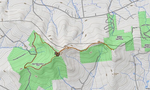
I took a walk on Saturday to Huntersfield Mountain, in Prattsville, NY, with a side trip to Ashland Pinnacle? Where in the world are these places? Google Maps offers directions to the trailhead. Once you're there, you can follow along with me on my own map, with my GPS track overlaid. As always, you can click through to embiggen.

Map of the hike

The trailhead is an old gravel pit at the pass where Huntersfield Road turns into Jim Cleveland Road. Note that within the state forest boundary, neither road receives maintenance from the highway department. They are impassable to vehicles in winter, and 4WD is recommended during bad weather at other times of the year. The trail climbs rapidly upward from the right-hand side of the pit. When I was there, I found the place quite a pigsty. Apparently, some irresponsible shooters had been firing at improvised targets. I found spray cans, Chinese food containers, ammunition boxes, beer cans and similar rubbish, all shot up. And I must have picked up two hundred spent 12-gauge shells.
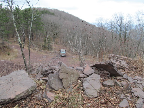
 Trailhead

Right above the pit are some old foundations, probably workings for the pit.
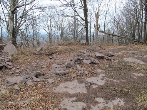
 Old foundations above the gravel pit

The trail continues up the mountain on a broad woods road. The trees surrounding are in bad shape. Many of them were split and blasted in the hurricanes of the last few years, and there is a lot of standing dead timber and deadfall.
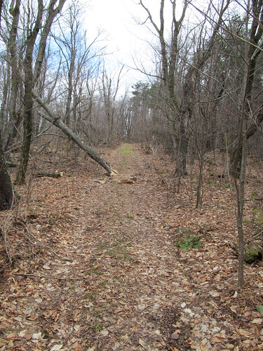
 Woods road

The dead trees are home to many polypore fungi. With the highly inflammable pith of these, and all the dead wood about, I wouldn't want for fuel for a fire if I needed one. Even in a pounding rainstorm, I'd be able to get one going readily.
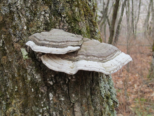
 Tinder fungus

The woods echo with the hammering of pileated woodpeckers. The dead wood makes ideal homes for the birds, and the termites are a major food source for them. Many trees have large excavations and corresponding large piles of sawdust at the base.
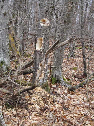
 Woodpeckers have been here

Near the summit, the trail joins with the loop trail serving the Huntersfield lean-to. The yellow markers for the loop appear.
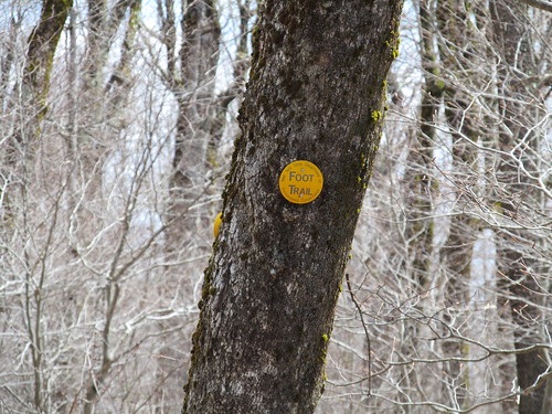
 Trail marker

At this elevation, the frost is still in the ground, and the water cannot percolate. The trail surface is punctuated with mudholes. I was glad I wore clunky leather boots and high gaiters!
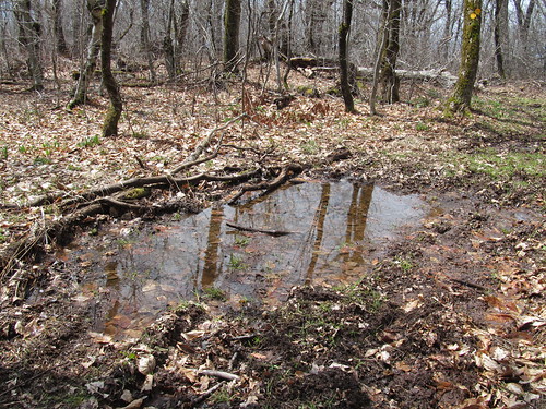
 Soggy trail

As the trail levels off on the flat summit, the lean-to appears. Uh-oh, it appears that someone's left the register box open.
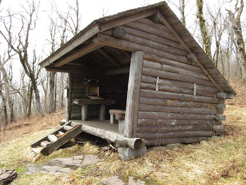
 Huntersfield Mountain Lean-To

The register has been gnawed a bit by rodents, but it's still legible. I note the name of one of my sometimes hiking partners, who's been up there two weeks earlier. At that point, he was still on snowshoes. It's amazing the difference that two weeks can make. I appear to have the forest to myself on this day of threatening weather. I sign in. Since I'm feeling good, I decide to explore the former route of the New York Long Path over to Ashland Pinnacle, and indicate my intention in the book. The Long Path no longer follows this route, because a disgruntled landowner has canceled a trail easement farther down, and now has several miles of roadwalk just to avoid his parcel. Hikers, please make doubly sure to follow Leave No Trace principles in the places where a trail crosses private land!
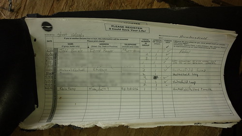
 Trail register

The trees have been cut away from the front of the lean-to, offering a view of the Catskill high peaks. I enjoy this lovely spot while I sit down to eat my lunch.
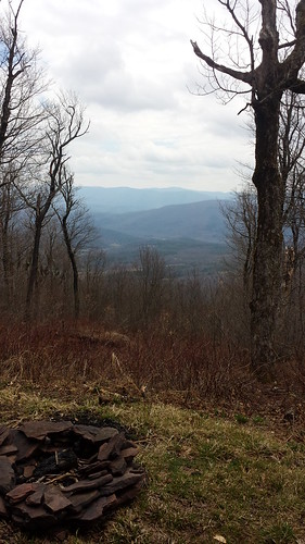
 View from Huntersfield lean-to

After lunch, I encounter the trail junction just east of the shelter, and set off on the old Long Path route. The trail is now blazed with red DEC markers as a spur trail, but the aqua blazes of the Long Path are still quite apparent.


Aqua blazes

I keep darting my eyes to the ground in hopes of spotting the Mourning Cloak and Grey Comma butterflies, which a friend has reported are already out. Alas, I don't see any butterflies all day. A flash of orange in the treadway turns out to be someone's dropped safety whistle. I pick it up, both in the interest of keeping the place clean and because the whistle, cleaned up, will probably be of use to someone.
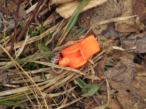
 Safety whistle

This section of trail is well blazed, but is so little traveled that it often feels like a bushwhack, particularly since I'm the only hiker up here. There is a considerable amount of blowdown - I brush out as best I can, but I have to leave a few heavy trees for the maintainers. And there's lots of light growth right in the treadway. In the summer, this section must be a hell of prickers and nettles. It's also quite muddy. In fact, I spot some Viola lanceolata growing right underfoot in the treadway. Since this species is an obligate wetland dweller, this particular spot of trail must be muddy year round! (There's probably a seep or spring just above.)
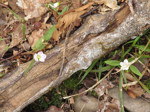
 Viola lanceolata

A mile or so down the trail, I spot a DEC marker disc, hung backward with the print facing the tree, and "VIEW" scratched on its back side. To the side, I spot an abandoned woods road that it seems to be indicating. Despite the fact that the road is all grown to prickers and beech saplings, it's not at all hard for an experienced eye to see the ruts leading off to the south. Never one to pass over a nice view, I head off down the road in search of the promised view. After maybe two hundred yards, I turn around. The road is clearly dropping in elevation into the valley of a creek, and it suddenly occurs to me that I'm straying off a trail easement on private land. Oops. I head back to the trail, having seen no view any better than what the trail offers. (A troll of Google and Bing satellite imagery suggests that there's none to be had.)

Farther along, there is a nice view, at least this early in the spring when the leaves are still off the trees. Looking out through the trees, I can see the Blackhead range, Ski Windham, and the Devil's Path.
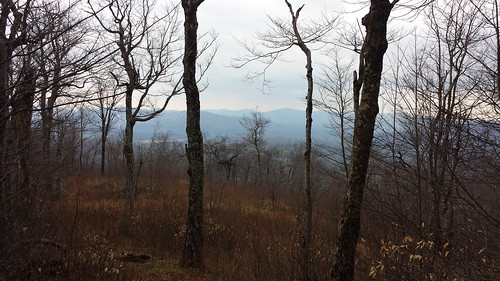
 From the former Long Path.

The last vestiges of the snow still cling to the ski runs.
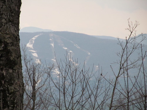

Ski runs

The trail crosses a patchwork of state, private, and New York City watershed land. I'm glad I've brought my New York City watershed access permit.

 he old Long Path goes just north of the Ashland Pinnacle summit, so I hope for a view from there as well. But the summit itself is on private land. There's a private trail that goes over there, but I respect the posters. The private trail is considerably better maintained than the public one. I suspect the landowner is an ATV rider or snowmobiler.
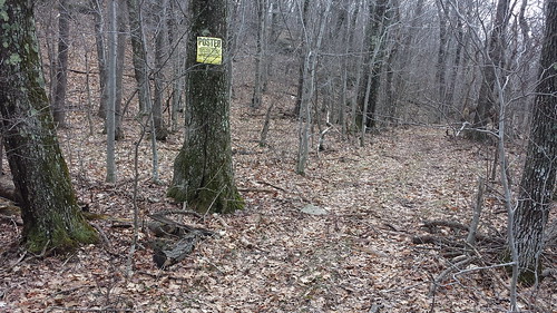
Private trail

Just then, a sudden cloudburst makes me adjust clothing. The temperature takes a rapid dip. (The ideal combination for the rest of the hike turns out to be rainsuit and underwear, with no midlayer.) I turn around and head back for Huntersfield, noticing some views of the Schoharie valley to the northwest that I hadn't seen on the trip out, largely because they were behind me. Between the rain and mist, and the trees in the foreground, they're not very photogenic, and I didn't get any usable shots to show you. But I was able to spot the Schoharie Reservoir gleaming in the distance, and the upper pond of the Mine Kill pumped storage facility.

At the top of Huntersfield, I turned right this time, and continued down the former Long Path down a slope of shale and scree, made squishy and slippery by the rain, which by now was starting to turn to sleet. The occasional fallen rock slab or overhanging ledge gave me a reminder that even though I was at the far northern end, this is still a Catskill trail.

At the bottom, the old Long Path route reaches one of the private land closures, and the trail, now carrying only the red DEC disks, continues its descent until it reaches another broad woods road, this one serving the plantations of the state reforestation area. (The whole mountain, once upon a time, was clearcut.) The road is broad and flat, but often underwater - this is mud season, after all. The rain falling on top, the reflected trees and clouds, and the vegetation and red sandstone make an interesting composition.
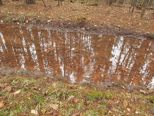
Wet woods road

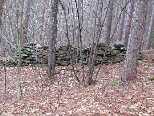
Along the road are many stone walls and foundations, evidence of former habitation.
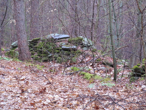

Old walls Old walls

The plantations that the road traverses have an unnatural (although not entirely unpleasant) feel to them. They consist of stands of trees, all the same species and age, growing in orderly rows. I notice at least pitch pines, white pines, red spruces, and hemlocks. A healthy understory is starting to grow up, and sooner or later Nature will restore some semblance of biodiversity, but recovery will take a very long time. In the defence of the foresters, at the time the trees were planted, the goal was rather to recover the economic value of the land by planting useful timber, and the homogeneous stands would make a subsequent harvest easier - another clearcut, years down the road. It was surely better than the previous generation's practice of merely leaving the land bare, with slash strewn everywhere, which led to horrific wildfires.
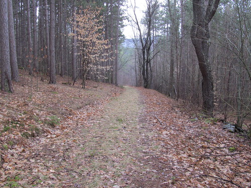
Old woods road

The woods road takes me down to the Huntersfield Brook, where I pick up the road I drove in on and walk up it the rest of the way to my car. It's a steep slog, as roadwalks go, about 400 feet of elevation gained over a half mile or so.

Getting back to the car, I grabbed my trash bag and brave the wind and sleet to pick up the trash, because I promised myself I'd leave the trailhead less of a mess than I found it. I called Mary Ann and apologized for the late departure - I'm going to be home about an hour and a half later than expected - and headed off down the hill. By the time I was down into Prattsville, the weather was rain showers and temperatures in the high 40's Fahrenheit - a major change from the mid-30's and sleet up above. Mountains make their own weather.

All in all, not a bad day. About an eight-and-a-half mile hike with 1900 feet of elevation gained and lost (about 1000 feet of elevation change between the summit of Huntersfield and the crossing of Huntersfield Brook). At my usual pace, I'd apply my personal Naismith Rule guidelines of 30 minutes to the mile, 40 minutes per 1000 feet of elevation, and arrive at roughly 4:15 for the distance and 2:40 for the climb and descent, for a total of 6:55. As it was, I did the loop in 6:05 with a twenty-minute break for lunch. I'm a slow hiker, but that's not too bad for having sat on my arse all winter, having shifted a fair amount of fallen brush out of the trail as I went, and getting slowed down a bit on wet shale.
Read more...

Sunday, March 30, 2014

Saturday walk, Holt preserve, Clarksville, NY 2014-03-29

I took a walk yesterday on Copeland Hill in Clarksville, NY.

I was mostly trying to relieve a bad case of cabin fever, but also brought along my smartphone, so that I could grab GPS tracks and put up the trail network on Open Street Map. This will eventually let me update my topographic map set for southeastern New York - but I only make a new set once every few months, because that's quite laborious.

This was probably the first weekend since winter began in earnest that the road into the upper trailhead was drivable. It is unmaintained in winter. With the spring thaw part way along, it's still a morass of ice and mud, passable only to a 4WD.


There was one dry parking space in the lot. Of course I grabbed it.


The trail register showed one other visitor on Saturday, plus one earlier in the week. The other visitor had apparently already come and gone. I saw no sign of him or his car. I had the place to myself all day.


The entrance offers the choice of an overlook or a pond.


I chose to visit the pond first, getting the panorama at the top of the post. A pretty place, isn't it? I walked around the pond, then followed the other red-blazed spur trail down to the blue trail from the entrance - so as to have the GPS log. The outlet of the pond was unfrozen, and babbling away merrily.


As I was turning around, I fumbled my notebook into the slush. Fortunately, it was back in its Ziploc, so no harm done. I picked it up again, and finished my walk around the pond. On the north side of the pond, the conservancy volunteers have placed a park bench for bird-watchers. It looks out across the pond, screened by the natural cover of a couple of spruces.


I stopped off there for a water break, and decided to enter the location of the bench as a GPS waypoint. I reached into my pocket for the smartphone. "Oh, my God, where's the phone?" Checked all the rest of my many pockets, to no avail. "It probably fell when I dropped the notebook." Walked back down there and had a look around. Nothing. Walked clear around the pond and the length of both the little spur trails, back to the entrance, with eyes on the ground. Nope. "Maybe I left it in the register box? I was there when I started the track recording." No such luck.

Facepalm!
Glumly, I headed back to my Explorer. If I was going to have to deal with bureaucrats over handset insurance, the walking was over for the day. I opened the tailgate, sat down, pulled off my Microspikes, opened my pack to put them away again, and... there's the phone. The phone doesn't go in my pack. I never put it in there. What the heck did I put it in there for?

Oh, well. I put the spikes back on, and headed back in, determined to try to enjoy the day now that that particular piece of idiocy was taken care of.

[Post hoc: I went and added the graphic after writing and saving this entire report. Something happened on my computer (it's got one of those buttonless touch-pads that always seem to act squirrely when I'm around), and the entire post got selected, and deleted, and 'undo' brought back only a single space character. So just as the 'facepalm' got put it, it brought about another one.]

Anyway, back to the walk. The preserve is an artificially reforested area, which has now grown to a mature but highly abnormal woodland. The trails traverse plantations, each of which has trees of a single species and a single age. While a healthy understory is starting to develop, the lack of diversity in canopy species is striking. I walked through stands of several species of pine (white pine, yellow pine, Scotch pine),

of spruce (at least red spruce and Norway spruce appeared),

of hemlock, and of tamarack.

The trail suffered somewhat from the 'monorail effect.' The tramp of snowshoes compacts the snow, and fresh snow blows into the trail. After several rounds of this, the trail is solid ice while the ground around it is soft snow. When the thaw comes, the snow melts faster than the ice, leaving a rail of ice where the trail is, and sometimes bare ground on either side.

(That ice is thicker than it looks: there's quite an accumulation of duff on top of it.) In spots, I could even see the prints of individual snowshoes, now sticking up in relief out of the ice.


I walked around the loops on the north side of the preserve. At the north end, they offer limited views to the north off the Helderberg escarpment. I would imagine that in summer, with the leaves on the trees, the views would be a disappointment, but in winter they're pretty.


After doing those loops, I returned to the entrance by the yellow trail. It is on a south-facing slope, and the snow is mostly gone from it. I was easily able to spot the stone walls and foundations of a long-abandoned farmstead.


The well of the farm is securely capped, so that it does not present a pitfall for the unwary visitor. Those who venture off trail in this part of the world need to be careful; there were several periods of boom and bust in local industries, and hence there is much abandoned settlement. Old wells, open mineshafts, and cellars of ruined buildings occasionally lie in wait.


Once I got back to the entrance, I walked down the road (impassable to motor vehicles, but a nice walk) to the lower entrance, and in on the white access trail, which I had missed when going by. There was a bridge out of place on the white trail, apparently by design, since it was secured to two trees with steel cables. It was fetched up on a gravel bar, with the main part of a stream flowing on one side and a small rivulet welling up from a seep on the other.


The stream, even bridgeless, was no major obstacle. It was easy to find a place so narrow that one long stride would clear it.


In fact, the road itself posed a much greater risk of wet feet. It was about six inches deep in ice, with water trickling over it, sometimes across the entire width.

Nevertheless, Microspikes were entirely up to the challenge, even on the 10-15% grade, and getting up was no more difficult than getting down.

I got back to the Ford just as it started to rain. I stopped to snag a few pictures of the more recently ruined farm right where the pavement ends.


The road out from the trailhead offered the best view of the day, a sweeping vista across the Hudson Valley with the mountains of Massachusetts and Vermont dimly visible through the rain and haze.


I drove home, took my wife out to a nice birthday dinner, and deferred writing about the trip until today.

All in all, a fun outing.

Read more...

Sunday, February 16, 2014

Plotterkill Falls, 2014-02-16

Kevin hadn't been hiking for about a month - the weather has been awful, and Kevin has been busy - so jumped at the chance to go snowshoeing on a sunny day and headed off to Schenectady's Plotterkill Preserve. The goal for the day was to catch a view of the lower Plotterkill Falls and Rynex Kill Falls, which are difficult to see in warmer weather. (The combination of the brush and the flow of the water makes them hard to get to.)

Kevin started out from the Coplon Road trailhead mid- to late-morning. He wore the tails on his snowshoes for the first time, because the 3-4-foot snowpack in the gorge was fairly powdery and unconsolidated, and he needed the flotation. The Coplon Road access trail and the south rim trail down to the stream were well broken out and he descended with very little trouble. The stream crossing was the easiest he's ever made it: cruising over all the water and scree on snowshoes is the way to do it!


stream crossing

(Kevin's luck is usually to find the crossing like the picture below, and have to detour some distance upstream or downstream to find a bridge)

Ford on the Plotter Kill

On the far side, Kevin notices a well-trodden snowshoe track heading off to the left! Great! He'll be able to follow someone else's track to the falls. (He's never been in there, and is glad not only for the guidance but also for the broken trail. Where the snow has slid off the avalanche scar, there's at least four feet of snow on top of the frozen stream. A broken trail is much easier to deal with!

The track is easy to follow. It crosses and recrosses the stream several times, and sometimes scrambles the bank fairly steeply, but Kevin's snowshoes are up to the task, and before long, he's catching his first sight of the lower falls.

First sight of the waterfalls

The distant picture fails to convey the scale; the falls are 60-70 feet high. When Kevin approaches closer they loom far overhead.

Lower Plotterkill Falls

Kevin notices that only one of the snowshoers who broke trail for him has come up to look at the lower Plotterkill Falls. The rest of them have turned right to the Rynex Kill Falls. When Kevin follows, he finds out why: they were a party of technical ice climbers, and the ice on the Rynex Kill Falls is pockmarked by their crampons and ice tools.

Rynex Kill Falls

After the obligatory pause for photography, adjustment of snowshoe bindings, and wiping of goggles, Kevin turns around and heads back downstream. He notices that one of the climbers has improvidently tried to come in bare-booted. While the crust on the snowshoe track holds him most of the time, he's left some spectacular postholes when he's broken through. Kevin probes one of them with a pole - it's thigh-deep on Kevin, and he's not exactly short.

Posthole

Before long, Kevin's back at the stream crossing below the avalanche scar, and turns up the trail to the north rim. Again, he is thankful that the ford is frozen over and he has a well-compacted track to follow.

Crossing by the avalanche

He pulls up his televators (wonderful invention, those!) and climbs up the north rim, following the climbers' track. During one of his stops to pant (that hill is steep), he pauses to look across the gorge at the old avalanche.

On the way to the top of the falls

As expected, most of the snowshoe tracks turn left at the north rim trail. (A few hardy souls have made the loop of the lower preserve.) Kevin follows, and is able to cruise along the north rim pretty well, except for the occasional spill and muttered profanity where he trips over a posthole and falls down. Barebooter, whoever you were, wear your snowshoes next time! Before long, Kevin comes to the stairway down to the Rynex Kill crossing. The stairway, three feet deep in snow, is kind of slippery, and Kevin executes an "inadvertent seated glissade" down to nearly the level of the stream. Nothing is hurt but his dignity, and with his snowshoes under him again, he strides out to where the climbers had their top-rope and have churned up the snow at the lip of the falls. The view he gets of the sidewall is another one that is impossible in warmer weather; he'd be standing in water on slick shale a few feet from a sixty-foot drop-off.

Top of Rynex Kill Falls

Beyond the Rynex Kill, the going gets tougher. The climbers have not gone that way, and indeed, nobody on snowshoes has since the last storm (which dumped about 14 inches of snow in the gorge). There are the tracks of two cross-country skiers, and that's about it. Kevin chooses the one that a herd of deer have decided to follow, on the basis that he can't mess it up for skiers any worse than the deer already have, and continues up the north rim. It's nearly as hard as breaking virgin snow, and Kevin's tracks are deep enough that he has to lift his snowshoes a long way at each step. He takes a number of spills from misjudging how high he has to step and catching a toe in the soft powder. Nevertheless, he manages to wallow on until the upper Plotterkill Falls comes in sight through the trees.

Approaching Upper Plotterkill Falls

Once again, the frozen stream lets him venture out for unusual viewpoints. He snowshoes across to the lip of the falls

Upper Plotterkill Falls

and is able to get a view down the gorge from the middle of the stream - another one that's impossible when the water is flowing.

Looking down the gorge

At this point, he turns around and retraces his steps to the car. On the way out, he notices a dead tree with an astonishing amount of woodpecker activity:

Woodpecker tree

and snaps one last picture of the bare rock where the avalanche swept everything into the stream.

Plotterkill avalanche

On the snowshoe out, he passes a group of three guys who have come in with downhill skis or snowboards and snow shovels, and have been busily constructing moguls on the pipeline cut. I guess that's one way to avoid paying for a lift ticket somewhere! It looks as if they've been having a great time. He returns to his car, soaking wet, tired, and grinning. All in all, a fun four hours or so.


Read more...

Tuesday, December 31, 2013

Panther Mountain (Ulster County, NY), 2013-12-29.

Kevin hadn't managed to get out hiking since late October (November is always an insanely busy time at work), and jumped at the chance when an Internet acquaintance named Jon (I give first names only) invited him for a day trip in the Catskills. After some negotiation, we chose Panther Mountain, coming in over Giant Ledge. Jon brought along two friends of his, Alex and Kevin. (Not me, I'm another Kevin!)

[UPDATED: I've included a few pictures from Jon's album of the hike. Thanks, Jon!] The hike wasn't very photogenic: the views were all whiteout. As Jon said at the summit, "I could have taken this picture in my backyard!" Read on for why Kevin didn't manage to get pictures...

Map of the hike

Because of the length of travel for Jon, Alex and Kevin (they were coming up from New Jersey), the group got started fairly late, about 10:30 in the morning. The weather forecast was, frankly, atrocious. It was expected to start raining heavily in the valleys at about 2 pm, and change over to snow sometime before evening. There was only one other car at the trailhead, a minivan; obviously, the weather has kept most climbers away. The four got going in good order across the two bridges that lead in from the road. That's Another Kevin in the orange beanie:


As it happened, the rain started before the team even made it from the hairpin turn on County Road 47 up to the ridge and the Giant Ledge trail junction. It turned the trail to a slippery mess of slush with a thin layer of sound ice underneath. Kevin began to bless the inventor of Microspikes.


The group stops to peel some insulation and don raingear as the sky starts to drip. As Kevin is putting on his pack cover, he has an "Oh my god!" moment. The little snap 'biner that had attached his camera case to his pack strap is still there, but the camera case is no longer on it. He decides (a) that he'd not likely find it among the jumbles of rock, and (b) if he were going to find it, he'd find it just as easily on the return trip. Not wanting to hold up the group any more than necessary, he simply decides to press on and begins rehearsing his apologies to Mary Ann for losing a second camera in less than a year.

On the group moved, as the rain continued to get harder and colder. The ascent to Giant Ledge was uneventful (with Kevin lagging far behind, as usual: he's slower than just about everyone). At one of several stops that Jon made to wait for Kevin to catch up, he noticed a creature that, uhm, didn't survive the last storm. I don't think I've ever seen a dead mouse hung in a tree like that before: an owl decorating for the holidays?

 https://lh3.googleusercontent.com/-F-_tD4rIhQY/UsGp--hqmUI/AAAAAAAAZWk/2I69Uc0F5zo/w705-h470-no/DSC_4979.JPG

All pause briefly to enjoy the view, which is somewhat obscured by sleet and fog.

After a few refreshments, everyone moves on, with Jon shouting, "Last one down to the col buys a round of beers!"

"I'm perfectly willing to buy a round, but not as a badge of shame!" Kevin answers, knowing perfectly well that he'll be the last one down.

On the way up to Panther, the four encounter the group from the minivan coming down. All smile and wave, but everyone is looking to keep moving. The wind is rising, the temps are dropping, and the rain has changed to sleet.

The hike again is uneventful, although the scrambles are quite icy. 


Microspikes and poles are entirely adequate to the job, and the four all make it readily to the summit of Panther Mountain for lunch. By now they've climbed into heavy wet snow, falling hard - probably an inch an hour. There is no view from the Panther overlook, which is shrouded in white-out. A quick squat and gobble, and everyone is more than ready to return to the cars! All pose for a "thumbs up at the summit" picture.


The hike down is uneventful, with very little lallygagging, over footing that has grown quite treacherous.


In fact, the three faster men don't even trouble to wait for Kevin at the overlooks or the trail junction - everyone is simply interested in getting off trail! Kevin does halloa and whistle for them at Giant Ledge, since he's walked the yellow-blazed trail on the west side of the narrow ridge in case there was a view. (No such luck. Still whiteout.) Kevin's pack feels much heavier than usual, without the weight of the camera in it.

Kevin goes slowly over the last quarter-mile, scanning the ground carefully for his camera case, to no avail. Disappointed, he trudges out to the car and greets the others (who did wait at the trailhead, in a nice warm car). As he's stowing his gear, he hears Jon, "Did you find your camera?"

"No, I looked, but I don't know if I'd even be able to spot it in all that broken rock."

"No, I mean, I saw it, and picked it up for you! It's in the register box."

"God bless you!" Kevin puts his microspikes back on, walks back to the box, opens it, retrieves the camera, and comes back with a much lighter heart. (And a much lighter pack - he discovers that his pack cover has accumulated about an inch of ice on it. No wonder it felt heavy!)

"Thanks again! Now, do you want me to buy that round I owe you?"

One of the younger men begs off: it turns out that he's brought nothing dry to change into (oops!) and just wants to get home. Kevin finishes putting stuff away and drives off into what is clearly shaping up to be an epic ice storm.

Some four hours later (the trip would ordinarily take just over two), Kevin pulls in at home, with one of the four winter 3500's in the bag. He's soaked to the skin, but stayed warm all day and is satisfied at a challenge met.

What went right: Peak bagged. That's three of the four winter peaks out of the way.

Kevin made good time (for him): up and down in  under 5 hours. He ordinarily would have budgeted six: 30 minutes per mile and 40 minutes per 1000 feet of elevation change (there is about 2000 feet of climb on this hike, since the hiker descends into the col between Giant Ledge and Panther, and climbs out of it again).

The system of layering in the boots worked like a charm. Polyester sock liners, doubled newspaper bags, merino wool hiking socks, well-sealed leather boots, gaiters. The sock liners came out wringing wet from condensation, but the wool socks stayed bone dry and Kevin's feet stayed warm. Vapor barriers are a good thing.

Trusty microspikes came through again. By the time that Kevin was out to the cars, there was an inch or so of ice on everything, but Kevin remained surefooted.

What went wrong: The camera went astray again. It's recovered, but obviously a snap 'biner isn't enough to attach it to the pack.

Everything on Kevin's body got soaked. While he had dry stuff in his pack, and wasn't cold at any time, he could have been in serious trouble on a multiday trip. On the other hand, in heavy sleet and freezing rain, it's not clear it's possible to stay dry. The Frogg Toggs rainsuit holds enough moisture in that Kevin's baselayer got soaked from condensation, but he wasn't wearing a midlayer at that point, and he'd surely have been just as wet without the rainsuit! If this sort of weather blew in on a multiday trip, and bailout was not an option, it would simply come down to "hike in wet stuff, sleep in dry stuff."

Lessons learnt: In retrospect, it was a bit foolhardy to start off the trip with the forecast as bad as it was - heavy sleet and freezing rain is classic hypothermia weather. But there was something of a challenge met, and on an extended trip, you don't get to pick your weather.

Jon's a good guy. Thanks again for retriving the camera! Note to self: Put the thing on a locking 'biner!

Next time, try wearing a windshirt under the midlayer as a vapor barrier. A wet synthetic baselayer is nearly as warm as a dry one, and keeping condensation out of the fleece would be a good thing.

Postscript: Kevin went to EMS on Monday to buy a screw-gate carabiner, and mentioned to the guy behind the counter that he needed it to better attach his camera to his pack. He bitched a little about the weather, and found that guy-behind-the-counter was in the party that was coming down Panther as Jon's group was heading up! Small world.

Read more...

Tuesday, October 22, 2013

Burroughs Range, 2013-10-12/13

Kevin got the wanderlust again by Columbus Day weekend, 2013, after a rather stressful time: daughter had had a car accident (with pending insurance claims still unsettled), and it's proposal-and-budget season again at work. (Why does this always seem to come as such a surprise to management?) Anyway, Kevin felt the need to get away for a while and recharge, and planned a three-day, two-night circuit of the Burroughs Range, with a side trip to tag Table Mountain and possibly Peekamoose. The trip wound up being cut short - for fun reasons for once. But Kevin successfully bagged three more Catskill high peaks.

What with one thing and another, Kevin didn't manage the "zero-dark-thirty" start time he'd hoped for. He also had some uncertainty about campsites, because a friend had warned him that the sites he'd planned in the event of a late start were closed. So when traffic on the way down to the southern Catskills proved slow-moving (there was some sort of foot race taking place on Route 30), he decided to adjust starting point and began at the Giant Ledge trailhead on County Road 47, rather than at the Woodland Valley campground. He didn't actually get on the trail until nearly noon.

The trailhead sports a lovely new bridge, replaced in the repairs after Hurricane Irene. The nearly-washed-out signpost was not replaced in the same repairs, and leans at a crazy angle.
The bridge at the Giant Ledge trailhead

All the blowdown in the storm has been a bonanza for the decomposers. Kevin spotted an enormous colony of puffballs growing on one downed tree.
 Puffballs

The autumn leaves were in full colour as Kevin started up the moderately steep trail. This year's display is, alas, something of a disappointment. A dry August has meant that the leaves started to brown off before they fully turned colour. Nevertheless, what colour there is, is lovely.
The trail starting out

For whatever reason, Kevin wasn't in top hiking form. He was aware of this, and decided to forgo the views on Giant Ledge - which, after all, he's seen before and intends to see again - and just press on. It took him several hours to make it to the campground in Woodland Valley, first up onto the ridge, then down into a ravine, and then up again on a long series of rock steps that the hikers sometimes call the Stairway to Heaven.

Kevin was treated to a typical bear sighting on the way: the hind end of a bear sow, disappearing at the gallop into the brush. No time to grab a camera before she was gone. (It's just as well. Seeing more of a bear is likely to be a problem.)

Down at the campground, Kevin astonished some of the tourists. "Do you know where Campsite #50 is?" "No, sorry, I'm just hiking through." "You're not staying here?" "No, I'm tenting up in the woods somewhere." "You spend the night in the woods?" "Well, yeah."

In any case, the campground provided Kevin an opportunity - which every backpacker knows is not to be missed - to use the porcelain privy. His load considerably lightened, he began the ascent of the Burroughs Range Trail.
Still moving slowly, in the late afternoon, he came to the last spring before the trail junction to Terrace Mountain. This is the last reliable water before crossing the Wittenberg and Cornell Mountain. He rapidly consumed his last litre of water, so as to have as much room as possible to take on fresh water, and refilled water bottle and bag, treating the water because the spring is running a mere trickle, looks dodgy, and tastes tannic.

Just about this time, Kevin's phone bleated about a low battery? (What? It's been in airplane mode all day, and the screen has been lit only a few times. True, the GPS has been running, but it'll usually last a couple of days that way!) It was noticeably warm to the touch. Kevin speculated that some application has gone into an infinite loop and shut the phone down. (Note to self: Reboot the phone at the trailhead!) The GPS track beyond the spring is lost. Kevin then continued up the trail, and discovered he was hiking much faster - perhaps he was running a bit dehydrated, despite remembering all day to drink?

In any case, it was too late in the day to contemplate climbing the Wittenberg, and Kevin turned left for the Terrace Mountain shelter. He crossed the overlook uneventfully, and got within a few hundred yards of the lean-to, but heard the noise of quite a large group of hikers there. Recognizing that there would be no space in the lean-to, and having seen an attractive stand of hemlocks a short distance back, he made an abrupt U turn, headed back into the hemlocks, swung off trail a couple of hundred feet on what appeared to be a faint herd path, and arrived at a rock outcropping covered with dead moss. The outcropping has a convenient rock to serve as a kitchen table.
Kevin's kitchen

There's a nice flat spot under hemlocks not to far away to serve as the bedroom in Kevin's home-away-from-home.
Kevin's bedroom

And a well-positioned tree branch served for the pantry. Kevin managed to get his line over it on only the second cast.
Kevin's pantry

He started his dinner - Italian trail glop (couscous, cubes of abruzzese sausage, shredded string cheese, and a tomato sauce compounded from dehydrated vegetables, tomato powder, herbs and spices) steeping in the freezer bag cozy. Oh good Heavens, he's forgotten to pack the olive oil! Just as well: the sausage is entirely greasy enough!

While dinner was steeping, Kevin pitched his tent, inflated his crash pad, unrolled his sleeping bag, arranged the rest of his duffel, and it was time to eat. The Italian glop (based on a recipe at trailcooking.com, but considerably modified) was pronounced a winner - suitable for being in the rotation on subsequent trips. It's tasty.

After washing up the kitchen, evening ablutions, and the hanging of the bearbag, it was time to crawl into the sleeping bag, review the map for the morrow, and plug the phone into the Minty Boost. Oh, [Nixonian expletive deleted]! The Minty Boost batteries are dead, too! (Note to self: Do not store the Minty Boost with batteries in place!). Kevin has packed a couple of pairs of spare lithium batteries in the camera case, and a battery swap soon had the phone charging. (It can get about a 50% charge off one pair of lithium AA's.) Kevin felt an overwhelming urge to close his eyes, and has soon drifted off peacefully as the fall of hemlock needles made a quiet patter on the tent.

About five in the morning, Kevin needed to make a brief predawn trip outside the tent. Returning to the sleeping bag for a moment to take the chill off, he decided to pack up by headlamp and get an early start on hiking. He pulled the sleeping bag around his head to warm his ears, rolled over, and found the sun shining brightly and his watch saying that it was a quarter to eight. He's slept nearly twelve hours! (Must have needed it: it had indeed been a stressful week.)

Kevin retrieved the bear bag, made coffee, packed up, and headed off in jig time - rolling in less than a half hour and eating breakfast on the move.

The Terrace Mountain overlook is a trifle overgrown, but with the leaves mostly off the trees, it offers some nice views. Kevin realized that the weather today might be iffy, with the peaks shrouded by a thin cloud layer.
Thin layer of clouds

An obstructed glance at the Wittenberg showed him how far he had yet to climb.
Looking up to Wittenberg

Beyond the trail junction, the ascent of the Wittenberg grows somewhat arduous, with many rock scrambles to negotiate. Nevertheless, Kevin made decent time, and by midmorning, he was taking in a spectacular view from the summit, above all the thin clouds he noticed on the way up. As Burroughs wrote,
The solitude of mountain-tops is peculiarly impressive, and it is certainly easier to believe the Deity appeared in a burning bush there than in the valley below. When the clouds of heaven, too, come down and envelop the top of the mountain,—how such a circumstance must have impressed the old God-fearing Hebrews! Moses knew well how to surround the law with the pomp and circumstance that would inspire the deepest awe and reverence. 
Wittenberg in the morning
Click through to get larger views!


Kevin met only a handful of other hikers on this peak, and after only a few moments of photography and socializing, set off on the Bruin's Causeway for Cornell Mountain. This ridge is an interesting formation. It is nowhere more than about fifty feet wide, with sheer cliffs dropping from both sides. It is a highway for wildlife, including the eponymous bears, who have left unmistakable evidence of their presence.
Bear scat

The west face of Wittenberg has presented more rock scrambling, but nothing nearly as challenging as the east face of Cornell, infamous for the Cornell Crack, a precipitous climb up a narrow chimney. Kevin once again found himself too preoccupied with climbing to have attention to spare for photography, but later found another climber's trip report with a spectacular photograph of the scene.

(Source: Backpacking Light

It's late enough in the season that unexpected ice is a possibility, and so the trail maintainers have fixed a piece of static line in the crack. Kevin gratefully made use of the rope, and the combination of the rope and the grippy nature of the rock made climbing to the top almost anticlimactic.

At the top, Kevin met a friendly but terrified 110-pound (50 kg) Alsatian named Zeus, whose family faced a problem. Zeus had somehow managed to ascend Cornell Mountain (and traverse Slide), but, having seen the Crack, he was now balking at every route of descent that Cornell offers. Two family members have been attempting to find a bushwhack route around the Crack (with limited success), and were now hiking back to their base camp to at least fetch their supplies and the dog food. Zeus had no climbing harness. Alas, Kevin had no bright ideas to offer (and no idea what the counterpart of a Swiss seat might be for a dog), so regretfully wished the family luck, and continued up. The Crack is only a few feet of elevation below the summit, which lies perhaps a hundred feet (30 m) off the Burroughs Range trail on a side trail. The summit overlook is nearly completely overgrown, but offers an obstructed view of the Ashokan reservoir through the clouds below.
View east from Cornell

A rock outcropping a few steps further along offers much better views to the north and west, including the eastern half of the Devil's Path,
Devil's Path from Cornell
and Slide Mountain - Kevin's next destination - with the scar of its eponymous avalanche still making a diagonal slash downward and to the right of the summit a century and a half after the rockslide.
View west to Slide Mountain from Cornell

Coming off this outcrop, the trail drops again over steep scrambles. The abrasion of the conglomerate rock air-conditioned the seat of Kevin's pants. Kevin was saved embarrassment only by being unaware that he was now displaying his black compression shorts to everyone standing behind him. (This accident surely means that he did not present the best of impressions to the people that he was about to encounter!)

Once in the col, the trail becomes a pleasant level walk through balsam forest, with some of the mixed-deciduous woods still making an occasional incursion. Just as spring is the time for wildflowers, autumn is the time for mushrooms, and Kevin noticed some odd white-rimmed bracket fungi clinging to a tree.
Tree fungi

The surface of the trail appears almost to be the work of man, since it is composed of white quartz pebbles that have eroded out of the "pudding stone" on the higher slopes and rolled down into the col. This section, called the Garden Path, is not quite like anything Kevin has hiked before.

The DEC has marked three camping areas in the col. Kevin's friend was wrong: camping is indeed permitted up here! Kevin notes the fact for future reference.
Campsite disc

At the west end of the ridge, the trail again becomes steep, with a difficult 700-foot ascent to the summit of Slide Mountain. Again, Kevin was too focused on climbing to pay attention to photography, but once again, someone else's trip report offers a photo that says it all:

Source: Zee Lemons: "To the Crack and back"


While Kevin stood at the base of this scramble, a family appeared at the top, including - of all things - a beagle! The dog's master sat on the upper ledge, put a climbing harness on the dog (all the dogs Kevin met that day had them, with the sole exception of the Alsatian), and began reaching in his pack for a line. The beagle looked at the man with a look as if to say, "why are you bothering with that?" He jumped down to the ledge that the lady in the picture is standing on, scampered across it, and scrabbled down the slab and the boulder scramble below, faster than the man could even call the dog's name. Kevin praised what a brave little dog he was, the creature favoured him with one wag of the tail, and immediately trotted down the trail to greet the next party coming up. More hiking skill in such a small package is, Kevin believes, not to be found in all of dogdom.

Shortly above this hair-raising scramble, Kevin encountered the Slide Mountain spring. This is a reliable source of sweet water at about the 3900-foot level, quite an unusual thing to find at that elevation in the Catskills. Since there had been no usable water source since the previous evening (Kevin failed to find the spring that supposedly exists along the Garden Path), Kevin was quite grateful to discover this source, finished his last cupful of water, and tanked up again.

Above the spring, Kevin encountered a gentleman and a lady hiking together, discussing the works of John Burroughs. They're hiking at about the same speed, and the three proceeded up the four long stairways and the remaining short scrambles to the mountain's summit. There the woman pointed out the errors in the Burroughs quote on the memorial tablet, and the three sat down to a late lunch. (Kevin had nibbled a few snacks on the trail, but had been sort of trying to hurry up to this point and hadn't stopped for a meal.)

The lady proceeded to pull out of her backpack an old volume of Burroughs, and commenced a reading of The Heart of the Southern Catskills. Kevin found himself drawn into a literary circle atop Slide Mountain - the subject of that essay - and learnt that the pair had been reƫnacting the hike that Burroughs describes in it! At the conclusion of the reading, they went on discussing the essay and their experience with the bushwhack ascent up the northern rampart of the mountain. They brought out a split of Champagne, poured out thimblesful, and invited the other hikers present to share in a toast to their patron author and their successful reƫnactment.

It turns out that the lady is named Joan Burroughs, and she is the great-granddaughter of the author and naturalist. Her companion is the experienced Catskill guide, Paul Misko, who is well qualified to accompany her on this adventure, having written most recently on his personal Catskill bushwhacking exploits in the Catskill Mountain Guide. Ms. Burroughs is the treasurer of the John Burroughs Association, which maintains Slabsides, the author's cabin, and its surrounding nature preserve, and sponsors annual awards for natural history writing. Kevin promised to repay her graciousness with a visit someday to Slabsides, and perhaps take out an Association membership.

By now, it had grown late enough in the day that Kevin's original plan to hike at least as far as a campsite on the East Branch of the Neversink River would mean hiking (and hanging a bearbag!) by headlamp. Since going even that far would leave him with a long hike on Monday to score additional peaks and still get back to his car, Kevin decides to hike on out to the Slide Mountain trailhead.

There are no regrets at this decision. The mountains will be there another day: they belong to the ages: their rock has rested in its place since the Devonian Sea laid it down, and their contours were excavated by the Ice Age. But the Burroughs reading was ephemeral: never again would that particular chance come along. If Kevin's purpose in hiking be to live in the moment, then a moment that presents itself must be seized!

On the way to the trailhead, Kevin shared a wistful story with the pair: he has noticed that Misko wears a patch from the 1973 Boy Scout jamboree at Valley Forge. The very first time that Kevin had ascended a 4000-foot peak, just over 40 years ago, was in the company of a man who had also attended that jamboree. Alas, their friendship was not to last long: within a couple of months after that climb, Kevin's friend lost his life in a plane crash: the plane that lies wrecked near the summit of Equinox Mountain in Vermont is his. Kevin confided that as the couple toasted Burroughs, he offered a silent toast to his late friend of four decades ago. Rest in peace, Charlie!

At the trailhead, Ms. Burroughs graciously offered Kevin a lift back to his car, sparing him a few miles of roadwalking by headlamp. Kevin gratefully accepted, and a few minutes later, bade the couple adieu, loaded his pack into his own car, and headed home.

What went right: A totally unexpected prowl through living American literature. Three successful ascents of Catskill high peaks, all involving tough Class 4 rock scrambles. Kevin's new tent used in earnest for the first time performs splendidly.

What went wrong: Too many dead batteries! Kevin must remember to reboot the smartphone before setting out (killing off background applications that might start running away), and remember not to store the Minty Boost with batteries in place, lest its USB connector encounter a short circuit.

Water was uncomfortably low by the time Kevin reached the spring on Slide Mountain: he'd have been in bad shape if it had run dry - not impossible after the late-summer drought! Carrying a fourth litre of water when approaching a high Catskill ridge from a dry camp would not be a bad idea.

Lessons learnt: The good that lies in human nature still shines brighter on the trail than in town. At each difficult scramble, successive parties overtook one another. All took turns spotting for one another, hauling one another's packs, and in general being helpful and pleasant. Not a trace of the nastiness that perennially infects our cities appeared on the mountains.

And most important: be always open to a serendipitous encounter. A plan is only a plan: sometimes a departure from the script proves to be a jewel.


Read more...