Showing posts with label mountain. Show all posts

Tuesday, September 8, 2020

2020-09-06 Eagle and Big Indian mountains

On Sunday, September 6, Cathy and I decided to go hiking again - this time to Eagle and Big Indian Mountains in the Catskills.

She was particularly eager to do Eagle because for her it was the one that got away and we decided that if all went well, we might be up to a second peak. Big Indian is one mountain over, and you've done 2/3 of the work of climbing it once you're on the approach trail!

We agreed to meet at 8am, Musician Standard Time (There isn't a musician who's ever on time for an early morning appointment), got rolling in good order and were on trail about 10:15.

We headed for the trailhead at Seager, a settlement named for George Seager, a settler who homesteaded there in 1800. The access road, Dry Brook Road, winds up a picturesque gorge and passes three covered bridges on the way in.

There were only two other cars at the trailhead, bearing decals like "Winter 35'er" and "Long Path End-to-End," so we knew we were in the company of some pretty awesome hikers. We exchanged pleasantries and started up the couple of miles of trail that cross Furlow, one of the estates of Gilded Age robber baron Jay Gould, which still belongs to his descendants. The descendants have graciously given hikers permission to access the trail (as well as one or two other blazed trails that cross their land elsewhere). The rest of the large estate is to be considered strictly off limits.

One of the easier stream crossings

The trail, an old carriage road, runs along the bank of Dry Brook, with numerous fords of tributaries and traverses of washouts, some of which have pretty sketchy footing. Bank of Dry Brook It's a pretty easy stretch of trail otherwise. It passes a lovely pool with a waterfall, which would have tempted us to swim were it not for the fact that it was a fairly chilly morning and there were obvious signs forbidding trespassing. (Always respect the landowner!)
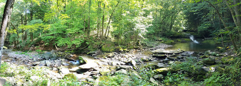
Waterfalls on Dry Brook

Incidentally, Dry Brook is anything but dry! The origin of its name is unclear. One speculation is that it was named "Drie Broek" by the Dutch because it is the third large stream above the Forks of the Delaware. That sounds a but odd to me: "Derde Kill," or "Derde Beek," would seem more likely as a name. But I've not heard a more likely explanation!

Stream crossing

In any case, the trail comes to a place where it joins a private road. It follows the road across the very wet Dry Brook at a ford. Even in high summer, an SUV must drive through flowing water there. I'm sure it's completely impassable in snowmelt! Again, the footing was a bit sketchy, but we managed to cross dryshod.

It was there that we ran into our second party of the day. They obviously belonged to a different subculture from ours.

“Are you guys heading to Camp 13?”(Never heard of it...)

“No, we're looking for where the trail up to Big Indian leaves the road. We want to make sure we don't miss it.”

“You need to ask that tall guy in the red cap. He's a real hiker and knows all the trails.”

Red-capped gentleman: “Oh, you mean up to the ridge? That trail goes straight up, you know!”

“We'd heard there were a few spots of scrambles.”

“So, are you guys backpacking?”

“No, just here for the day.”

“Daytripping? All the way up there?” He shook his head. “Good luck!”

We decided not to tell him that we were planning to attack two mountains. We pretty quickly spotted the trail sign - the turnoff is not nearly as obscure as others' trip reports had led us to believe, and continued down a wet trail, now following Shandaken Brook, fording it back and forth a few times. to the beginning of the state-owned wilderness and a lean-to.

Shandaken Creek lean-to

Up to this point (about 2.5 miles [4 km] in), there's been only about 400 feet (120 m) of elevation gain. The trail now begins to climb in earnest, gaining about 900 feet (275 m) more in the next mile (1.6 km) taking a steep path full of loose rock with blackberries on one side and nettles on the other. We managed to avoid taking any bad scratches or stings, although Cathy did take a bit of a tumble off a rock that was both loose and slick with algae. She bounced right back up, with the only damage being a slightly wrenched thumb from a trekking pole strap. She's a trouper!

Once we made it to the col, and started along the ridge for Eagle Mountain. The trail was level a lot of the time, interspersed with scrambles up steep ledges. (Everywhere in the Catskills, there's a scramble at about 3400 feet (anout 1 km) elevation, where a layer of soft mudstone is overlaid by a layer of much harder conglomerate rock.)

One of the scrambles on Eagle Mountain One of the scrambles on Eagle Mountain

We negotiated the scrambles, Cathy with more grace than Kevin, found the turnoff, and arrived at the summit, where I was surprised to find a canister. I learnt from other hikers that it was only a year old. We signed in, and had a chat with another party— relative newcomers to the Catskills—who were backpacking the Pine Hill-West Branch trail over Big Indian, Eagle, Haynes, Balsam and Belle Ayre mountains.
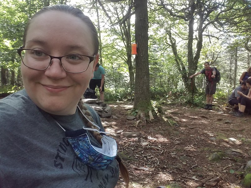
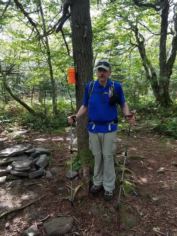
Cathy's summit selfie Cathy grabs a picture of Kevin

I don't know the origin of the “Eagle Mountain”” name, but once upon a time, the Catskills were known for having the birds. Herman Melville wrote [Moby-Dick, chapter 96]:

[...]there is a Catskill eagle in some souls that can alike dive down into the blackest gorges, and soar out of them again and become invisible in the sunny spaces. And even if he for ever flies within the gorge, that gorge is in the mountains; so that even in his lowest swoop the mountain eagle is still higher than other birds upon the plain, even though they soar.

I'll think of that as the reason for the name; it might be an uplifting enough thought to keep me climbing!

While we were eating our own lunch, we were visited by a couple: an old mountain-man and his mountain-woman. We learnt that she's completed the Catskill Grid: climbing each of the 35 high peaks in every month of the year, for a total of 420 ascents. (Not an achievement that would appeal to me: I like to see new places!) We wished them well, they wished us luck in finishing the 35, and we headed back for the col.

At the trail junction, we had a strategy conference. It was mid-afternoon by now, and we had to decide: do we head down, or do we press on for Big Indian Mountain? We decided that if we still had enough natural light to take the ford by the private road, we could hike the remaining couple of miles by headlamp if necessary, and decided to go for it. (We are not immune to get-there-itis.)

The way up along the ridge to Big Indian was a little longer and steeper than the one to Eagle, There was more loose rock, more scrambling, and a few tilting slabs of rock where Cathy was pleasantly surprised that the soles of her new shoes gripped (so no need to find better holds). The slabs are obviously a problem in winter—they were covered with scratches from climbers' crampons trying to gain purchase.

Along the way, Cathy asked me about the “Big Indian” name. I was able to tell her that Big Indian Mountain, Big Indian Hollow, and the village called Big Indian were all named for an extremely tall native, the subject of a local legend that I couldn't recall. I looked it up after we got home. The legend appears to be one of the ones invented out of whole cloth by 19th-century developers to sell land in their villages.

Winnisook, so the story goes [Charles M. Skinner, Myths & Legends of Our Own Land. Philadelphia, Penna.: J.B. Lippincott, 1896, pp. 28-29], was a seven-foot-tall Algonquin, who fell in love with a Huguenot girl from the hollow, named Gertrude Molyneux. He asked for her hand, but her father refused, and insisted she marry a white man, She conceded, and was married to one Joseph Bundy, who proved to be an abusive drunk. Believing that she would be happier among the natives, she eloped with Winnisook. Her family's search for her was in vain, unto one day Winnisook was sighted leading a cattle-raiding party. The villagers gave pursuit, with Bundy leading the chase. Bundy, crying that Winnisook had stolen not only his cattle but also his wife, fired his rifle. The mortally wounded Winnisook crawled into the hollow of a pine tree, where the farmers lost sight of him. Gertrude later found him there, sitting bolt upright, but dead. The villagers were fond of pointing out the tree, until the construction of a railroad in the valley removed it. (The railroad itself did not survive for very many years.)

Since Skinner's book, the story has grown in the telling. Mary Lou Stapleton, once a shopkeeper in the valley, added the detail that nobody had been able to extract Winnisook's body from the tree, and it had grown about him. As she tells the story: ['TravelStorys': “Catskill Mountain Scenic Byway - Legend of Winnisook”, available on SoundCloud], when the railroad men felled the tree, the skeleton of the Big Indian fell out, and they said, "well, we have the name of our town now. It's called Big Indian."

She went on to say,

I used to do events at my store. I would do a little event called, “Celebration of the Big Indian.” I would have vendors and I would have drumming. It was the last time that we did it and it was a lot of people there. I came home and I was just exhausted. And at three o’clock in the morning I woke up and it was like someone was calling me. I went back down to the store and I circle there, and I actually saw a vision. I saw all very, very old indians dancing in a circle. And they were calling me. So I went in the circle and I danced for two hours, until 5 in the morning, and I was with all these native people. And I came back home and I went to bed. A few months after that, I was given my name, and it was “Spirit Dancer.” That was pretty amazing… That was pretty amazing.

Winnisook Lake, and the exclusive Winnisook Club, at the head of the valley, are also named for the Big Indian.

Whatever the truth of the legends, Cathy and I pressed on, she unaware of them, and I having forgotten them. When the trail leveled out near the summit, we started searching for how best to get to the true summit and the canister. The trip reports we'd read all said that there was a well-trodden herd path that led from the trail to the canister. We scouted for it, and found three herd paths leading east from the trail. The first, and most promising-looking, petered out after a few hundred feet, at a false summit perhaps a quarter-mile north of the true one. The second, nearly as well-trodden, scrambled a ledge and then disappeared.

The third herd path was the least auspicious of the three, but third time was the charm! We were able to follow it, falling briefly back on the compass when it occasionally vanished, all the way to the summit clearing (with a leaf-shrouded hit at a view to the southeast,) We signed in, took the obligatory selfie, but didn't hang around. We were going to have to make tracks if we were to have light for the trip out!

Big Indian Mountain

We rushed all the way back on the same trails that we used to get in, moving so fast that we occasionally noticed ourselves getting winded and sweaty - on descent! We made excellent time, arriving back at the trailhead around 7:15, doing the five miles (8 km), including 1700 feet (about 500 m) of occasionally steep, scrambly, slippery descent, and many rock-hops over creeks, in about two-and-a-half hours. Cathy hadn't lit her headlamp at all. My vision in dim light isn't as good as hers, so I had used mine for the last half-mile or so, with the Sun having disappeared behind the Dry Brook Ridge and the trail running in the shadows of a deep pine forest.

Cathy's smart-watch showed us as having hiked 13 miles (21 km) on the nose, with 2400 feet (730 m) of elevation gain. That's probably her most strenuous Catskill day yet, and close to being mine! We scored two new technically-trailless peaks for Cathy, and one new one for me, bringing my tally to 29/35 + 4/4 in winter—just six climbs to go to finish the 3500's! Alas, Doubletop is now closed to me. The owners are allowing only hikers from six neighbouring mostly-rural counties to climb it, and I don't live in any of the six. Unless the situation changes,, I'll probably max out at 34/35. Scuttlebutt on the trail is that Doubletop will soon be closed to hikers altogether—the latest generation of the family is more protective of the land.


Read more...

Tuesday, December 31, 2013

Panther Mountain (Ulster County, NY), 2013-12-29.

Kevin hadn't managed to get out hiking since late October (November is always an insanely busy time at work), and jumped at the chance when an Internet acquaintance named Jon (I give first names only) invited him for a day trip in the Catskills. After some negotiation, we chose Panther Mountain, coming in over Giant Ledge. Jon brought along two friends of his, Alex and Kevin. (Not me, I'm another Kevin!)

[UPDATED: I've included a few pictures from Jon's album of the hike. Thanks, Jon!] The hike wasn't very photogenic: the views were all whiteout. As Jon said at the summit, "I could have taken this picture in my backyard!" Read on for why Kevin didn't manage to get pictures...

Map of the hike

Because of the length of travel for Jon, Alex and Kevin (they were coming up from New Jersey), the group got started fairly late, about 10:30 in the morning. The weather forecast was, frankly, atrocious. It was expected to start raining heavily in the valleys at about 2 pm, and change over to snow sometime before evening. There was only one other car at the trailhead, a minivan; obviously, the weather has kept most climbers away. The four got going in good order across the two bridges that lead in from the road. That's Another Kevin in the orange beanie:


As it happened, the rain started before the team even made it from the hairpin turn on County Road 47 up to the ridge and the Giant Ledge trail junction. It turned the trail to a slippery mess of slush with a thin layer of sound ice underneath. Kevin began to bless the inventor of Microspikes.


The group stops to peel some insulation and don raingear as the sky starts to drip. As Kevin is putting on his pack cover, he has an "Oh my god!" moment. The little snap 'biner that had attached his camera case to his pack strap is still there, but the camera case is no longer on it. He decides (a) that he'd not likely find it among the jumbles of rock, and (b) if he were going to find it, he'd find it just as easily on the return trip. Not wanting to hold up the group any more than necessary, he simply decides to press on and begins rehearsing his apologies to Mary Ann for losing a second camera in less than a year.

On the group moved, as the rain continued to get harder and colder. The ascent to Giant Ledge was uneventful (with Kevin lagging far behind, as usual: he's slower than just about everyone). At one of several stops that Jon made to wait for Kevin to catch up, he noticed a creature that, uhm, didn't survive the last storm. I don't think I've ever seen a dead mouse hung in a tree like that before: an owl decorating for the holidays?

 https://lh3.googleusercontent.com/-F-_tD4rIhQY/UsGp--hqmUI/AAAAAAAAZWk/2I69Uc0F5zo/w705-h470-no/DSC_4979.JPG

All pause briefly to enjoy the view, which is somewhat obscured by sleet and fog.

After a few refreshments, everyone moves on, with Jon shouting, "Last one down to the col buys a round of beers!"

"I'm perfectly willing to buy a round, but not as a badge of shame!" Kevin answers, knowing perfectly well that he'll be the last one down.

On the way up to Panther, the four encounter the group from the minivan coming down. All smile and wave, but everyone is looking to keep moving. The wind is rising, the temps are dropping, and the rain has changed to sleet.

The hike again is uneventful, although the scrambles are quite icy. 


Microspikes and poles are entirely adequate to the job, and the four all make it readily to the summit of Panther Mountain for lunch. By now they've climbed into heavy wet snow, falling hard - probably an inch an hour. There is no view from the Panther overlook, which is shrouded in white-out. A quick squat and gobble, and everyone is more than ready to return to the cars! All pose for a "thumbs up at the summit" picture.


The hike down is uneventful, with very little lallygagging, over footing that has grown quite treacherous.


In fact, the three faster men don't even trouble to wait for Kevin at the overlooks or the trail junction - everyone is simply interested in getting off trail! Kevin does halloa and whistle for them at Giant Ledge, since he's walked the yellow-blazed trail on the west side of the narrow ridge in case there was a view. (No such luck. Still whiteout.) Kevin's pack feels much heavier than usual, without the weight of the camera in it.

Kevin goes slowly over the last quarter-mile, scanning the ground carefully for his camera case, to no avail. Disappointed, he trudges out to the car and greets the others (who did wait at the trailhead, in a nice warm car). As he's stowing his gear, he hears Jon, "Did you find your camera?"

"No, I looked, but I don't know if I'd even be able to spot it in all that broken rock."

"No, I mean, I saw it, and picked it up for you! It's in the register box."

"God bless you!" Kevin puts his microspikes back on, walks back to the box, opens it, retrieves the camera, and comes back with a much lighter heart. (And a much lighter pack - he discovers that his pack cover has accumulated about an inch of ice on it. No wonder it felt heavy!)

"Thanks again! Now, do you want me to buy that round I owe you?"

One of the younger men begs off: it turns out that he's brought nothing dry to change into (oops!) and just wants to get home. Kevin finishes putting stuff away and drives off into what is clearly shaping up to be an epic ice storm.

Some four hours later (the trip would ordinarily take just over two), Kevin pulls in at home, with one of the four winter 3500's in the bag. He's soaked to the skin, but stayed warm all day and is satisfied at a challenge met.

What went right: Peak bagged. That's three of the four winter peaks out of the way.

Kevin made good time (for him): up and down in  under 5 hours. He ordinarily would have budgeted six: 30 minutes per mile and 40 minutes per 1000 feet of elevation change (there is about 2000 feet of climb on this hike, since the hiker descends into the col between Giant Ledge and Panther, and climbs out of it again).

The system of layering in the boots worked like a charm. Polyester sock liners, doubled newspaper bags, merino wool hiking socks, well-sealed leather boots, gaiters. The sock liners came out wringing wet from condensation, but the wool socks stayed bone dry and Kevin's feet stayed warm. Vapor barriers are a good thing.

Trusty microspikes came through again. By the time that Kevin was out to the cars, there was an inch or so of ice on everything, but Kevin remained surefooted.

What went wrong: The camera went astray again. It's recovered, but obviously a snap 'biner isn't enough to attach it to the pack.

Everything on Kevin's body got soaked. While he had dry stuff in his pack, and wasn't cold at any time, he could have been in serious trouble on a multiday trip. On the other hand, in heavy sleet and freezing rain, it's not clear it's possible to stay dry. The Frogg Toggs rainsuit holds enough moisture in that Kevin's baselayer got soaked from condensation, but he wasn't wearing a midlayer at that point, and he'd surely have been just as wet without the rainsuit! If this sort of weather blew in on a multiday trip, and bailout was not an option, it would simply come down to "hike in wet stuff, sleep in dry stuff."

Lessons learnt: In retrospect, it was a bit foolhardy to start off the trip with the forecast as bad as it was - heavy sleet and freezing rain is classic hypothermia weather. But there was something of a challenge met, and on an extended trip, you don't get to pick your weather.

Jon's a good guy. Thanks again for retriving the camera! Note to self: Put the thing on a locking 'biner!

Next time, try wearing a windshirt under the midlayer as a vapor barrier. A wet synthetic baselayer is nearly as warm as a dry one, and keeping condensation out of the fleece would be a good thing.

Postscript: Kevin went to EMS on Monday to buy a screw-gate carabiner, and mentioned to the guy behind the counter that he needed it to better attach his camera to his pack. He bitched a little about the weather, and found that guy-behind-the-counter was in the party that was coming down Panther as Jon's group was heading up! Small world.

Read more...

Wednesday, October 2, 2013

Blackhead Range, 2013-09-21/22

Kevin was going to go to the 20th Annual Tcl/Tk Conference in New Orleans the week of September 23. Knowing well his penchant for unhealthy living at such things (way too much food, booze and computer science, and way too little sleep!), he decided to get a health fix by doing a weekend backpack.

He picked the Blackhead Range because he hadn't done it before, and it looked like a nice near-loop, with only three miles of roadwalk to get back to the car if nobody else wanted to come along. The plan was to head in over Camel's Hump, Thomas Cole Mountain, Black Dome, and Blackhead itself, make camp in the ravine of the Batavia Kill, and return via the Escarpment Trail over Acra Point, Burnt Knob and Windham High Peak. map Kevin put out a call on a few hiking social networks to see if anyone would want to come along. He got a nibble from a guy on catskillmountaneer.com (since he didn't think to ask permission to mention him, he'll call the guy by the fake name of 'Jim'). Jim asked to bring his brother-in-law Fred (none of these names is real), and then his two friends Carl and Rama, all from New Jersey.

It turns out that for various reasons, the four of them wanted a less ambitious hike, and Kevin rather lost control of the itinerary. Eventually, he simply told Jim, "OK, you guys do what you like. I'll solo the first couple of peaks and meet you on the trail and at the Batavia Kill lean-to." Right from the start, he knew this might be a peculiar hike. The mileages are all wrong at the sign on the trailhead: Trail sign
It's surely more than 0.4 miles from Black Dome to Blackhead! For heaven's sake, it's at least 0.2 mile of elevation change! Mentally adjusting, Kevin dons his backpack and heads off. The approach trail comes up an old woods road at first, badly eroded and rather wet. Kevin notices an interesting cluster of puffballs that has colonized a downed tree. Puffballs

The trail turns left at the border of the state land (where the register box stands) and then climbs much more steeply up to the western ridge of the Blackheads. The climb remains moderate, though, with switchbacks and rock steps easing the steep bits. Kevin misses a turn and does one short scramble to find the trail at the top. Once on the ridge, the ascent is gradual again, through open second-growth woodland. Approach trail

Kevin notices motion off to one side of the trail. It's another garter snake, Thamnophis sirtalis. Garter snake This snake comes in a dazzling variety of colour morphs. Kevin thinks this one is a pretty specimen. Garter snake

Before long, Kevin finds himself at the 3500 foot marker, 3500 foot sign
and a few feet further along is the top of Camel's Hump (a 3500-foot peak that the Catskill 3500 Club considers a false summit of Thomas Cole Mountain owing to its lack of prominence). A cairn marks the summit: Camel's Hump and a rock outcropping offers a panoramic view to the north past Windham High Peak all the way to the Adirondacks. View from Camel's Hump
Kevin stops for lunch at the overlook, and is overtaken by a large party of students from the University of Connecticut. One young lady with the group asks, "Is this the first peak or the second?"
He has to answer, "Not even the first one, yet, but this is the best overlook on Thomas Cole."
Another kid arrives, points to the east, and says, "that must be Black Dome, right?" Thomas Cole Mountain Kevin answers, "No, that's Thomas Cole Mountain."
"I thought this was Thomas Cole Mountain."
"No, this is just an outcropping on the western spur. The hikers call it Camel's Hump. You've got another 400 feet or so of ascent to go."

Shortly after that, and after taking several pictures of the group with their cameras, Kevin heads off again up to the true summit of Thomas Cole Mountain. The summit has no view, although there's a partial view about halfway over from Camel's Hump looking south to the western Devil's Path. View south from west ridge of Thomas Cole Mountain
Kevin pauses for a few moments at the summit rock, and the UConn party catches up with him again. He points out that they've indeed reached the top this time, anticlimactic as it may be. Again, he hikes on while they are congratulating each other.

The trail between Thomas Cole and Black Dome is a little steeper, but still not too bad - most of it is a very pleasant walk through virgin balsam forest. It's a bit scrubby, up near 3900 feet, but has its characteristic heavenly fragrance, which always brings a smile to Kevin's face. The long-stride walking passes all too quickly, and before long Kevin comes to the equally viewless summit of Black Dome.

He knows he's past the summit when the trail abruptly changes its character and becomes a serious rock scramble, full of sections best negotiated with hands as well as feet. Scramble on Black Dome

Just below the peak, he runs into Jim and his friends, who are negotiating their second and final climb of the day. The group exchange introductions and a few pleasantries, but everyone has more climbing to do!

The New Jersey contingent makes its final push for the summit of Black Dome, while Kevin plunges down into the col between Black Dome and Blackhead. The rock outcroppings that he must negotiate have spectacular, if vertiginous vistas, looking ahead to Blackhead and off the top of the Catskill Escarpment, Blackhead and the northern Escarpment across the Hudson Valley into Massachusetts and Vermont, Blackhead and south across Lake Capra and Stoppel Point to Kaaterskill High Peak and Round Top View south along the Escarpment Capra Lake, Kaaterskill High Peak, and Round Top
After the obligatory pause to photograph this remote landscape, Kevin continues the climb down to the col between Black Dome and Blackhead, and up onto Blackhead itself. The ridge is quite open, and the wind starts blowing away the first autumn leaves and raising the dust. The climb here is steeper still, and the trail in places is best followed by observing the scratches that years of winter climbers' crampons have left in the rock.

Part way up the exposed ridge, Kevin glances to the right, and says, "uh-oh!" The cloud base of a thunderstorm has engulfed the distant tops of the Devil's Path, which are about 3-400 feet lower in elevation than where Kevin is now standing. Devil's Path and an approaching storm
He tries to snare a panorama, but the vegetation is blowing too much in the gale and the images obstinately refuse to line up for the stitcher. Then he kicks the hiking into high gear in hopes of getting to a lower elevation before the rain and lightning arrive.

He comes panting to the summit of Blackhead, turns right momentarily to check out the Camp Steel overlook. That outcropping is now overgrown and viewless, so Kevin takes just a moment to snap a phonecam shot to show that he made it before turning north to get down the mountain. Camp Steel overlook.
The north side of Blackhead is by far the longest and steepest scramble of the day, being 1100 feet of near-continuous hands-and-feet scrambling. The sky is darkening ominously, and Kevin feels a few raindrops, when suddenly his smartphone gets a signal and proceeds to send out the texts that Kevin composed on each summit as he went by. Mary Ann answers, and starts up a conversation by text message. Kevin cuts her off: "I'm in an exposed position, and there's a thunderstorm coming. I'm ok, but a little busy right now, no time to chat." and continues climbing down.

At the base, a side trail leads west a mere quarter of a mile to the Batavia Kill lean-to. After looking around several of the tent sites, Kevin pulls up to the lean-to itself, and encounters the four men from New Jersey. Two of them have hung their hammocks at a tent site, and two of them are ensconced in the lean-to itself; all are cooking dinner. Kevin checks out the tent sites, finds that the nearest vacant one already has Jim's bearbag line right above it, hears a clap of thunder, and decides to share the lean-to rather than pitching. His new tent can wait for another day.

There's a roaring fire at the lean-to, courtesy of Fred and Carl. Kevin supposes he's grateful for the warmth, even though all his gear will now smell like a wet campfire. He treats a few more litres of water - he's just about out - from the skanky stream near the leanto. (He envies the New Jerseyites, whose route took them right by a piped spring with a fine flow of clear sweet water.)

Jim and Kevin make the perfect team for bearbag hanging. Kevin spots the perfect branch, but his rock throws consistently come up two feet short. (At 57, his throwing arm isn't what it once was.) Jim rapidly remedies the situation, hooking the branch on the second cast. Returning to the leanto, Kevin cooks and eats dinner, brushes teeth, repacks his bearbag, and goes out, demonstrating to Fred the ropework for a PCT hang. (It's a perfect hang, at least 10 feet below a branch, 20 feet off the ground, 10 feet out from the trunk, and nothing in reach from the ground.) Kevin's and Fred's bearbags are safely hoisted.

After that, it's into the sleeping bag (or, rather, under it - it's too warm in the lean-to with the fire going to zip it), a bit of desultory conversation (including the puzzling, "I think it's great that you're still getting out and doing this at your age," addressed to Kevin), and off to sleep as the rain starts to beat heavily on the lean-to roof as the wind whistles through the chinks in the walls.

A couple of hours later, Kevin jerks awake. What's wrong? He notices a few drops of water on his sleeping bag. Uh-oh. The roof leaks. Fortunately, the shelter isn't crowded with just the three men - no wait, there's a fourth? Jim the hammocker has noted his hammock swaying between the creaking trees, felt the spindrift coming horizontally under his rainfly, and heard the widowmakers crashing down in the woods around him, and gone to ground in the lean-to. Anyway, four hikers in a lean-to still isn't crowded; Kevin shoves over from beneath the leak, uses his pack towel to neaten up the puddle, puts his bucket under the drip, and tries to go back to sleep, until he realizes that he's not going to make it to morning.

After the unenviable task of pulling on his rainsuit and boots, tromping off into the woods, digging a hole in the now-sodden ground, and exposing his fundamentals to the thunderstorm, he feels much better, obeys Deuteronomy 23:13, returns to the lean-to, washes his hands and sleeps through to daylight.

In the morning, while Kevin is having his coffee and porridge, Jim goes back to the hammock and discovers that his outer clothing is thoroughly soaked, and decides that if he's going to be hiking in his one dry T-shirt and compression boxers, he's just going to hike back to his van. Rama makes an appearance after sleeping in - and he'd been the first to retire the night before - and reveals that he's nursing a sore knee. (Kevin is able to provide Vitamin I.) Fred announces that he has a concert in New Jersey that he wants to get to, so the decision is made to simply hike down to Big Hollow Road, where Jim has parked his van.

Kevin's not too distressed by this, since the Windham High Peak section is one that he's just done; he'd simply picked it as being a more pleasant return route than the road. The group load up, proceed to the other trailhead to drop off Kevin, say, "let's do this again some time," and split up.

On the whole, a successful trip. Kevin manages to bag three Catskill peaks in a single day, a feat he hasn't managed before, and gets the reward of a night in camp with a congenial crowd.

Read more...